Mignon elevation
Mignon (Alabama, Talladega County), United States elevation is 164 meters and Mignon elevation in feet is 538 ft above sea level [src 1]. Mignon is a section of populated place (feature code) with elevation that is 115 meters (377 ft) smaller than average city elevation in United States.
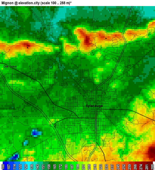
Below is the Elevation map of Mignon, which displays elevation range with different colors. Scale of the first map is from 100 to 288 m (328 to 945 ft) with average elevation of 180 meters (=591 ft) [note 1]
These maps also provides idea of topography and contour of this city, they are displayed at different zoom levels. More info about maps, scale and edge coordinates you can find below images.
| \ | Map #1 | Topo.Map |
| Scale [m] | 100..288 m | × |
| Scale [ft] | 328..945 ft | × |
| Average | 180 m = 591 ft | × |
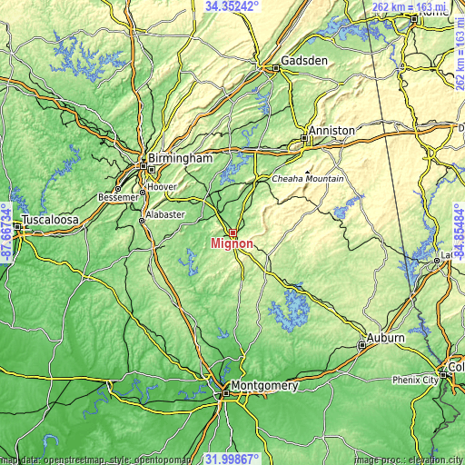
| Width | 8.18 km = 5.1 mi | 261.7 km = 162.6 mi |
| Height | 8.18 km = 5.1 mi | 261.7 km = 162.6 mi |
| ↑Max Latitude | 33.220221° | 34.35242° |
| Latitude at center | 33.18345° | 33.18345° |
| ↓Min Latitude | 33.146663° | 31.99867° |
| ← Min Longitude | -86.305035° | -87.66734° |
| Longitude center | -86.26109° | -86.26109° |
| →Max Longitude | -86.217145° | -84.85484° |
Nearby cities:
Cities around Mignon sort by population:
• Talladega elevation 170 m
31.6 km,  27°
27°
• Sylacauga 169 m
1.4 km,  142°
142°
• Childersburg 130 m
13.7 km,  320°
320°
• Columbiana 167 m
32.2 km,  268°
268°
• Vincent 140 m
26.4 km,  327°
327°
• Wilsonville 131 m
21.5 km,  285°
285°
• Stewartville 225 m
11.7 km,  172°
172°
• Harpersville 138 m
24.3 km, 317°
• Westover 150 m
31.5 km,  305°
305°
• Goodwater 264 m
23.4 km,  124°
124°
• Fayetteville 134 m
14.1 km,  252°
252°
• Shelby 152 m
31.2 km, 254°
Multilingual:
 En español:
Mignon elevación 164 m.
 En France:
Mignon élévation 164 m.


Sources and notes:
- [note 1] Map square and city borders are not equal. Map elevation data is calculated only from area inside that square.
- [src 1] Elevation data from geonames database provided with same terms of usage.
- [src 2] The elevation map of Mignon is generated using elevation data from NASA's 3 arcsec (90m) resolution SRTM data.
- [src 3] Base (background) map © OpenStreetMap contributors tiles are generated by Geofabrik and OpenTopoMap.
Copyright & License:
This Mignon Elevation Map is licensed under CC BY-SA. You may reuse any part from this page, if you give a proper credit by linking to this URL:
 More info on terms of use page.