Greenville elevation
Greenville (Alabama, Butler County), United States elevation is 135 meters and Greenville elevation in feet is 443 ft above sea level [src 1]. Greenville is a seat of a second-order administrative division (feature code) with elevation that is 144 meters (472 ft) smaller than average city elevation in United States.
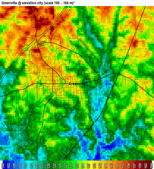
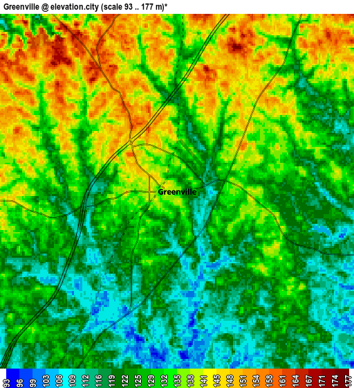
Below is the Elevation map of Greenville, which displays elevation range with different colors. Scale of the first map is from 100 to 164 m (328 to 538 ft) with average elevation of 129.6 meters (=425 ft) [note 1]
These maps also provides idea of topography and contour of this city, they are displayed at different zoom levels. More info about maps, scale and edge coordinates you can find below images.
| \ | Map #1 | Map #2 | Topo.Map |
| Scale [m] | 100..164 m | 93..177 m | × |
| Scale [ft] | 328..538 ft | 305..581 ft | × |
| Average | 129.6 m = 425 ft | 129.2 m = 424 ft | × |
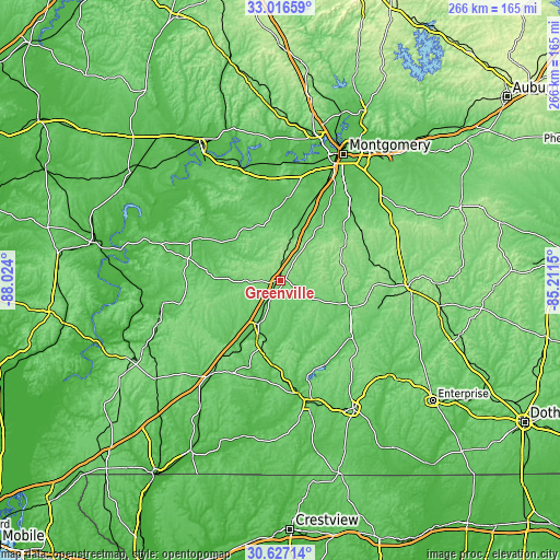
| Width | 8.3 km = 5.2 mi | 16.61 km = 10.3 mi | 265.7 km = 165.1 mi |
| Height | 8.3 km = 5.2 mi | 16.61 km = 10.3 mi | 265.7 km = 165.1 mi |
| ↑Max Latitude | 31.866929° | 31.904243° | 33.01659° |
| Latitude at center | 31.8296° | 31.8296° | 31.8296° |
| ↓Min Latitude | 31.792256° | 31.754896° | 30.62714° |
| ← Min Longitude | -86.661695° | -86.705641° | -88.024° |
| Longitude center | -86.61775° | -86.61775° | -86.61775° |
| →Max Longitude | -86.573805° | -86.529859° | -85.2115° |
Nearby cities:
Cities around Greenville sort by population:
• Montgomery elevation 76 m
66.8 km,  26°
26°
• Troy 169 m
61.2 km,  92°
92°
• Andalusia 110 m
59.4 km,  167°
167°
• Opp 104 m
69.8 km,  150°
150°
• Elba 61 m
69.6 km,  131°
131°
• Evergreen 90 m
54.5 km,  216°
216°
• Luverne 111 m
35.7 km,  110°
110°
• Taylor 168 m
39.7 km,  65°
65°
• Camden 66 m
66 km,  285°
285°
• Georgiana 92 m
24.4 km,  208°
208°
• Fort Deposit 144 m
17.6 km,  12°
12°
• Hayneville 78 m
39.6 km, 5°
Multilingual:
 En español:
Greenville elevación 135 m.
 En France:
Greenville élévation 135 m.
 Auf Deutsch:
Greenville höhe über dem Meeresspiegel ist 135 m.

Sources and notes:
- [note 1] Map square and city borders are not equal. Map elevation data is calculated only from area inside that square.
- [src 1] Elevation data from geonames database provided with same terms of usage.
- [src 2] The elevation map of Greenville is generated using elevation data from NASA's 3 arcsec (90m) resolution SRTM data.
- [src 3] Base (background) map © OpenStreetMap contributors tiles are generated by Geofabrik and OpenTopoMap.
Copyright & License:
This Greenville Elevation Map is licensed under CC BY-SA. You may reuse any part from this page, if you give a proper credit by linking to this URL:
 More info on terms of use page.