Jinja elevation
Jinja (Eastern Region, Jinja District), Uganda elevation is 1187 meters and Jinja elevation in feet is 3894 ft above sea level [src 1]. Jinja is a seat of a first-order administrative division (feature code) with elevation that is 72 meters (236 ft) smaller than average city elevation in Uganda.
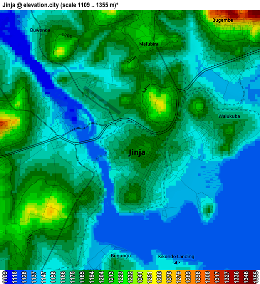
Below is the Elevation map of Jinja, which displays elevation range with different colors. Scale of the first map is from 1109 to 1355 m (3638 to 4446 ft) with average elevation of 1169.9 meters (=3838 ft) [note 1]
These maps also provides idea of topography and contour of this city, they are displayed at different zoom levels. More info about maps, scale and edge coordinates you can find below images.
| \ | Map #1 | Map #2 | Topo.Map |
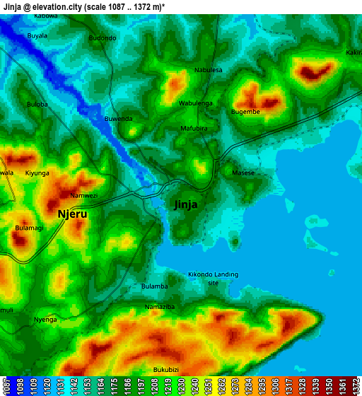
| Scale [m] | 1109..1355 m | 1087..1372 m | × |
| Scale [ft] | 3638..4446 ft | 3566..4501 ft | × |
| Average | 1169.9 m = 3838 ft | 1186 m = 3891 ft | × |
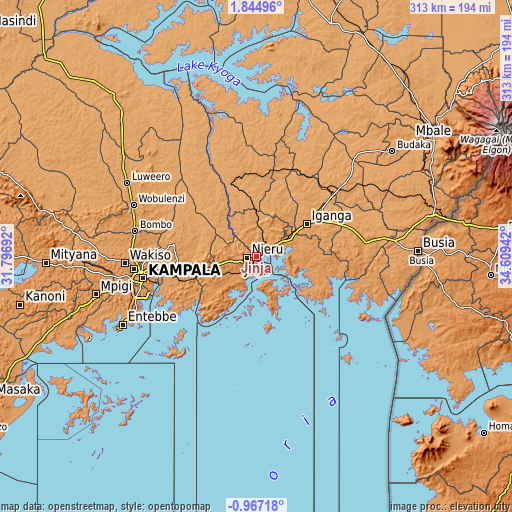
| Width | 9.77 km = 6.1 mi | 19.54 km = 12.1 mi | 312.7 km = 194.3 mi |
| Height | 9.77 km = 6.1 mi | 19.54 km = 12.1 mi | 312.7 km = 194.3 mi |
| ↑Max Latitude | 0.482964° | 0.526907° | 1.84496° |
| Latitude at center | 0.43902° | 0.43902° | 0.43902° |
| ↓Min Latitude | 0.395076° | 0.351131° | -0.96718° |
| ← Min Longitude | 33.159225° | 33.115279° | 31.79692° |
| Longitude center | 33.20317° | 33.20317° | 33.20317° |
| →Max Longitude | 33.247115° | 33.291061° | 34.60942° |
Nearby cities:
Cities around Jinja sort by population:
• Mukono elevation 1188 m
50.7 km,  259°
259°
• Njeru 1152 m
2.7 km,  276°
276°
• Iganga 1128 m
35.1 km,  57°
57°
• Lugazi 1208 m
30.6 km, 255°
• Kayunga 1071 m
45.6 km,  309°
309°
• Buwenge 1124 m
23.7 km,  351°
351°
• Kamuli 1120 m
57.3 km, 350°
• Bugembe 1312 m
6.4 km,  41°
41°
• Mayuge 1192 m
30.9 km,  85°
85°
• Luuka Town 1151 m
31 km,  20°
20°
• Buikwe 1230 m
24.2 km,  242°
242°
• Kitamilo 1134 m
24.1 km,  179°
179°
Multilingual:
 En español:
Jinja elevación 1187 m.
 En France:
Jinja élévation 1187 m.


Sources and notes:
- [note 1] Map square and city borders are not equal. Map elevation data is calculated only from area inside that square.
- [src 1] Elevation data from geonames database provided with same terms of usage.
- [src 2] The elevation map of Jinja is generated using elevation data from NASA's 3 arcsec (90m) resolution SRTM data.
- [src 3] Base (background) map © OpenStreetMap contributors tiles are generated by Geofabrik and OpenTopoMap.
Copyright & License:
This Jinja Elevation Map is licensed under CC BY-SA. You may reuse any part from this page, if you give a proper credit by linking to this URL:
 More info on terms of use page.