Drohobych elevation
Drohobych (Lviv), Ukraine elevation is 301 meters and Drohobych elevation in feet is 988 ft above sea level [src 1]. Drohobych is a seat of a second-order administrative division (feature code) with elevation that is 144 meters (472 ft) bigger than average city elevation in Ukraine.
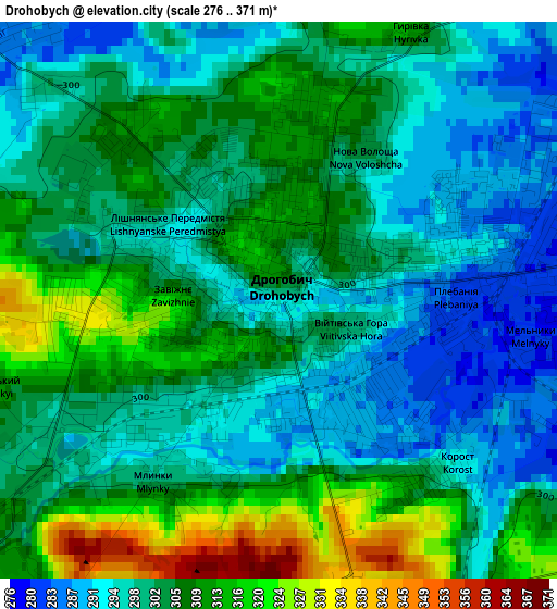
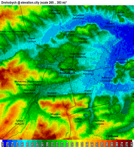
Below is the Elevation map of Drohobych, which displays elevation range with different colors. Scale of the first map is from 276 to 371 m (906 to 1217 ft) with average elevation of 302.8 meters (=993 ft) [note 1]
These maps also provides idea of topography and contour of this city, they are displayed at different zoom levels. More info about maps, scale and edge coordinates you can find below images.
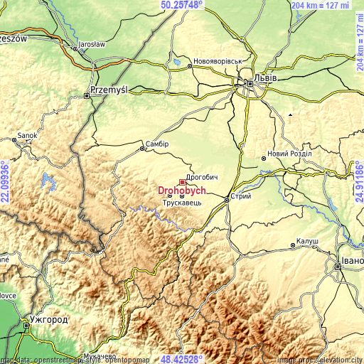
| \ | Map #1 | Map #2 | Topo.Map |
| Scale [m] | 276..371 m | 265..383 m | × |
| Scale [ft] | 906..1217 ft | 869..1257 ft | × |
| Average | 302.8 m = 993 ft | 309.3 m = 1015 ft | × |
| Width | 6.37 km = 4 mi | 12.73 km = 7.9 mi | 203.7 km = 126.6 mi |
| Height | 6.37 km = 4 mi | 12.73 km = 7.9 mi | 203.7 km = 126.6 mi |
| ↑Max Latitude | 49.378529° | 49.407132° | 50.25748° |
| Latitude at center | 49.34991° | 49.34991° | 49.34991° |
| ↓Min Latitude | 49.321274° | 49.292621° | 48.42528° |
| ← Min Longitude | 23.461665° | 23.417719° | 22.09936° |
| Longitude center | 23.50561° | 23.50561° | 23.50561° |
| →Max Longitude | 23.549555° | 23.593501° | 24.91186° |
Nearby cities:
Cities around Drohobych sort by population:
• Stryi elevation 296 m
27.2 km,  110°
110°
• Boryslav 359 m
8.8 km,  217°
217°
• Truskavets’ 356 m
8 km,  179°
179°
• Stebnyk 314 m
7.5 km,  145°
145°
• Ralivka 296 m
25.6 km,  310°
310°
• Ulychne 339 m
16.7 km,  140°
140°
• Duliby 306 m
26 km,  120°
120°
• Medenychi 268 m
19.9 km,  63°
63°
• Rykhtychi 293 m
5.4 km,  43°
43°
• Pidbuzh 391 m
18.7 km,  264°
264°
• Skhidnytsya 548 m
17.6 km, 219°
• Dublyany 281 m
18.6 km,  332°
332°
Multilingual:
 En español:
Drohobych elevación 301 m.
 En France:
Drohobych élévation 301 m.
 Auf Deutsch:
Drohobych höhe über dem Meeresspiegel ist 301 m.

Sources and notes:
- [note 1] Map square and city borders are not equal. Map elevation data is calculated only from area inside that square.
- [src 1] Elevation data from geonames database provided with same terms of usage.
- [src 2] The elevation map of Drohobych is generated using elevation data from NASA's 3 arcsec (90m) resolution SRTM data.
- [src 3] Base (background) map © OpenStreetMap contributors tiles are generated by Geofabrik and OpenTopoMap.
Copyright & License:
This Drohobych Elevation Map is licensed under CC BY-SA. You may reuse any part from this page, if you give a proper credit by linking to this URL:
 More info on terms of use page.