Hryshkivtsi elevation
Hryshkivtsi (Zhytomyr), Ukraine elevation is 261 meters and Hryshkivtsi elevation in feet is 856 ft above sea level [src 1]. Hryshkivtsi is a populated place (feature code) with elevation that is 104 meters (341 ft) bigger than average city elevation in Ukraine.
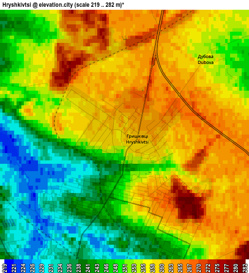
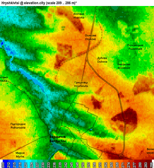
Below is the Elevation map of Hryshkivtsi, which displays elevation range with different colors. Scale of the first map is from 219 to 282 m (719 to 925 ft) with average elevation of 252.9 meters (=830 ft) [note 1]
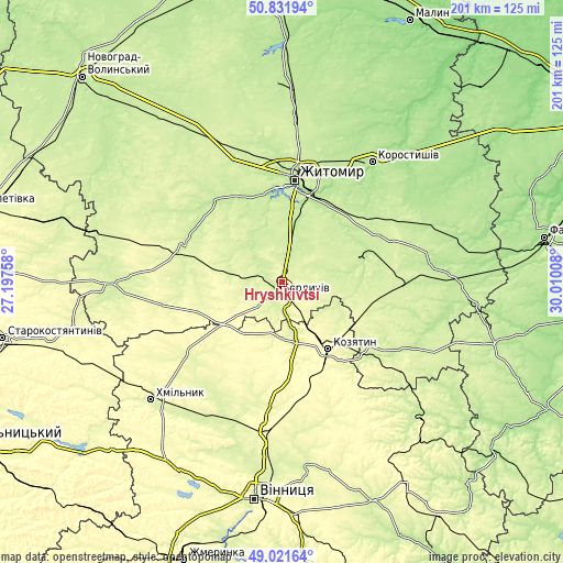
These maps also provides idea of topography and contour of this city, they are displayed at different zoom levels. More info about maps, scale and edge coordinates you can find below images.
| \ | Map #1 | Map #2 | Topo.Map |
| Scale [m] | 219..282 m | 209..286 m | × |
| Scale [ft] | 719..925 ft | 686..938 ft | × |
| Average | 252.9 m = 830 ft | 250.6 m = 822 ft | × |
| Width | 6.29 km = 3.9 mi | 12.58 km = 7.8 mi | 201.3 km = 125.1 mi |
| Height | 6.29 km = 3.9 mi | 12.58 km = 7.8 mi | 201.3 km = 125.1 mi |
| ↑Max Latitude | 49.963567° | 49.991828° | 50.83194° |
| Latitude at center | 49.93529° | 49.93529° | 49.93529° |
| ↓Min Latitude | 49.906996° | 49.878686° | 49.02164° |
| ← Min Longitude | 28.559885° | 28.515939° | 27.19758° |
| Longitude center | 28.60383° | 28.60383° | 28.60383° |
| →Max Longitude | 28.647775° | 28.691721° | 30.01008° |
Nearby cities:
Cities around Hryshkivtsi sort by population:
• Zhytomyr elevation 228 m
37 km,  8°
8°
• Berdychiv 250 m
4 km,  181°
181°
• Kozyatyn 293 m
29.6 km,  146°
146°
• Korostyshiv 180 m
53.3 km,  37°
37°
• Andrushivka 212 m
31.3 km,  71°
71°
• Chudniv 246 m
37.1 km,  290°
290°
• Ozerne 220 m
28.6 km,  18°
18°
• Ruzhyn 227 m
49.1 km,  118°
118°
• Ulaniv 269 m
43.1 km,  231°
231°
• Chervone 230 m
19 km,  85°
85°
• Denyshi 210 m
34.1 km,  335°
335°
• Chornorudka 241 m
34.2 km,  106°
106°
Multilingual:
 En español:
Hryshkivtsi elevación 261 m.
 En France:
Hryshkivtsi élévation 261 m.
 Auf Deutsch:
Hryshkivtsi höhe über dem Meeresspiegel ist 261 m.

Sources and notes:
- [note 1] Map square and city borders are not equal. Map elevation data is calculated only from area inside that square.
- [src 1] Elevation data from geonames database provided with same terms of usage.
- [src 2] The elevation map of Hryshkivtsi is generated using elevation data from NASA's 3 arcsec (90m) resolution SRTM data.
- [src 3] Base (background) map © OpenStreetMap contributors tiles are generated by Geofabrik and OpenTopoMap.
Copyright & License:
This Hryshkivtsi Elevation Map is licensed under CC BY-SA. You may reuse any part from this page, if you give a proper credit by linking to this URL:
 More info on terms of use page.