Krasnokuts’k elevation
Krasnokuts’k (Kharkiv), Ukraine elevation is 122 meters and Krasnokuts’k elevation in feet is 400 ft above sea level [src 1]. Krasnokuts’k is a seat of a second-order administrative division (feature code) with elevation that is 35 meters (115 ft) smaller than average city elevation in Ukraine.
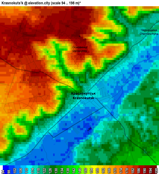
Below is the Elevation map of Krasnokuts’k, which displays elevation range with different colors. Scale of the first map is from 94 to 198 m (308 to 650 ft) with average elevation of 141.7 meters (=465 ft) [note 1]
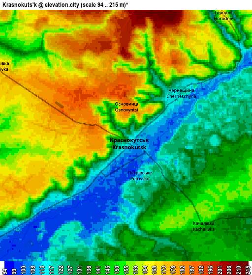
These maps also provides idea of topography and contour of this city, they are displayed at different zoom levels. More info about maps, scale and edge coordinates you can find below images.
| \ | Map #1 | Map #2 | Topo.Map |
| Scale [m] | 94..198 m | 94..215 m | × |
| Scale [ft] | 308..650 ft | 308..705 ft | × |
| Average | 141.7 m = 465 ft | 147.1 m = 483 ft | × |
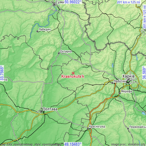
| Width | 6.27 km = 3.9 mi | 12.55 km = 7.8 mi | 200.7 km = 124.7 mi |
| Height | 6.27 km = 3.9 mi | 12.55 km = 7.8 mi | 200.7 km = 124.7 mi |
| ↑Max Latitude | 50.09422° | 50.122404° | 50.96022° |
| Latitude at center | 50.06602° | 50.06602° | 50.06602° |
| ↓Min Latitude | 50.037803° | 50.009569° | 49.15483° |
| ← Min Longitude | 35.118805° | 35.074859° | 33.7565° |
| Longitude center | 35.16275° | 35.16275° | 35.16275° |
| →Max Longitude | 35.206695° | 35.250641° | 36.569° |
Nearby cities:
Cities around Krasnokuts’k sort by population:
• Okhtyrka elevation 111 m
33 km,  325°
325°
• Bohodukhiv 150 m
28.2 km,  67°
67°
• Kotel’va 100 m
28.8 km,  270°
270°
• Valky 138 m
41.1 km,  128°
128°
• Trostyanets’ 120 m
48.6 km,  343°
343°
• Chutove 101 m
39.5 km,  179°
179°
• Oposhnya 173 m
41.2 km,  252°
252°
• Velyka Pysarivka 119 m
45.8 km,  29°
29°
• Kolomak 115 m
27.1 km,  158°
158°
• Kyrykivka 114 m
33.3 km,  354°
354°
• Huty 120 m
14.9 km,  59°
59°
• Staryy Merchyk 186 m
43.6 km,  102°
102°
Multilingual:
 En español:
Krasnokuts’k elevación 122 m.
 En France:
Krasnokuts’k élévation 122 m.
 Auf Deutsch:
Krasnokuts’k höhe über dem Meeresspiegel ist 122 m.

Sources and notes:
- [note 1] Map square and city borders are not equal. Map elevation data is calculated only from area inside that square.
- [src 1] Elevation data from geonames database provided with same terms of usage.
- [src 2] The elevation map of Krasnokuts’k is generated using elevation data from NASA's 3 arcsec (90m) resolution SRTM data.
- [src 3] Base (background) map © OpenStreetMap contributors tiles are generated by Geofabrik and OpenTopoMap.
Copyright & License:
This Krasnokuts’k Elevation Map is licensed under CC BY-SA. You may reuse any part from this page, if you give a proper credit by linking to this URL:
 More info on terms of use page.