Melioratyvne elevation
Melioratyvne (Dnipropetrovsk), Ukraine elevation is 72 meters and Melioratyvne elevation in feet is 236 ft above sea level [src 1]. Melioratyvne is a populated place (feature code) with elevation that is 85 meters (279 ft) smaller than average city elevation in Ukraine.
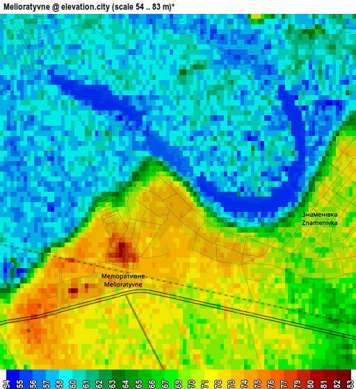
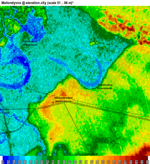
Below is the Elevation map of Melioratyvne, which displays elevation range with different colors. Scale of the first map is from 54 to 83 m (177 to 272 ft) with average elevation of 64.1 meters (=210 ft) [note 1]
These maps also provides idea of topography and contour of this city, they are displayed at different zoom levels. More info about maps, scale and edge coordinates you can find below images.
| \ | Map #1 | Map #2 | Topo.Map |
| Scale [m] | 54..83 m | 51..86 m | × |
| Scale [ft] | 177..272 ft | 167..282 ft | × |
| Average | 64.1 m = 210 ft | 64.2 m = 211 ft | × |
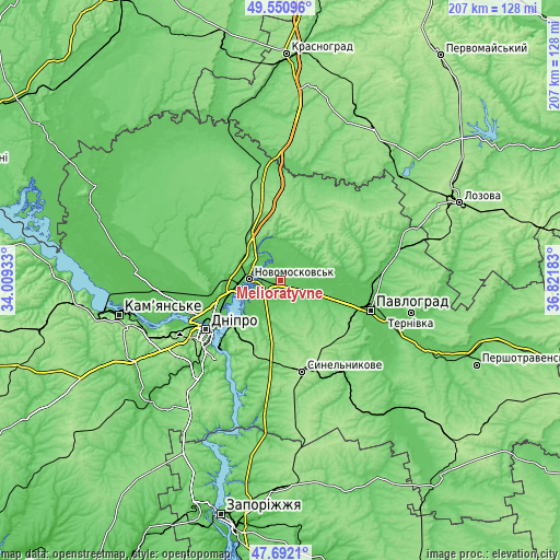
| Width | 6.46 km = 4 mi | 12.92 km = 8 mi | 206.7 km = 128.4 mi |
| Height | 6.46 km = 4 mi | 12.92 km = 8 mi | 206.7 km = 128.4 mi |
| ↑Max Latitude | 48.659126° | 48.688145° | 49.55096° |
| Latitude at center | 48.63009° | 48.63009° | 48.63009° |
| ↓Min Latitude | 48.601037° | 48.571968° | 47.6921° |
| ← Min Longitude | 35.371635° | 35.327689° | 34.00933° |
| Longitude center | 35.41558° | 35.41558° | 35.41558° |
| →Max Longitude | 35.459525° | 35.503471° | 36.82183° |
Nearby cities:
Cities around Melioratyvne sort by population:
• Dnipro elevation 100 m
33.6 km,  235°
235°
• Pavlohrad 70 m
35.2 km,  107°
107°
• Novomoskovs’k 58 m
12.5 km,  274°
274°
• Synel’nykove 171 m
35.2 km,  167°
167°
• Pidhorodne 56 m
23.5 km,  254°
254°
• Mahdalynivka 100 m
48.9 km,  311°
311°
• Hubynykha 126 m
23.2 km,  329°
329°
• Spas’ke 68 m
26.9 km,  278°
278°
• Partyzans’ke 61 m
44.8 km,  263°
263°
• Aviatorske 145 m
38.2 km,  220°
220°
• Kaydaki 134 m
35.4 km, 217°
• Yur”yivka 77 m
45.9 km,  74°
74°
Multilingual:
 En español:
Melioratyvne elevación 72 m.
 En France:
Melioratyvne élévation 72 m.
 Auf Deutsch:
Melioratyvne höhe über dem Meeresspiegel ist 72 m.

Sources and notes:
- [note 1] Map square and city borders are not equal. Map elevation data is calculated only from area inside that square.
- [src 1] Elevation data from geonames database provided with same terms of usage.
- [src 2] The elevation map of Melioratyvne is generated using elevation data from NASA's 3 arcsec (90m) resolution SRTM data.
- [src 3] Base (background) map © OpenStreetMap contributors tiles are generated by Geofabrik and OpenTopoMap.
Copyright & License:
This Melioratyvne Elevation Map is licensed under CC BY-SA. You may reuse any part from this page, if you give a proper credit by linking to this URL:
 More info on terms of use page.