Shyryayeve elevation
Shyryayeve (Odesa, Shyryayivs’kyy Rayon), Ukraine elevation is 54 meters and Shyryayeve elevation in feet is 177 ft above sea level [src 1]. Shyryayeve is a seat of a second-order administrative division (feature code) with elevation that is 103 meters (338 ft) smaller than average city elevation in Ukraine.
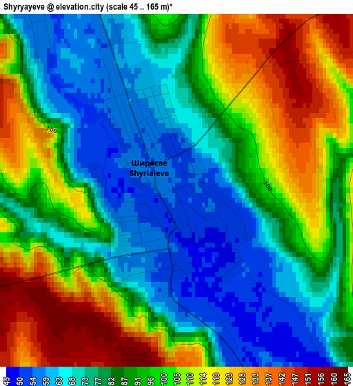
Below is the Elevation map of Shyryayeve, which displays elevation range with different colors. Scale of the first map is from 45 to 165 m (148 to 541 ft) with average elevation of 91.1 meters (=299 ft) [note 1]
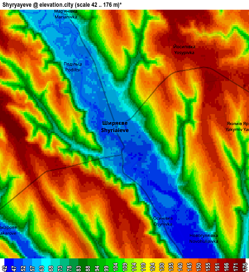
These maps also provides idea of topography and contour of this city, they are displayed at different zoom levels. More info about maps, scale and edge coordinates you can find below images.
| \ | Map #1 | Map #2 | Topo.Map |
| Scale [m] | 45..165 m | 42..176 m | × |
| Scale [ft] | 148..541 ft | 138..577 ft | × |
| Average | 91.1 m = 299 ft | 114 m = 374 ft | × |
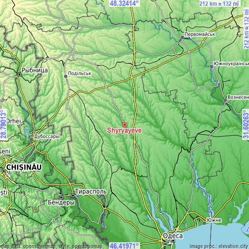
| Width | 6.62 km = 4.1 mi | 13.23 km = 8.2 mi | 211.8 km = 131.6 mi |
| Height | 6.62 km = 4.1 mi | 13.23 km = 8.2 mi | 211.7 km = 131.5 mi |
| ↑Max Latitude | 47.410268° | 47.439999° | 48.32414° |
| Latitude at center | 47.38052° | 47.38052° | 47.38052° |
| ↓Min Latitude | 47.350755° | 47.320973° | 46.41971° |
| ← Min Longitude | 30.152435° | 30.108489° | 28.79013° |
| Longitude center | 30.19638° | 30.19638° | 30.19638° |
| →Max Longitude | 30.240325° | 30.284271° | 31.60263° |
Nearby cities:
Cities around Shyryayeve sort by population:
• Rozdil’na elevation 146 m
60.4 km,  188°
188°
• Lyubashivka 176 m
51 km,  5°
5°
• Berezivka 14 m
57.1 km,  110°
110°
• Velyka Mykhaylivka 48 m
42.1 km,  217°
217°
• Okny 93 m
58.1 km,  287°
287°
• Zakharivka 68 m
33.4 km,  260°
260°
• Zatyshshya 176 m
24.9 km, 257°
• Mykolayivka 41 m
45.7 km,  66°
66°
• Velykoploske 181 m
57 km, 224°
• Kuchurhan 54 m
39.1 km,  231°
231°
• Ivanivka 19 m
49.5 km,  155°
155°
• Ananyiv Pershyi 82 m
42.3 km,  333°
333°
Multilingual:
 En español:
Shyryayeve elevación 54 m.
 En France:
Shyryayeve élévation 54 m.
 Auf Deutsch:
Shyryayeve höhe über dem Meeresspiegel ist 54 m.

Sources and notes:
- [note 1] Map square and city borders are not equal. Map elevation data is calculated only from area inside that square.
- [src 1] Elevation data from geonames database provided with same terms of usage.
- [src 2] The elevation map of Shyryayeve is generated using elevation data from NASA's 3 arcsec (90m) resolution SRTM data.
- [src 3] Base (background) map © OpenStreetMap contributors tiles are generated by Geofabrik and OpenTopoMap.
Copyright & License:
This Shyryayeve Elevation Map is licensed under CC BY-SA. You may reuse any part from this page, if you give a proper credit by linking to this URL:
 More info on terms of use page.