Rozdil’na elevation
Rozdil’na (Odesa, Rozdil’nyans’kyy Rayon), Ukraine elevation is 146 meters and Rozdil’na elevation in feet is 479 ft above sea level [src 1]. Rozdil’na is a seat of a second-order administrative division (feature code) with elevation that is 11 meters (36 ft) smaller than average city elevation in Ukraine.
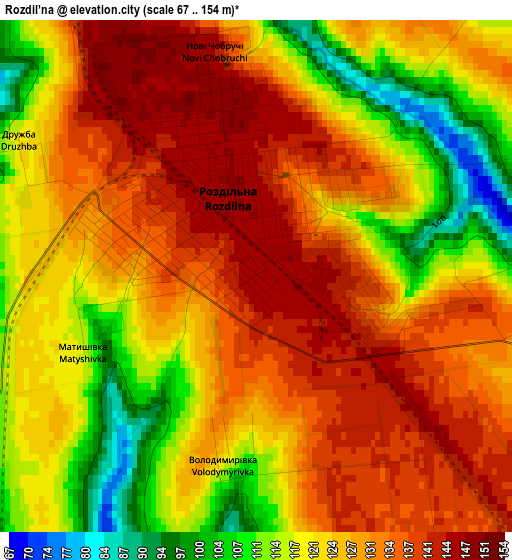
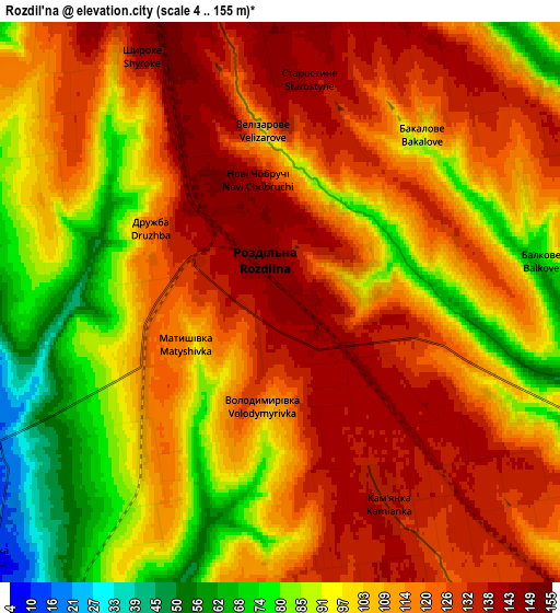
Below is the Elevation map of Rozdil’na, which displays elevation range with different colors. Scale of the first map is from 67 to 154 m (220 to 505 ft) with average elevation of 125.9 meters (=413 ft) [note 1]
These maps also provides idea of topography and contour of this city, they are displayed at different zoom levels. More info about maps, scale and edge coordinates you can find below images.
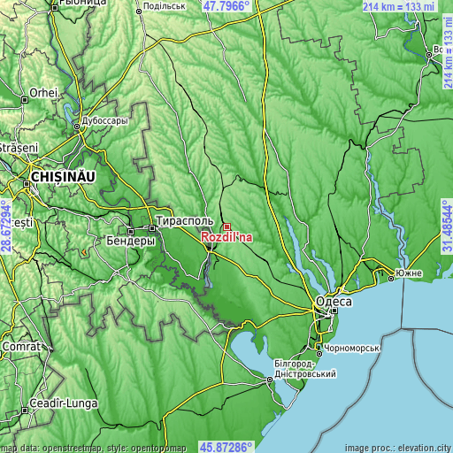
| \ | Map #1 | Map #2 | Topo.Map |
| Scale [m] | 67..154 m | 4..155 m | × |
| Scale [ft] | 220..505 ft | 13..509 ft | × |
| Average | 125.9 m = 413 ft | 110.5 m = 363 ft | × |
| Width | 6.68 km = 4.2 mi | 13.37 km = 8.3 mi | 213.9 km = 132.9 mi |
| Height | 6.68 km = 4.2 mi | 13.37 km = 8.3 mi | 213.9 km = 132.9 mi |
| ↑Max Latitude | 46.87339° | 46.903423° | 47.7966° |
| Latitude at center | 46.84334° | 46.84334° | 46.84334° |
| ↓Min Latitude | 46.813273° | 46.78319° | 45.87286° |
| ← Min Longitude | 30.035245° | 29.991299° | 28.67294° |
| Longitude center | 30.07919° | 30.07919° | 30.07919° |
| →Max Longitude | 30.123135° | 30.167081° | 31.48544° |
Nearby cities:
Cities around Rozdil’na sort by population:
• Bilyayivka elevation 7 m
41.4 km,  165°
165°
• Lymanske 11 m
22.5 km,  202°
202°
• Teplodar 78 m
42 km,  153°
153°
• Usatove 25 m
56.1 km,  127°
127°
• Mayaky 16 m
49.6 km,  162°
162°
• Velyka Mykhaylivka 48 m
31.2 km,  327°
327°
• Velykoploske 181 m
36.2 km,  301°
301°
• Kuchurhan 54 m
41.8 km, 328°
• Ivanivka 19 m
33.1 km,  63°
63°
• Kremidivka 75 m
55.1 km,  102°
102°
• Stepanivka 10 m
8.9 km,  232°
232°
• Stepove 53 m
15.5 km,  180°
180°
Multilingual:
 En español:
Rozdil’na elevación 146 m.
 En France:
Rozdil’na élévation 146 m.
 Auf Deutsch:
Rozdil’na höhe über dem Meeresspiegel ist 146 m.
 На русском:
Razdel’naya, Posad Pazdelnaya, Раздельная высота над уровнем моря 146 м
Sources and notes:
- [note 1] Map square and city borders are not equal. Map elevation data is calculated only from area inside that square.
- [src 1] Elevation data from geonames database provided with same terms of usage.
- [src 2] The elevation map of Rozdil’na is generated using elevation data from NASA's 3 arcsec (90m) resolution SRTM data.
- [src 3] Base (background) map © OpenStreetMap contributors tiles are generated by Geofabrik and OpenTopoMap.
Copyright & License:
This Rozdil’na Elevation Map is licensed under CC BY-SA. You may reuse any part from this page, if you give a proper credit by linking to this URL:
 More info on terms of use page.