Zymohiria elevation
Zymohiria (Luhansk), Ukraine elevation is 53 meters and Zymohiria elevation in feet is 174 ft above sea level [src 1]. Zymohiria is a populated place (feature code) with elevation that is 104 meters (341 ft) smaller than average city elevation in Ukraine.
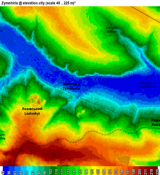
Below is the Elevation map of Zymohiria, which displays elevation range with different colors. Scale of the first map is from 50 to 180 m (164 to 591 ft) with average elevation of 102.8 meters (=337 ft) [note 1]
These maps also provides idea of topography and contour of this city, they are displayed at different zoom levels. More info about maps, scale and edge coordinates you can find below images.

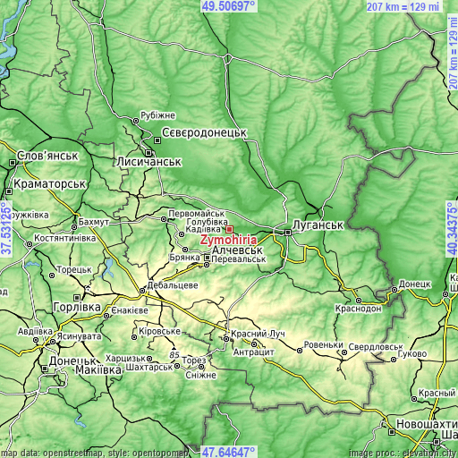
| \ | Map #1 | Map #2 | Topo.Map |
| Scale [m] | 50..180 m | 49..225 m | × |
| Scale [ft] | 164..591 ft | 161..738 ft | × |
| Average | 102.8 m = 337 ft | 127.1 m = 417 ft | × |
| Width | 6.46 km = 4 mi | 12.93 km = 8 mi | 206.9 km = 128.6 mi |
| Height | 6.46 km = 4 mi | 12.93 km = 8 mi | 206.9 km = 128.6 mi |
| ↑Max Latitude | 48.614342° | 48.643387° | 49.50697° |
| Latitude at center | 48.58528° | 48.58528° | 48.58528° |
| ↓Min Latitude | 48.556202° | 48.527107° | 47.64647° |
| ← Min Longitude | 38.893555° | 38.849609° | 37.53125° |
| Longitude center | 38.9375° | 38.9375° | 38.9375° |
| →Max Longitude | 38.981445° | 39.025391° | 40.34375° |
Nearby cities:
Cities around Zymohiria sort by population:
• Alchevs’k elevation 211 m
15.7 km,  214°
214°
• Kadiyivka 217 m
21.7 km,  264°
264°
• Bryanka 219 m
21.2 km,  247°
247°
• Kirovs’k 196 m
22.4 km,  285°
285°
• Pereval’s’k 227 m
17.8 km,  202°
202°
• Uspenka 93 m
27.3 km,  142°
142°
• Slov`yanoserbsk 68 m
12.9 km,  14°
14°
• Artemivs’k 282 m
22.1 km,  223°
223°
• Bile 68 m
13 km, 140°
• Rozkishne 55 m
27.3 km,  112°
112°
• Tr’okhizbenka 49 m
19.2 km, 5°
• Lenina 182 m
23.1 km, 138°
Multilingual:
 En español:
Zimogiria elevación 53 m.
 En France:
Zymohiria élévation 53 m.
 Auf Deutsch:
Zymohiria höhe über dem Meeresspiegel ist 53 m.
 На русском:
Zimogor'ye, Зимогорье, Zimogor’ye, Zimogorie высота над уровнем моря 53 м
Sources and notes:
- [note 1] Map square and city borders are not equal. Map elevation data is calculated only from area inside that square.
- [src 1] Elevation data from geonames database provided with same terms of usage.
- [src 2] The elevation map of Zymohiria is generated using elevation data from NASA's 3 arcsec (90m) resolution SRTM data.
- [src 3] Base (background) map © OpenStreetMap contributors tiles are generated by Geofabrik and OpenTopoMap.
Copyright & License:
This Zymohiria Elevation Map is licensed under CC BY-SA. You may reuse any part from this page, if you give a proper credit by linking to this URL:
 More info on terms of use page.