Magole elevation
Magole (Morogoro, Kilosa), Tanzania elevation is 433 meters and Magole elevation in feet is 1421 ft above sea level [src 1]. Magole is a populated place (feature code) with elevation that is 510 meters (1673 ft) smaller than average city elevation in Tanzania.
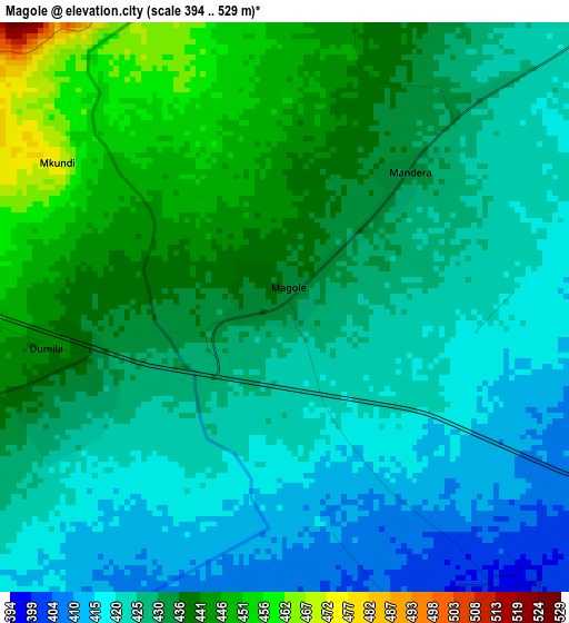
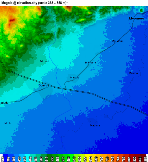
Below is the Elevation map of Magole, which displays elevation range with different colors. Scale of the first map is from 394 to 529 m (1293 to 1736 ft) with average elevation of 429.8 meters (=1410 ft) [note 1]
These maps also provides idea of topography and contour of this city, they are displayed at different zoom levels. More info about maps, scale and edge coordinates you can find below images.
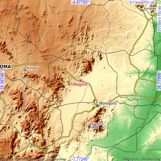
| \ | Map #1 | Map #2 | Topo.Map |
| Scale [m] | 394..529 m | 368..858 m | × |
| Scale [ft] | 1293..1736 ft | 1207..2815 ft | × |
| Average | 429.8 m = 1410 ft | 446.2 m = 1464 ft | × |
| Width | 9.71 km = 6 mi | 19.42 km = 12.1 mi | 310.8 km = 193.1 mi |
| Height | 9.71 km = 6 mi | 19.42 km = 12.1 mi | 310.8 km = 193.1 mi |
| ↑Max Latitude | -6.333295° | -6.289616° | -4.97765° |
| Latitude at center | -6.37697° | -6.37697° | -6.37697° |
| ↓Min Latitude | -6.420642° | -6.464309° | -7.77248° |
| ← Min Longitude | 37.329785° | 37.285839° | 35.96748° |
| Longitude center | 37.37373° | 37.37373° | 37.37373° |
| →Max Longitude | 37.417675° | 37.461621° | 38.77998° |
Nearby cities:
Cities around Magole sort by population:
• Morogoro elevation 504 m
58.7 km,  147°
147°
• Kilosa 495 m
66.6 km,  220°
220°
• Geiro 1284 m
61.5 km,  294°
294°
• Chalinze 212 m
112.1 km,  104°
104°
• Mpwapwa 998 m
98.4 km,  271°
271°
• Kibakwe 1133 m
117.5 km,  251°
251°
• Msowero 462 m
25.9 km,  227°
227°
• Ngerengere 196 m
92 km,  116°
116°
• Lugoba 250 m
106.3 km,  94°
94°
• Kongwa 1023 m
107.6 km,  280°
280°
• Kimamba 441 m
52.4 km,  210°
210°
• Mvomero 418 m
11.5 km,  42°
42°
Multilingual:
 En español:
Magole elevación 433 m.
 En France:
Magole élévation 433 m.


Sources and notes:
- [note 1] Map square and city borders are not equal. Map elevation data is calculated only from area inside that square.
- [src 1] Elevation data from geonames database provided with same terms of usage.
- [src 2] The elevation map of Magole is generated using elevation data from NASA's 3 arcsec (90m) resolution SRTM data.
- [src 3] Base (background) map © OpenStreetMap contributors tiles are generated by Geofabrik and OpenTopoMap.
Copyright & License:
This Magole Elevation Map is licensed under CC BY-SA. You may reuse any part from this page, if you give a proper credit by linking to this URL:
 More info on terms of use page.