Çerkezköy elevation
Çerkezköy (Tekirdağ), Turkey elevation is 164 meters and Çerkezköy elevation in feet is 538 ft above sea level [src 1]. Çerkezköy is a populated place (feature code) with elevation that is 559 meters (1834 ft) smaller than average city elevation in Turkey.
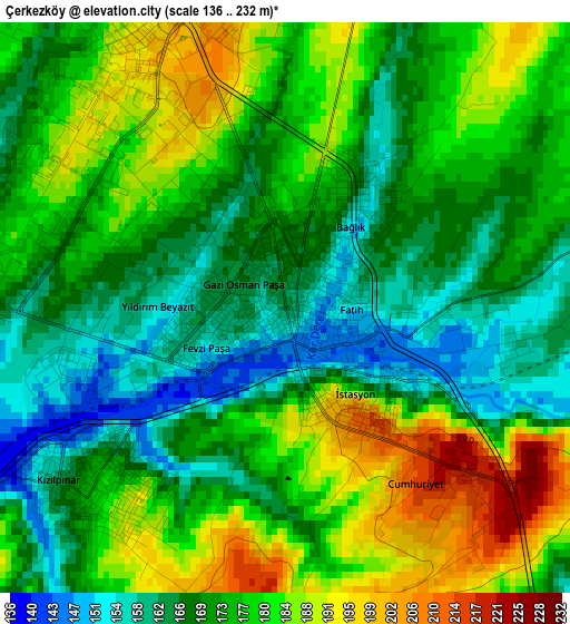
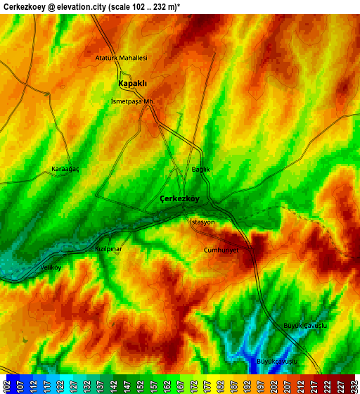
Below is the Elevation map of Çerkezköy, which displays elevation range with different colors. Scale of the first map is from 136 to 232 m (446 to 761 ft) with average elevation of 174.7 meters (=573 ft) [note 1]
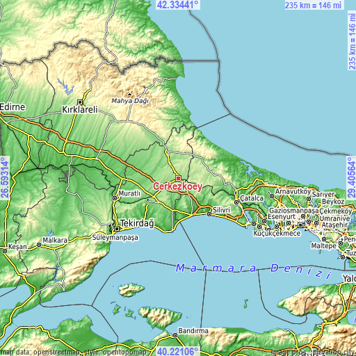
These maps also provides idea of topography and contour of this city, they are displayed at different zoom levels. More info about maps, scale and edge coordinates you can find below images.
| \ | Map #1 | Map #2 | Topo.Map |
| Scale [m] | 136..232 m | 102..232 m | × |
| Scale [ft] | 446..761 ft | 335..761 ft | × |
| Average | 174.7 m = 573 ft | 180.5 m = 592 ft | × |
| Width | 7.34 km = 4.6 mi | 14.69 km = 9.1 mi | 235 km = 146 mi |
| Height | 7.34 km = 4.6 mi | 14.69 km = 9.1 mi | 235 km = 146 mi |
| ↑Max Latitude | 41.319303° | 41.3523° | 42.33441° |
| Latitude at center | 41.28629° | 41.28629° | 41.28629° |
| ↓Min Latitude | 41.25326° | 41.220214° | 40.22106° |
| ← Min Longitude | 27.955445° | 27.911499° | 26.59314° |
| Longitude center | 27.99939° | 27.99939° | 27.99939° |
| →Max Longitude | 28.043335° | 28.087281° | 29.40564° |
Nearby cities:
Cities around Çerkezköy sort by population:
• Çorlu elevation 172 m
21.9 km,  229°
229°
• Silivri 9 m
31.4 km,  138°
138°
• Velimeşe 137 m
10.7 km,  250°
250°
• Marmaracık 153 m
22.3 km, 246°
• Çanta 88 m
24.1 km,  163°
163°
• Büyükçavuşlu 144 m
7.4 km,  133°
133°
• Karacaköy 23 m
34.4 km,  67°
67°
• Sultanköy 27 m
29.5 km,  181°
181°
• Beyazköy 95 m
25.6 km,  285°
285°
• Saray 165 m
18.7 km,  339°
339°
• Sinekli 224 m
17.2 km,  112°
112°
• Kapaklı 197 m
5 km, 341°
Multilingual:
 En español:
Çerkezköy elevación 164 m.
 En France:
Çerkezköy élévation 164 m.
 Auf Deutsch:
Çerkezköy höhe über dem Meeresspiegel ist 164 m.

Sources and notes:
- [note 1] Map square and city borders are not equal. Map elevation data is calculated only from area inside that square.
- [src 1] Elevation data from geonames database provided with same terms of usage.
- [src 2] The elevation map of Çerkezköy is generated using elevation data from NASA's 3 arcsec (90m) resolution SRTM data.
- [src 3] Base (background) map © OpenStreetMap contributors tiles are generated by Geofabrik and OpenTopoMap.
Copyright & License:
This Çerkezköy Elevation Map is licensed under CC BY-SA. You may reuse any part from this page, if you give a proper credit by linking to this URL:
 More info on terms of use page.