Çorlu elevation
Çorlu (Tekirdağ), Turkey elevation is 172 meters and Çorlu elevation in feet is 564 ft above sea level [src 1]. Çorlu is a seat of a second-order administrative division (feature code) with elevation that is 551 meters (1808 ft) smaller than average city elevation in Turkey.
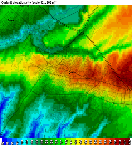
Below is the Elevation map of Çorlu, which displays elevation range with different colors. Scale of the first map is from 82 to 202 m (269 to 663 ft) with average elevation of 135.4 meters (=444 ft) [note 1]
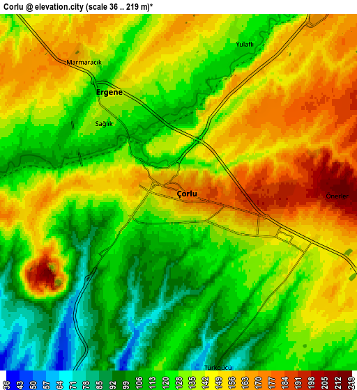
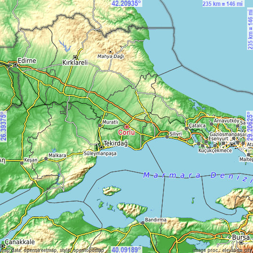
These maps also provides idea of topography and contour of this city, they are displayed at different zoom levels. More info about maps, scale and edge coordinates you can find below images.
| \ | Map #1 | Map #2 | Topo.Map |
| Scale [m] | 82..202 m | 36..219 m | × |
| Scale [ft] | 269..663 ft | 118..719 ft | × |
| Average | 135.4 m = 444 ft | 133.8 m = 439 ft | × |
| Width | 7.36 km = 4.6 mi | 14.72 km = 9.1 mi | 235.4 km = 146.3 mi |
| Height | 7.36 km = 4.6 mi | 14.72 km = 9.1 mi | 235.4 km = 146.3 mi |
| ↑Max Latitude | 41.192247° | 41.225308° | 42.20935° |
| Latitude at center | 41.15917° | 41.15917° | 41.15917° |
| ↓Min Latitude | 41.126076° | 41.092965° | 40.09189° |
| ← Min Longitude | 27.756055° | 27.712109° | 26.39375° |
| Longitude center | 27.8° | 27.8° | 27.8° |
| →Max Longitude | 27.843945° | 27.887891° | 29.20625° |
Nearby cities:
Cities around Çorlu sort by population:
• Tekirdağ elevation 44 m
31.5 km,  230°
230°
• Çerkezköy 164 m
21.9 km,  49°
49°
• Marmara Ereğlisi 6 m
24.7 km,  148°
148°
• Velimeşe 137 m
12.4 km,  31°
31°
• Marmaracık 153 m
6.5 km,  324°
324°
• Çanta 88 m
25.3 km,  110°
110°
• Büyükçavuşlu 144 m
23.8 km,  67°
67°
• Sultanköy 27 m
22 km,  134°
134°
• Büyükkarıştıran 76 m
26.5 km,  306°
306°
• Muratlı 84 m
25.2 km,  273°
273°
• Kapaklı 197 m
24.2 km,  38°
38°
• Beyazköy 95 m
22.5 km,  339°
339°
Multilingual:
 En español:
Çorlu elevación 172 m.
 En France:
Çorlu élévation 172 m.


Sources and notes:
- [note 1] Map square and city borders are not equal. Map elevation data is calculated only from area inside that square.
- [src 1] Elevation data from geonames database provided with same terms of usage.
- [src 2] The elevation map of Çorlu is generated using elevation data from NASA's 3 arcsec (90m) resolution SRTM data.
- [src 3] Base (background) map © OpenStreetMap contributors tiles are generated by Geofabrik and OpenTopoMap.
Copyright & License:
This Çorlu Elevation Map is licensed under CC BY-SA. You may reuse any part from this page, if you give a proper credit by linking to this URL:
 More info on terms of use page.