Gürsu elevation
Gürsu (Bursa), Turkey elevation is 110 meters and Gürsu elevation in feet is 361 ft above sea level [src 1]. Gürsu is a seat of a second-order administrative division (feature code) with elevation that is 613 meters (2011 ft) smaller than average city elevation in Turkey.
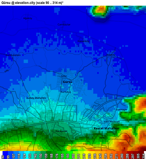
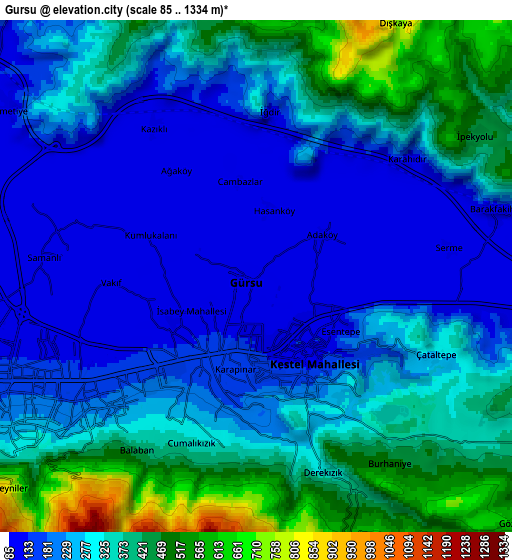
Below is the Elevation map of Gürsu, which displays elevation range with different colors. Scale of the first map is from 90 to 314 m (295 to 1030 ft) with average elevation of 124.1 meters (=407 ft) [note 1]
These maps also provides idea of topography and contour of this city, they are displayed at different zoom levels. More info about maps, scale and edge coordinates you can find below images.
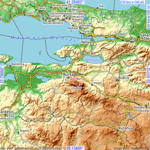
| \ | Map #1 | Map #2 | Topo.Map |
| Scale [m] | 90..314 m | 85..1334 m | × |
| Scale [ft] | 295..1030 ft | 279..4377 ft | × |
| Average | 124.1 m = 407 ft | 284.7 m = 934 ft | × |
| Width | 7.46 km = 4.6 mi | 14.92 km = 9.3 mi | 238.8 km = 148.4 mi |
| Height | 7.46 km = 4.6 mi | 14.92 km = 9.3 mi | 238.8 km = 148.4 mi |
| ↑Max Latitude | 40.252308° | 40.285839° | 41.28403° |
| Latitude at center | 40.21876° | 40.21876° | 40.21876° |
| ↓Min Latitude | 40.185196° | 40.151615° | 39.13648° |
| ← Min Longitude | 29.150925° | 29.106979° | 27.78862° |
| Longitude center | 29.19487° | 29.19487° | 29.19487° |
| →Max Longitude | 29.238815° | 29.282761° | 30.60112° |
Nearby cities:
Cities around Gürsu sort by population:
• Bursa elevation 155 m
11.7 km,  257°
257°
• Gemlik 5 m
23.8 km,  352°
352°
• Kestel 122 m
2.7 km,  146°
146°
• Demirtaş 113 m
10.1 km,  305°
305°
• Yenice 365 m
24.2 km,  127°
127°
• Umurbey 230 m
21.8 km,  357°
357°
• Kirazlı 929 m
18.6 km,  224°
224°
• Cerrah 327 m
27 km, 127°
• Çalı 131 m
23.9 km, 256°
• Nilüfer 69 m
23.7 km,  268°
268°
• Osmangazi 150 m
11.8 km, 257°
• Yıldırım 171 m
8 km,  245°
245°
Multilingual:
 En español:
Gürsu elevación 110 m.
 En France:
Gürsu élévation 110 m.


Sources and notes:
- [note 1] Map square and city borders are not equal. Map elevation data is calculated only from area inside that square.
- [src 1] Elevation data from geonames database provided with same terms of usage.
- [src 2] The elevation map of Gürsu is generated using elevation data from NASA's 3 arcsec (90m) resolution SRTM data.
- [src 3] Base (background) map © OpenStreetMap contributors tiles are generated by Geofabrik and OpenTopoMap.
Copyright & License:
This Gürsu Elevation Map is licensed under CC BY-SA. You may reuse any part from this page, if you give a proper credit by linking to this URL:
 More info on terms of use page.