Karacabey elevation
Karacabey (Bursa), Turkey elevation is 26 meters and Karacabey elevation in feet is 85 ft above sea level [src 1]. Karacabey is a seat of a second-order administrative division (feature code) with elevation that is 697 meters (2287 ft) smaller than average city elevation in Turkey.
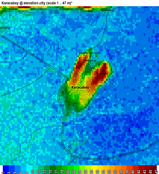
Below is the Elevation map of Karacabey, which displays elevation range with different colors. Scale of the first map is from 1 to 47 m (3 to 154 ft) with average elevation of 8.6 meters (=28 ft) [note 1]
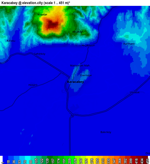
These maps also provides idea of topography and contour of this city, they are displayed at different zoom levels. More info about maps, scale and edge coordinates you can find below images.
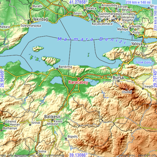
| \ | Map #1 | Map #2 | Topo.Map |
| Scale [m] | 1..47 m | 1..451 m | × |
| Scale [ft] | 3..154 ft | 3..1480 ft | × |
| Average | 8.6 m = 28 ft | 33 m = 108 ft | × |
| Width | 7.46 km = 4.6 mi | 14.93 km = 9.3 mi | 238.8 km = 148.4 mi |
| Height | 7.46 km = 4.6 mi | 14.93 km = 9.3 mi | 238.8 km = 148.4 mi |
| ↑Max Latitude | 40.24678° | 40.280314° | 41.27858° |
| Latitude at center | 40.21323° | 40.21323° | 40.21323° |
| ↓Min Latitude | 40.179663° | 40.146079° | 39.13086° |
| ← Min Longitude | 28.317255° | 28.273309° | 26.95495° |
| Longitude center | 28.3612° | 28.3612° | 28.3612° |
| →Max Longitude | 28.405145° | 28.449091° | 29.76745° |
Nearby cities:
Cities around Karacabey sort by population:
• Bandırma elevation 40 m
36.1 km,  295°
295°
• Mustafakemalpaşa 25 m
19.9 km,  168°
168°
• Susurluk 55 m
37.5 km,  207°
207°
• Manyas 55 m
38.1 km,  240°
240°
• Tatkavaklı 36 m
20 km,  178°
178°
• Görükle 121 m
40.7 km,  87°
87°
• Devecikonağı 67 m
37.3 km,  152°
152°
• Çaltılıbük 81 m
35 km,  144°
144°
• Göbel 43 m
28.3 km,  220°
220°
• Mahmudiye 172 m
28.1 km,  60°
60°
• Soldere 254 m
24.7 km,  133°
133°
• Aksakal 54 m
22.8 km,  251°
251°
Multilingual:
 En español:
Karacabey elevación 26 m.
 En France:
Karacabey élévation 26 m.
 Auf Deutsch:
Karacabey höhe über dem Meeresspiegel ist 26 m.

Sources and notes:
- [note 1] Map square and city borders are not equal. Map elevation data is calculated only from area inside that square.
- [src 1] Elevation data from geonames database provided with same terms of usage.
- [src 2] The elevation map of Karacabey is generated using elevation data from NASA's 3 arcsec (90m) resolution SRTM data.
- [src 3] Base (background) map © OpenStreetMap contributors tiles are generated by Geofabrik and OpenTopoMap.
Copyright & License:
This Karacabey Elevation Map is licensed under CC BY-SA. You may reuse any part from this page, if you give a proper credit by linking to this URL:
 More info on terms of use page.