Pınarhisar elevation
Pınarhisar (Kırklareli), Turkey elevation is 208 meters and Pınarhisar elevation in feet is 682 ft above sea level [src 1]. Pınarhisar is a seat of a second-order administrative division (feature code) with elevation that is 515 meters (1690 ft) smaller than average city elevation in Turkey.
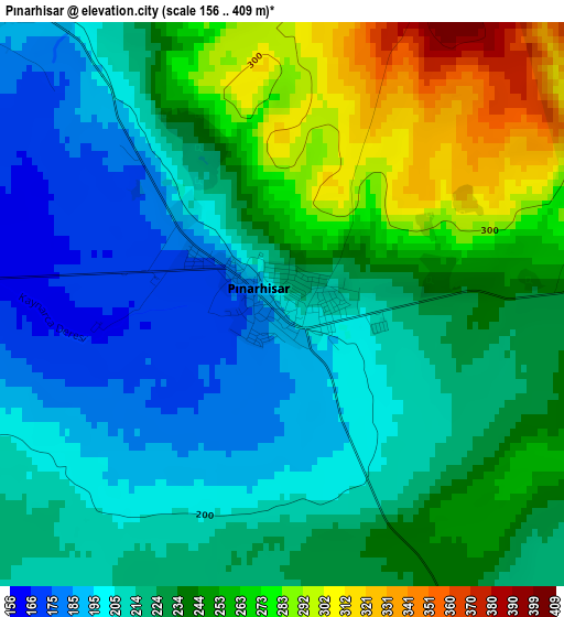
Below is the Elevation map of Pınarhisar, which displays elevation range with different colors. Scale of the first map is from 156 to 409 m (512 to 1342 ft) with average elevation of 230.1 meters (=755 ft) [note 1]
These maps also provides idea of topography and contour of this city, they are displayed at different zoom levels. More info about maps, scale and edge coordinates you can find below images.
| \ | Map #1 | Map #2 | Topo.Map |
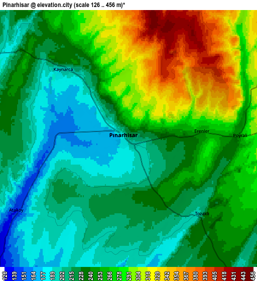
| Scale [m] | 156..409 m | 126..456 m | × |
| Scale [ft] | 512..1342 ft | 413..1496 ft | × |
| Average | 230.1 m = 755 ft | 247.7 m = 813 ft | × |
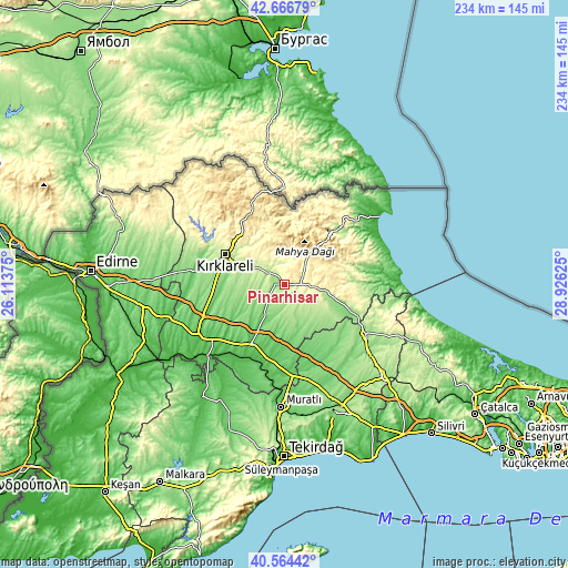
| Width | 7.31 km = 4.5 mi | 14.61 km = 9.1 mi | 233.8 km = 145.3 mi |
| Height | 7.31 km = 4.5 mi | 14.61 km = 9.1 mi | 233.8 km = 145.3 mi |
| ↑Max Latitude | 41.657012° | 41.689836° | 42.66679° |
| Latitude at center | 41.62417° | 41.62417° | 41.62417° |
| ↓Min Latitude | 41.591312° | 41.558437° | 40.56442° |
| ← Min Longitude | 27.476055° | 27.432109° | 26.11375° |
| Longitude center | 27.52° | 27.52° | 27.52° |
| →Max Longitude | 27.563945° | 27.607891° | 28.92625° |
Nearby cities:
Cities around Pınarhisar sort by population:
• Lüleburgaz elevation 71 m
27.9 km,  208°
208°
• Kırklareli 215 m
27.4 km,  296°
296°
• Babaeski 58 m
41.4 km,  239°
239°
• Vize 175 m
21.2 km,  105°
105°
• Üsküp 306 m
15.6 km,  322°
322°
• Yoğuntaş 348 m
43.9 km, 301°
• Saray 165 m
39 km,  120°
120°
• İnece 105 m
38 km,  278°
278°
• Dereköy 490 m
36.2 km,  339°
339°
• Büyükkarıştıran 76 m
36.1 km,  176°
176°
• Beyazköy 95 m
34.3 km,  153°
153°
• Sergen 425 m
18.1 km,  60°
60°
Multilingual:
 En español:
Pınarhisar elevación 208 m.
 En France:
Pınarhisar élévation 208 m.
 Auf Deutsch:
Pınarhisar höhe über dem Meeresspiegel ist 208 m.

Sources and notes:
- [note 1] Map square and city borders are not equal. Map elevation data is calculated only from area inside that square.
- [src 1] Elevation data from geonames database provided with same terms of usage.
- [src 2] The elevation map of Pınarhisar is generated using elevation data from NASA's 3 arcsec (90m) resolution SRTM data.
- [src 3] Base (background) map © OpenStreetMap contributors tiles are generated by Geofabrik and OpenTopoMap.
Copyright & License:
This Pınarhisar Elevation Map is licensed under CC BY-SA. You may reuse any part from this page, if you give a proper credit by linking to this URL:
 More info on terms of use page.