Söğütlü elevation
Söğütlü (Sakarya), Turkey elevation is 20 meters and Söğütlü elevation in feet is 66 ft above sea level [src 1]. Söğütlü is a seat of a second-order administrative division (feature code) with elevation that is 703 meters (2306 ft) smaller than average city elevation in Turkey.
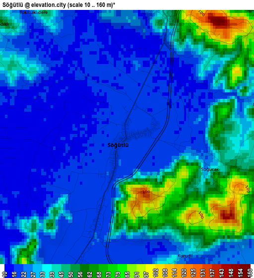
Below is the Elevation map of Söğütlü, which displays elevation range with different colors. Scale of the first map is from 10 to 160 m (33 to 525 ft) with average elevation of 33.8 meters (=111 ft) [note 1]
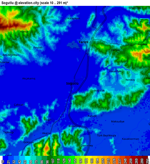
These maps also provides idea of topography and contour of this city, they are displayed at different zoom levels. More info about maps, scale and edge coordinates you can find below images.
| \ | Map #1 | Map #2 | Topo.Map |
| Scale [m] | 10..160 m | 10..291 m | × |
| Scale [ft] | 33..525 ft | 33..955 ft | × |
| Average | 33.8 m = 111 ft | 50.2 m = 165 ft | × |
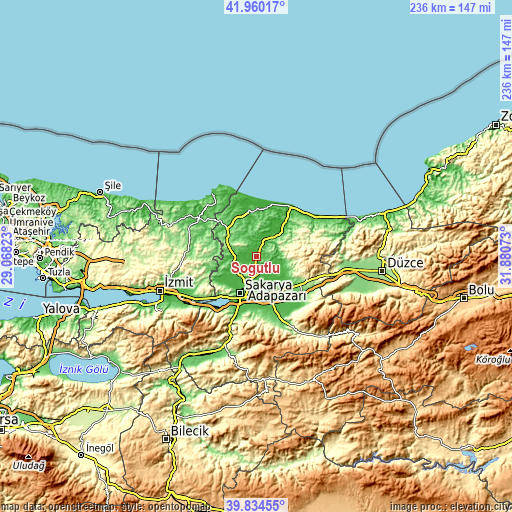
| Width | 7.39 km = 4.6 mi | 14.77 km = 9.2 mi | 236.3 km = 146.8 mi |
| Height | 7.39 km = 4.6 mi | 14.77 km = 9.2 mi | 236.3 km = 146.8 mi |
| ↑Max Latitude | 40.939105° | 40.972293° | 41.96017° |
| Latitude at center | 40.9059° | 40.9059° | 40.9059° |
| ↓Min Latitude | 40.872678° | 40.83944° | 39.83455° |
| ← Min Longitude | 30.430535° | 30.386589° | 29.06823° |
| Longitude center | 30.47448° | 30.47448° | 30.47448° |
| →Max Longitude | 30.518425° | 30.562371° | 31.88073° |
Nearby cities:
Cities around Söğütlü sort by population:
• Adapazarı elevation 34 m
15.2 km,  203°
203°
• Hendek 185 m
25.9 km,  117°
117°
• Akyazı 46 m
27.5 km,  153°
153°
• Ferizli 42 m
4 km,  13°
13°
• Kaynarca 51 m
19.7 km,  314°
314°
• Arifiye 68 m
25.1 km, 204°
• Akmeşe 184 m
24.1 km,  254°
254°
• Kazımpaşa 48 m
19.7 km,  229°
229°
• Ortaköy 272 m
18.6 km,  66°
66°
• Erenler 46 m
18.1 km, 202°
• Kaymas 142 m
17.6 km,  276°
276°
• Serdivan 31 m
16.7 km,  208°
208°
Multilingual:
 En español:
Söğütlü elevación 20 m.
 En France:
Söğütlü élévation 20 m.


Sources and notes:
- [note 1] Map square and city borders are not equal. Map elevation data is calculated only from area inside that square.
- [src 1] Elevation data from geonames database provided with same terms of usage.
- [src 2] The elevation map of Söğütlü is generated using elevation data from NASA's 3 arcsec (90m) resolution SRTM data.
- [src 3] Base (background) map © OpenStreetMap contributors tiles are generated by Geofabrik and OpenTopoMap.
Copyright & License:
This Söğütlü Elevation Map is licensed under CC BY-SA. You may reuse any part from this page, if you give a proper credit by linking to this URL:
 More info on terms of use page.