Dursunlu elevation
Dursunlu (Hatay), Turkey elevation is 221 meters and Dursunlu elevation in feet is 725 ft above sea level [src 1]. Dursunlu is a populated place (feature code) with elevation that is 502 meters (1647 ft) smaller than average city elevation in Turkey.
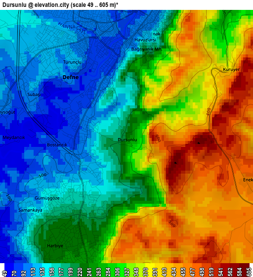
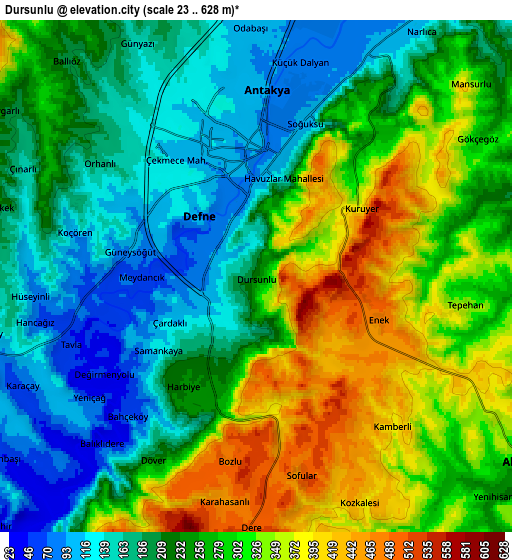
Below is the Elevation map of Dursunlu, which displays elevation range with different colors. Scale of the first map is from 49 to 605 m (161 to 1985 ft) with average elevation of 269.4 meters (=884 ft) [note 1]
These maps also provides idea of topography and contour of this city, they are displayed at different zoom levels. More info about maps, scale and edge coordinates you can find below images.
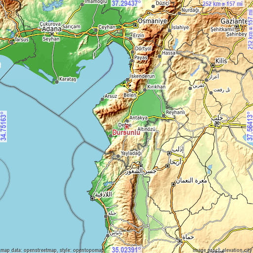
| \ | Map #1 | Map #2 | Topo.Map |
| Scale [m] | 49..605 m | 23..628 m | × |
| Scale [ft] | 161..1985 ft | 75..2060 ft | × |
| Average | 269.4 m = 884 ft | 252.8 m = 829 ft | × |
| Width | 7.89 km = 4.9 mi | 15.78 km = 9.8 mi | 252.5 km = 156.9 mi |
| Height | 7.89 km = 4.9 mi | 15.78 km = 9.8 mi | 252.4 km = 156.8 mi |
| ↑Max Latitude | 36.202829° | 36.238282° | 37.29437° |
| Latitude at center | 36.16736° | 36.16736° | 36.16736° |
| ↓Min Latitude | 36.131875° | 36.096374° | 35.02391° |
| ← Min Longitude | 36.113935° | 36.069989° | 34.75163° |
| Longitude center | 36.15788° | 36.15788° | 36.15788° |
| →Max Longitude | 36.201825° | 36.245771° | 37.56413° |
Nearby cities:
Cities around Dursunlu sort by population:
• Antakya elevation 104 m
4.4 km,  359°
359°
• Gümüşgöze 172 m
3.1 km,  226°
226°
• Toygarlı 204 m
9.2 km,  303°
303°
• Tepehan 355 m
6.4 km,  98°
98°
• Günyazı 161 m
8.2 km,  333°
333°
• Aşağıokçular 74 m
2 km,  306°
306°
• Büyükçat 44 m
9.3 km, 231°
• Samankaya 135 m
3.3 km, 234°
• Balıklıdere 50 m
7 km,  222°
222°
• Karaçay 60 m
8 km,  243°
243°
• Hıdırbey 125 m
5.3 km, 329°
• Harbiye 237 m
4.1 km,  213°
213°
Multilingual:
 En español:
Dursunlu elevación 221 m.
 En France:
Dursunlu élévation 221 m.
 Auf Deutsch:
Dursunlu höhe über dem Meeresspiegel ist 221 m.

Sources and notes:
- [note 1] Map square and city borders are not equal. Map elevation data is calculated only from area inside that square.
- [src 1] Elevation data from geonames database provided with same terms of usage.
- [src 2] The elevation map of Dursunlu is generated using elevation data from NASA's 3 arcsec (90m) resolution SRTM data.
- [src 3] Base (background) map © OpenStreetMap contributors tiles are generated by Geofabrik and OpenTopoMap.
Copyright & License:
This Dursunlu Elevation Map is licensed under CC BY-SA. You may reuse any part from this page, if you give a proper credit by linking to this URL:
 More info on terms of use page.