Akhisar elevation
Akhisar (Manisa), Turkey elevation is 103 meters and Akhisar elevation in feet is 338 ft above sea level [src 1]. Akhisar is a seat of a second-order administrative division (feature code) with elevation that is 620 meters (2034 ft) smaller than average city elevation in Turkey.
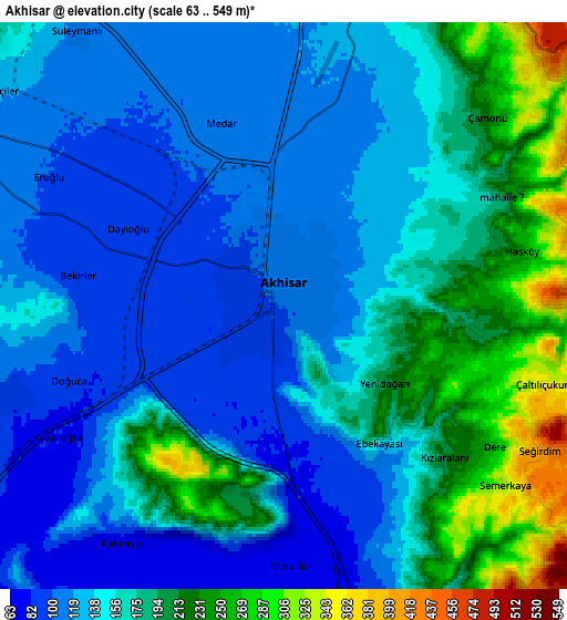
Below is the Elevation map of Akhisar, which displays elevation range with different colors. Scale of the first map is from 79 to 343 m (259 to 1125 ft) with average elevation of 119.4 meters (=392 ft) [note 1]
These maps also provides idea of topography and contour of this city, they are displayed at different zoom levels. More info about maps, scale and edge coordinates you can find below images.

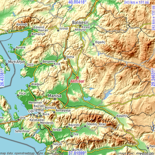
| \ | Map #1 | Map #2 | Topo.Map |
| Scale [m] | 79..343 m | 63..549 m | × |
| Scale [ft] | 259..1125 ft | 207..1801 ft | × |
| Average | 119.4 m = 392 ft | 156.5 m = 513 ft | × |
| Width | 7.6 km = 4.7 mi | 15.21 km = 9.5 mi | 243.3 km = 151.2 mi |
| Height | 7.6 km = 4.7 mi | 15.21 km = 9.5 mi | 243.3 km = 151.2 mi |
| ↑Max Latitude | 38.952703° | 38.986869° | 40.00418° |
| Latitude at center | 38.91852° | 38.91852° | 38.91852° |
| ↓Min Latitude | 38.884321° | 38.850105° | 37.81599° |
| ← Min Longitude | 27.796115° | 27.752169° | 26.43381° |
| Longitude center | 27.84006° | 27.84006° | 27.84006° |
| →Max Longitude | 27.884005° | 27.927951° | 29.24631° |
Nearby cities:
Cities around Akhisar sort by population:
• Soma elevation 155 m
35.7 km,  326°
326°
• Kırkağaç 213 m
25.6 km,  324°
324°
• Saruhanlı 43 m
31.2 km,  229°
229°
• Gölmarmara 105 m
23.6 km,  164°
164°
• Ahmetli 85 m
45.2 km,  169°
169°
• Gördes 671 m
38.9 km,  87°
87°
• Kınık 84 m
43.7 km,  295°
295°
• Zeytinliova 236 m
16.3 km, 299°
• Üçpınar 78 m
46.2 km,  243°
243°
• Gölcük 441 m
45.6 km,  15°
15°
• Halitpaşa 188 m
29.5 km,  208°
208°
• Gelembe 238 m
28.9 km,  1°
1°
Multilingual:
 En español:
Akhisar elevación 103 m.
 En France:
Akhisar élévation 103 m.
 Auf Deutsch:
Thyatira höhe über dem Meeresspiegel ist 103 m.

Sources and notes:
- [note 1] Map square and city borders are not equal. Map elevation data is calculated only from area inside that square.
- [src 1] Elevation data from geonames database provided with same terms of usage.
- [src 2] The elevation map of Akhisar is generated using elevation data from NASA's 3 arcsec (90m) resolution SRTM data.
- [src 3] Base (background) map © OpenStreetMap contributors tiles are generated by Geofabrik and OpenTopoMap.
Copyright & License:
This Akhisar Elevation Map is licensed under CC BY-SA. You may reuse any part from this page, if you give a proper credit by linking to this URL:
 More info on terms of use page.