Çatalhöyük elevation
Çatalhöyük (Konya), Turkey elevation is 1008 meters and Çatalhöyük elevation in feet is 3307 ft above sea level [src 1]. Çatalhöyük is a populated place (feature code) with elevation that is 285 meters (935 ft) bigger than average city elevation in Turkey.
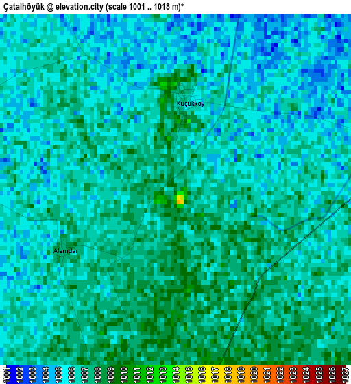
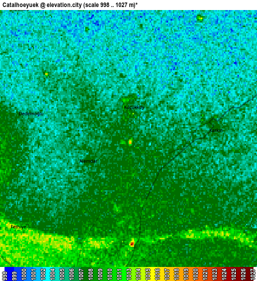
Below is the Elevation map of Çatalhöyük, which displays elevation range with different colors. Scale of the first map is from 1001 to 1018 m (3284 to 3340 ft) with average elevation of 1006.1 meters (=3301 ft) [note 1]
These maps also provides idea of topography and contour of this city, they are displayed at different zoom levels. More info about maps, scale and edge coordinates you can find below images.
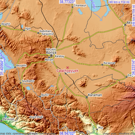
| \ | Map #1 | Map #2 | Topo.Map |
| Scale [m] | 1001..1018 m | 998..1027 m | × |
| Scale [ft] | 3284..3340 ft | 3274..3369 ft | × |
| Average | 1006.1 m = 3301 ft | 1006 m = 3301 ft | × |
| Width | 7.74 km = 4.8 mi | 15.47 km = 9.6 mi | 247.5 km = 153.8 mi |
| Height | 7.74 km = 4.8 mi | 15.47 km = 9.6 mi | 247.5 km = 153.8 mi |
| ↑Max Latitude | 37.703247° | 37.738008° | 38.77323° |
| Latitude at center | 37.66847° | 37.66847° | 37.66847° |
| ↓Min Latitude | 37.633677° | 37.598867° | 36.54702° |
| ← Min Longitude | 32.782945° | 32.738999° | 31.42064° |
| Longitude center | 32.82689° | 32.82689° | 32.82689° |
| →Max Longitude | 32.870835° | 32.914781° | 34.23314° |
Nearby cities:
Cities around Çatalhöyük sort by population:
• Konya elevation 1030 m
37.6 km,  306°
306°
• Çumra 1015 m
11.6 km,  203°
203°
• Yarma 1003 m
16.6 km,  17°
17°
• Ovakavağı 1005 m
10.6 km,  63°
63°
• Güneysınır 1122 m
45.2 km,  191°
191°
• Hotamış 1007 m
43.4 km,  94°
94°
• Hatunsaray 1105 m
43.1 km,  257°
257°
• Dinek 1194 m
42.5 km,  205°
205°
• Selçuklu 1020 m
38 km, 309°
• Hatip 1085 m
36.9 km,  285°
285°
• Meram 1030 m
36.3 km,  299°
299°
• Karatay 1011 m
34.3 km, 310°
Multilingual:
 En español:
Çatalhöyük elevación 1008 m.
 En France:
Çatal Höyük élévation 1008 m.
 Auf Deutsch:
Çatalhöyük höhe über dem Meeresspiegel ist 1008 m.

Sources and notes:
- [note 1] Map square and city borders are not equal. Map elevation data is calculated only from area inside that square.
- [src 1] Elevation data from geonames database provided with same terms of usage.
- [src 2] The elevation map of Çatalhöyük is generated using elevation data from NASA's 3 arcsec (90m) resolution SRTM data.
- [src 3] Base (background) map © OpenStreetMap contributors tiles are generated by Geofabrik and OpenTopoMap.
Copyright & License:
This Çatalhöyük Elevation Map is licensed under CC BY-SA. You may reuse any part from this page, if you give a proper credit by linking to this URL:
 More info on terms of use page.