Sbikha elevation
Sbikha (Kairouan), Tunisia elevation is 66 meters and Sbikha elevation in feet is 217 ft above sea level [src 1]. Sbikha is a populated place (feature code) with elevation that is 83 meters (272 ft) smaller than average city elevation in Tunisia.
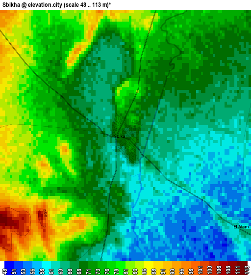
Below is the Elevation map of Sbikha, which displays elevation range with different colors. Scale of the first map is from 48 to 113 m (157 to 371 ft) with average elevation of 70.8 meters (=232 ft) [note 1]
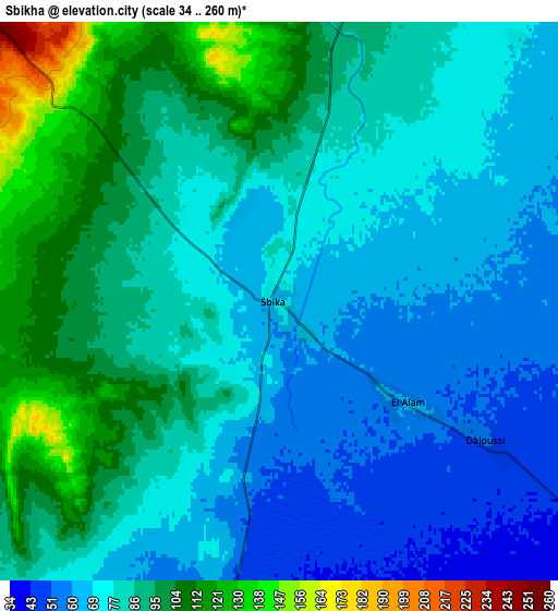
These maps also provides idea of topography and contour of this city, they are displayed at different zoom levels. More info about maps, scale and edge coordinates you can find below images.
| \ | Map #1 | Map #2 | Topo.Map |
| Scale [m] | 48..113 m | 34..260 m | × |
| Scale [ft] | 157..371 ft | 112..853 ft | × |
| Average | 70.8 m = 232 ft | 81.4 m = 267 ft | × |
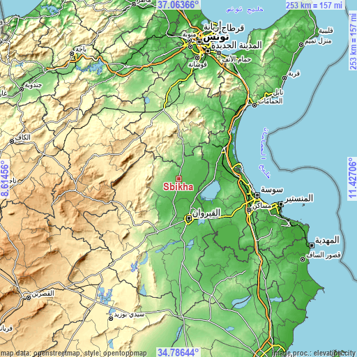
| Width | 7.91 km = 4.9 mi | 15.83 km = 9.8 mi | 253.2 km = 157.3 mi |
| Height | 7.91 km = 4.9 mi | 15.83 km = 9.8 mi | 253.2 km = 157.3 mi |
| ↑Max Latitude | 35.968825° | 36.004383° | 37.06366° |
| Latitude at center | 35.93325° | 35.93325° | 35.93325° |
| ↓Min Latitude | 35.897659° | 35.862053° | 34.78644° |
| ← Min Longitude | 9.976865° | 9.932919° | 8.61456° |
| Longitude center | 10.02081° | 10.02081° | 10.02081° |
| →Max Longitude | 10.064755° | 10.108701° | 11.42706° |
Nearby cities:
Cities around Sbikha sort by population:
• Sousse elevation 24 m
56.8 km,  102°
102°
• Kairouan 65 m
29.2 km,  166°
166°
• Msaken 47 m
55.3 km,  114°
114°
• Hammam Sousse 10 m
53.1 km, 98°
• Akouda 33 m
49.6 km, 98°
• El Fahs 195 m
50.1 km,  348°
348°
• Zaghouan 176 m
53.4 km,  11°
11°
• Sidi Bou Ali 19 m
40.8 km,  86°
86°
• Haffouz 284 m
45.7 km,  222°
222°
• Harqalah 21 m
45.2 km,  76°
76°
• Port el Kantaoui 8 m
51.8 km, 95°
• Sidi el Hani 87 m
39.4 km,  137°
137°
Multilingual:
 En español:
Sbikha elevación 66 m.
 En France:
Sbikha élévation 66 m.


Sources and notes:
- [note 1] Map square and city borders are not equal. Map elevation data is calculated only from area inside that square.
- [src 1] Elevation data from geonames database provided with same terms of usage.
- [src 2] The elevation map of Sbikha is generated using elevation data from NASA's 3 arcsec (90m) resolution SRTM data.
- [src 3] Base (background) map © OpenStreetMap contributors tiles are generated by Geofabrik and OpenTopoMap.
Copyright & License:
This Sbikha Elevation Map is licensed under CC BY-SA. You may reuse any part from this page, if you give a proper credit by linking to this URL:
 More info on terms of use page.