Khao Wong elevation
Khao Wong (Kalasin), Thailand elevation is 194 meters and Khao Wong elevation in feet is 636 ft above sea level [src 1]. Khao Wong is a seat of a second-order administrative division (feature code) with elevation that is 69 meters (226 ft) bigger than average city elevation in Thailand.
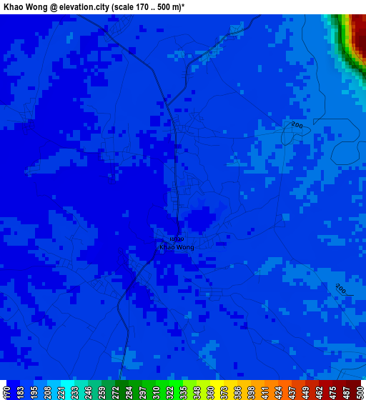
Below is the Elevation map of Khao Wong, which displays elevation range with different colors. Scale of the first map is from 170 to 500 m (558 to 1640 ft) with average elevation of 190.3 meters (=624 ft) [note 1]
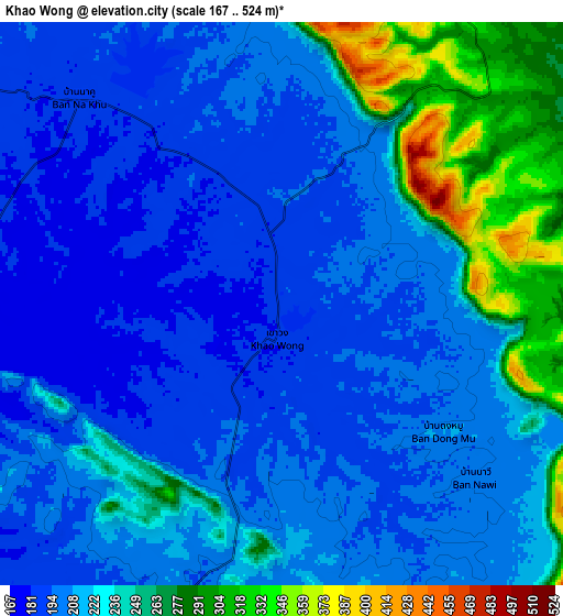
These maps also provides idea of topography and contour of this city, they are displayed at different zoom levels. More info about maps, scale and edge coordinates you can find below images.
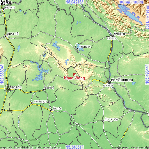
| \ | Map #1 | Map #2 | Topo.Map |
| Scale [m] | 170..500 m | 167..524 m | × |
| Scale [ft] | 558..1640 ft | 548..1719 ft | × |
| Average | 190.3 m = 624 ft | 219.9 m = 721 ft | × |
| Width | 9.36 km = 5.8 mi | 18.72 km = 11.6 mi | 299.5 km = 186.1 mi |
| Height | 9.36 km = 5.8 mi | 18.72 km = 11.6 mi | 299.5 km = 186.1 mi |
| ↑Max Latitude | 16.742167° | 16.784245° | 18.04216° |
| Latitude at center | 16.70008° | 16.70008° | 16.70008° |
| ↓Min Latitude | 16.657984° | 16.615878° | 15.34851° |
| ← Min Longitude | 104.046245° | 104.002299° | 102.68394° |
| Longitude center | 104.09019° | 104.09019° | 104.09019° |
| →Max Longitude | 104.134135° | 104.178081° | 105.49644° |
Nearby cities:
Cities around Khao Wong sort by population:
• Kuchinarai elevation 169 m
18.2 km,  193°
193°
• Moeiwadi 176 m
35.3 km,  168°
168°
• Nong Phok 185 m
45 km,  164°
164°
• Khok Si Suphan 172 m
43.1 km,  27°
27°
• Khamcha-i 185 m
37.6 km,  111°
111°
• Nong Sung 198 m
36.5 km,  131°
131°
• Somdet 199 m
36.3 km,  270°
270°
• Phu Phan 288 m
35.5 km,  339°
339°
• Na Mon 184 m
35.1 km,  246°
246°
• Tao Ngoi 183 m
34 km,  13°
13°
• Huai Phueng 191 m
20 km, 253°
• Na Khu 192 m
9.8 km,  316°
316°
Multilingual:
 En español:
Khao Wong elevación 194 m.
 En France:
Khao Wong élévation 194 m.
 Auf Deutsch:
Khao Wong höhe über dem Meeresspiegel ist 194 m.

Sources and notes:
- [note 1] Map square and city borders are not equal. Map elevation data is calculated only from area inside that square.
- [src 1] Elevation data from geonames database provided with same terms of usage.
- [src 2] The elevation map of Khao Wong is generated using elevation data from NASA's 3 arcsec (90m) resolution SRTM data.
- [src 3] Base (background) map © OpenStreetMap contributors tiles are generated by Geofabrik and OpenTopoMap.
Copyright & License:
This Khao Wong Elevation Map is licensed under CC BY-SA. You may reuse any part from this page, if you give a proper credit by linking to this URL:
 More info on terms of use page.