Lat Yao elevation
Lat Yao (Nakhon Sawan), Thailand elevation is 62 meters and Lat Yao elevation in feet is 203 ft above sea level [src 1]. Lat Yao is a seat of a second-order administrative division (feature code) with elevation that is 63 meters (207 ft) smaller than average city elevation in Thailand.
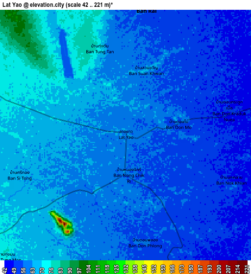
Below is the Elevation map of Lat Yao, which displays elevation range with different colors. Scale of the first map is from 47 to 77 m (154 to 253 ft) with average elevation of 59.1 meters (=194 ft) [note 1]
These maps also provides idea of topography and contour of this city, they are displayed at different zoom levels. More info about maps, scale and edge coordinates you can find below images.

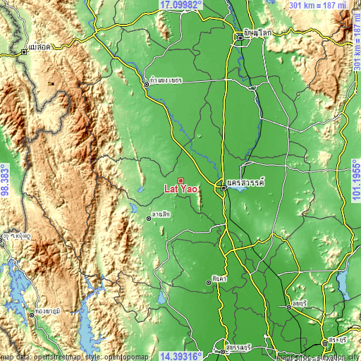
| \ | Map #1 | Map #2 | Topo.Map |
| Scale [m] | 47..77 m | 42..221 m | × |
| Scale [ft] | 154..253 ft | 138..725 ft | × |
| Average | 59.1 m = 194 ft | 60 m = 197 ft | × |
| Width | 9.41 km = 5.8 mi | 18.81 km = 11.7 mi | 301 km = 187 mi |
| Height | 9.41 km = 5.8 mi | 18.81 km = 11.7 mi | 301 km = 187 mi |
| ↑Max Latitude | 15.793291° | 15.835573° | 17.09982° |
| Latitude at center | 15.751° | 15.751° | 15.751° |
| ↓Min Latitude | 15.7087° | 15.666392° | 14.39316° |
| ← Min Longitude | 99.745305° | 99.701359° | 98.383° |
| Longitude center | 99.78925° | 99.78925° | 99.78925° |
| →Max Longitude | 99.833195° | 99.877141° | 101.1955° |
Nearby cities:
Cities around Lat Yao sort by population:
• Nakhon Sawan elevation 31 m
37.6 km,  97°
97°
• Khanu Woralaksaburi 52 m
35.4 km,  12°
12°
• Thap Than 45 m
34.1 km,  161°
161°
• Lan Sak 112 m
40.2 km,  214°
214°
• Kao Liao 36 m
32.9 km,  70°
70°
• Nong Chang 54 m
40.4 km,  172°
172°
• Krok Phra 26 m
37.2 km,  125°
125°
• Mae Poen 133 m
35.7 km,  253°
253°
• Mae Wong 129 m
29.2 km,  276°
276°
• Banphot Phisai 46 m
29 km,  45°
45°
• Chum Ta Bong 101 m
28.6 km,  242°
242°
• Sawang Arom 44 m
20.1 km, 157°
Multilingual:
 En español:
Lat Yao elevación 62 m.
 En France:
Lat Yao élévation 62 m.


Sources and notes:
- [note 1] Map square and city borders are not equal. Map elevation data is calculated only from area inside that square.
- [src 1] Elevation data from geonames database provided with same terms of usage.
- [src 2] The elevation map of Lat Yao is generated using elevation data from NASA's 3 arcsec (90m) resolution SRTM data.
- [src 3] Base (background) map © OpenStreetMap contributors tiles are generated by Geofabrik and OpenTopoMap.
Copyright & License:
This Lat Yao Elevation Map is licensed under CC BY-SA. You may reuse any part from this page, if you give a proper credit by linking to this URL:
 More info on terms of use page.