Thoen elevation
Thoen (Lampang), Thailand elevation is 170 meters and Thoen elevation in feet is 558 ft above sea level [src 1]. Thoen is a seat of a second-order administrative division (feature code) with elevation that is 45 meters (148 ft) bigger than average city elevation in Thailand.
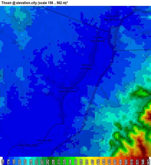
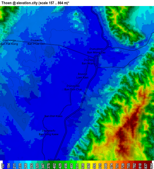
Below is the Elevation map of Thoen, which displays elevation range with different colors. Scale of the first map is from 158 to 562 m (518 to 1844 ft) with average elevation of 194.3 meters (=637 ft) [note 1]
These maps also provides idea of topography and contour of this city, they are displayed at different zoom levels. More info about maps, scale and edge coordinates you can find below images.
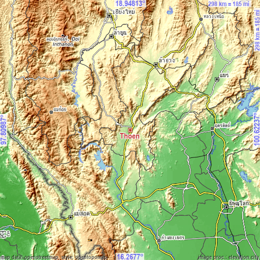
| \ | Map #1 | Map #2 | Topo.Map |
| Scale [m] | 158..562 m | 157..864 m | × |
| Scale [ft] | 518..1844 ft | 515..2835 ft | × |
| Average | 194.3 m = 637 ft | 277.8 m = 911 ft | × |
| Width | 9.31 km = 5.8 mi | 18.63 km = 11.6 mi | 298 km = 185.2 mi |
| Height | 9.31 km = 5.8 mi | 18.63 km = 11.6 mi | 298.1 km = 185.2 mi |
| ↑Max Latitude | 17.65477° | 17.696641° | 18.94813° |
| Latitude at center | 17.61289° | 17.61289° | 17.61289° |
| ↓Min Latitude | 17.571° | 17.5291° | 16.2677° |
| ← Min Longitude | 99.172175° | 99.128229° | 97.80987° |
| Longitude center | 99.21612° | 99.21612° | 99.21612° |
| →Max Longitude | 99.260065° | 99.304011° | 100.62237° |
Nearby cities:
Cities around Thoen sort by population:
• Si Satchanalai elevation 77 m
58.6 km,  100°
100°
• Ban Tak 148 m
64.9 km,  192°
192°
• Ko Kha 223 m
67.1 km,  16°
16°
• Mae Tha 250 m
66 km,  28°
28°
• Wang Chin 108 m
51.3 km,  54°
54°
• Soem Ngam 248 m
50.4 km,  3°
3°
• Thung Saliam 94 m
48.9 km,  131°
131°
• Thung Hua Chang 567 m
47.7 km,  335°
335°
• Sam Ngao 145 m
45.9 km,  206°
206°
• Li 458 m
35.1 km,  306°
306°
• Sop Prap 200 m
32.4 km, 23°
• Mae Phrik 162 m
21.4 km, 210°
Multilingual:
 En español:
Thoen elevación 170 m.
 En France:
Thoen élévation 170 m.


Sources and notes:
- [note 1] Map square and city borders are not equal. Map elevation data is calculated only from area inside that square.
- [src 1] Elevation data from geonames database provided with same terms of usage.
- [src 2] The elevation map of Thoen is generated using elevation data from NASA's 3 arcsec (90m) resolution SRTM data.
- [src 3] Base (background) map © OpenStreetMap contributors tiles are generated by Geofabrik and OpenTopoMap.
Copyright & License:
This Thoen Elevation Map is licensed under CC BY-SA. You may reuse any part from this page, if you give a proper credit by linking to this URL:
 More info on terms of use page.