Ma‘arratmişrīn elevation
Ma‘arratmişrīn (Idlib), Syria elevation is 339 meters and Ma‘arratmişrīn elevation in feet is 1112 ft above sea level [src 1]. Ma‘arratmişrīn is a seat of a third-order administrative division (feature code) with elevation that is 190 meters (623 ft) smaller than average city elevation in Syria.
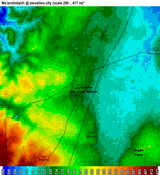
Below is the Elevation map of Ma‘arratmişrīn, which displays elevation range with different colors. Scale of the first map is from 290 to 417 m (951 to 1368 ft) with average elevation of 337.5 meters (=1107 ft) [note 1]
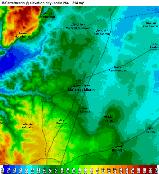
These maps also provides idea of topography and contour of this city, they are displayed at different zoom levels. More info about maps, scale and edge coordinates you can find below images.
| \ | Map #1 | Map #2 | Topo.Map |
| Scale [m] | 290..417 m | 264..514 m | × |
| Scale [ft] | 951..1368 ft | 866..1686 ft | × |
| Average | 337.5 m = 1107 ft | 345.5 m = 1134 ft | × |
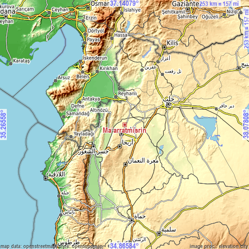
| Width | 7.9 km = 4.9 mi | 15.81 km = 9.8 mi | 253 km = 157.2 mi |
| Height | 7.9 km = 4.9 mi | 15.81 km = 9.8 mi | 253 km = 157.2 mi |
| ↑Max Latitude | 36.047059° | 36.082583° | 37.14079° |
| Latitude at center | 36.01152° | 36.01152° | 36.01152° |
| ↓Min Latitude | 35.975965° | 35.940393° | 34.86584° |
| ← Min Longitude | 36.627885° | 36.583939° | 35.26558° |
| Longitude center | 36.67183° | 36.67183° | 36.67183° |
| →Max Longitude | 36.715775° | 36.759721° | 38.07808° |
Nearby cities:
Cities around Ma‘arratmişrīn sort by population:
• Idlib elevation 442 m
9.6 km,  200°
200°
• Sarāqib 366 m
20.3 km,  143°
143°
• Salqīn 370 m
24.3 km,  305°
305°
• Binnish 363 m
7.2 km,  148°
148°
• Kafr Takhārīm 469 m
18.3 km, 309°
• Ad Dānā 400 m
24 km,  21°
21°
• Arīḩā 598 m
22.7 km,  194°
194°
• Al Atārib 311 m
19.8 km,  44°
44°
• Armanāz 336 m
17.2 km,  297°
297°
• Qarqania 541 m
15.1 km,  339°
339°
• Sarmīn 390 m
12.9 km,  158°
158°
• Taftanāz 329 m
10.4 km,  98°
98°
Multilingual:
 En español:
Ma‘arratmişrīn elevación 339 m.
 En France:
Ma‘arratmişrīn élévation 339 m.
 Auf Deutsch:
Ma‘arratmişrīn höhe über dem Meeresspiegel ist 339 m.

Sources and notes:
- [note 1] Map square and city borders are not equal. Map elevation data is calculated only from area inside that square.
- [src 1] Elevation data from geonames database provided with same terms of usage.
- [src 2] The elevation map of Ma‘arratmişrīn is generated using elevation data from NASA's 3 arcsec (90m) resolution SRTM data.
- [src 3] Base (background) map © OpenStreetMap contributors tiles are generated by Geofabrik and OpenTopoMap.
Copyright & License:
This Ma‘arratmişrīn Elevation Map is licensed under CC BY-SA. You may reuse any part from this page, if you give a proper credit by linking to this URL:
 More info on terms of use page.