Guatajiagua elevation
Guatajiagua (Morazán), El Salvador elevation is 288 meters and Guatajiagua elevation in feet is 945 ft above sea level [src 1]. Guatajiagua is a populated place (feature code) with elevation that is 183 meters (600 ft) smaller than average city elevation in El Salvador.
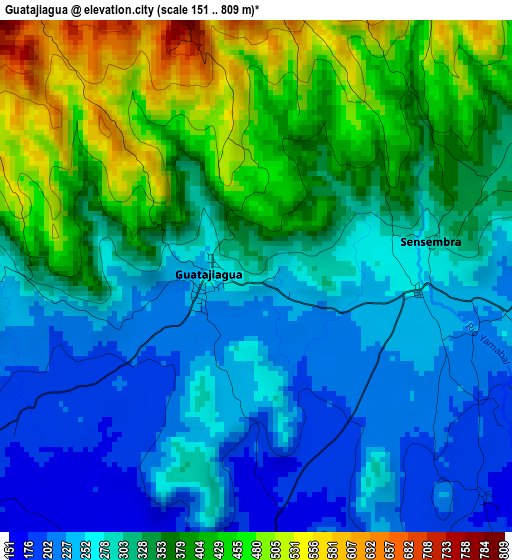
Below is the Elevation map of Guatajiagua, which displays elevation range with different colors. Scale of the first map is from 151 to 809 m (495 to 2654 ft) with average elevation of 327.5 meters (=1074 ft) [note 1]
These maps also provides idea of topography and contour of this city, they are displayed at different zoom levels. More info about maps, scale and edge coordinates you can find below images.
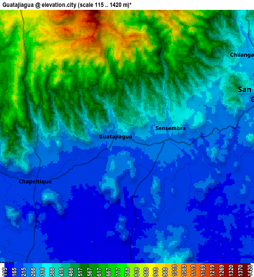
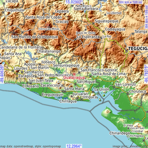
| \ | Map #1 | Map #2 | Topo.Map |
| Scale [m] | 151..809 m | 115..1420 m | × |
| Scale [ft] | 495..2654 ft | 377..4659 ft | × |
| Average | 327.5 m = 1074 ft | 393.4 m = 1291 ft | × |
| Width | 9.5 km = 5.9 mi | 18.99 km = 11.8 mi | 303.8 km = 188.8 mi |
| Height | 9.5 km = 5.9 mi | 18.99 km = 11.8 mi | 303.9 km = 188.8 mi |
| ↑Max Latitude | 13.709367° | 13.752057° | 15.02902° |
| Latitude at center | 13.66667° | 13.66667° | 13.66667° |
| ↓Min Latitude | 13.623965° | 13.581252° | 12.2964° |
| ← Min Longitude | -88.243945° | -88.287891° | -89.60625° |
| Longitude center | -88.2° | -88.2° | -88.2° |
| →Max Longitude | -88.156055° | -88.112109° | -86.79375° |
Nearby cities:
Cities around Guatajiagua sort by population:
• San Miguel elevation 130 m
20.5 km,  174°
174°
• San Francisco 270 m
11.4 km,  71°
71°
• Chinameca 718 m
24.6 km,  221°
221°
• Ciudad Barrios 847 m
13.2 km,  327°
327°
• Nueva Guadalupe 495 m
22 km,  227°
227°
• Jocoro 230 m
20.6 km,  105°
105°
• Chapeltique 186 m
8.1 km,  242°
242°
• Lolotique 527 m
20.8 km, 231°
• Cacaopera 636 m
16.8 km,  48°
48°
• Moncagua 231 m
15.8 km,  200°
200°
• Sociedad 346 m
20.1 km,  79°
79°
• Sesori 184 m
18.8 km,  287°
287°
Multilingual:
 En español:
Guatajiagua elevación 288 m.
 En France:
Guatajiagua élévation 288 m.
 Auf Deutsch:
Guatajiagua höhe über dem Meeresspiegel ist 288 m.

Sources and notes:
- [note 1] Map square and city borders are not equal. Map elevation data is calculated only from area inside that square.
- [src 1] Elevation data from geonames database provided with same terms of usage.
- [src 2] The elevation map of Guatajiagua is generated using elevation data from NASA's 3 arcsec (90m) resolution SRTM data.
- [src 3] Base (background) map © OpenStreetMap contributors tiles are generated by Geofabrik and OpenTopoMap.
Copyright & License:
This Guatajiagua Elevation Map is licensed under CC BY-SA. You may reuse any part from this page, if you give a proper credit by linking to this URL:
 More info on terms of use page.