Jucuapa elevation
Jucuapa (Usulután), El Salvador elevation is 476 meters and Jucuapa elevation in feet is 1562 ft above sea level [src 1]. Jucuapa is a populated place (feature code) with elevation that is 5 meters (16 ft) bigger than average city elevation in El Salvador.
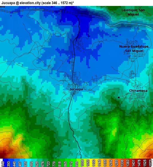
Below is the Elevation map of Jucuapa, which displays elevation range with different colors. Scale of the first map is from 346 to 1572 m (1135 to 5157 ft) with average elevation of 616.8 meters (=2024 ft) [note 1]
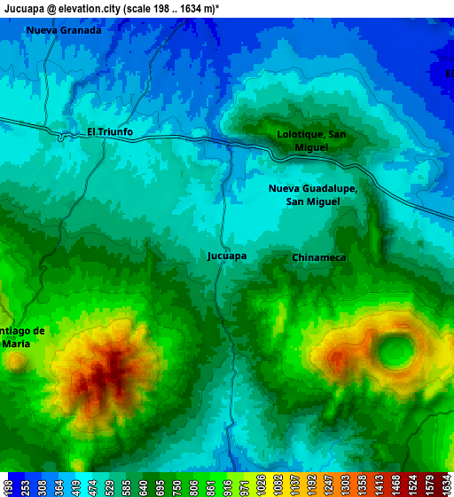
These maps also provides idea of topography and contour of this city, they are displayed at different zoom levels. More info about maps, scale and edge coordinates you can find below images.
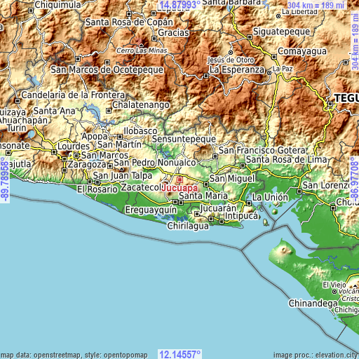
| \ | Map #1 | Map #2 | Topo.Map |
| Scale [m] | 346..1572 m | 198..1634 m | × |
| Scale [ft] | 1135..5157 ft | 650..5361 ft | × |
| Average | 616.8 m = 2024 ft | 610.9 m = 2004 ft | × |
| Width | 9.5 km = 5.9 mi | 19 km = 11.8 mi | 304 km = 188.9 mi |
| Height | 9.5 km = 5.9 mi | 19 km = 11.8 mi | 304.1 km = 189 mi |
| ↑Max Latitude | 13.559394° | 13.602111° | 14.87993° |
| Latitude at center | 13.51667° | 13.51667° | 13.51667° |
| ↓Min Latitude | 13.473938° | 13.431198° | 12.14557° |
| ← Min Longitude | -88.427275° | -88.471221° | -89.78958° |
| Longitude center | -88.38333° | -88.38333° | -88.38333° |
| →Max Longitude | -88.339385° | -88.295439° | -86.97708° |
Nearby cities:
Cities around Jucuapa sort by population:
• San Rafael Oriente elevation 212 m
15.3 km,  166°
166°
• Santiago de María 896 m
9.7 km,  247°
247°
• Berlín 975 m
16.3 km,  263°
263°
• El Tránsito 119 m
18.9 km, 168°
• Chinameca 718 m
4.1 km,  117°
117°
• Santa Elena 180 m
15.3 km,  193°
193°
• Nueva Guadalupe 495 m
4.1 km,  62°
62°
• Ozatlán 237 m
19.5 km,  220°
220°
• Concepción Batres 108 m
18.6 km, 174°
• Chapeltique 186 m
18.1 km,  44°
44°
• Lolotique 527 m
5.2 km, 44°
• Moncagua 231 m
14.5 km,  82°
82°
Multilingual:
 En español:
Jucuapa elevación 476 m.
 En France:
Jucuapa élévation 476 m.


Sources and notes:
- [note 1] Map square and city borders are not equal. Map elevation data is calculated only from area inside that square.
- [src 1] Elevation data from geonames database provided with same terms of usage.
- [src 2] The elevation map of Jucuapa is generated using elevation data from NASA's 3 arcsec (90m) resolution SRTM data.
- [src 3] Base (background) map © OpenStreetMap contributors tiles are generated by Geofabrik and OpenTopoMap.
Copyright & License:
This Jucuapa Elevation Map is licensed under CC BY-SA. You may reuse any part from this page, if you give a proper credit by linking to this URL:
 More info on terms of use page.