Ozatlán elevation
Ozatlán (Usulután), El Salvador elevation is 237 meters and Ozatlán elevation in feet is 778 ft above sea level [src 1]. Ozatlán is a populated place (feature code) with elevation that is 234 meters (768 ft) smaller than average city elevation in El Salvador.
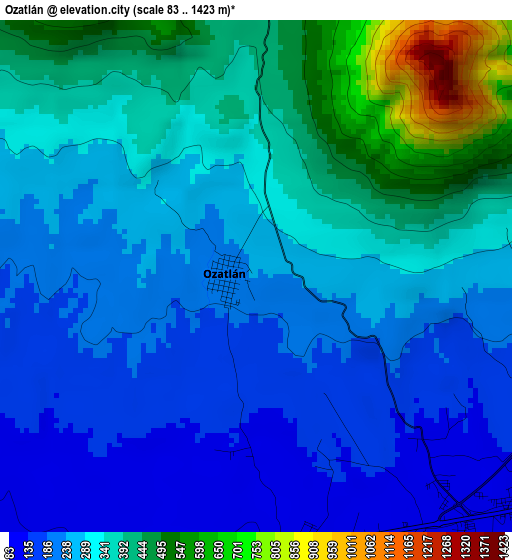
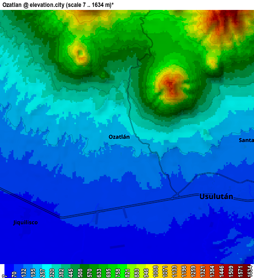
Below is the Elevation map of Ozatlán, which displays elevation range with different colors. Scale of the first map is from 83 to 1423 m (272 to 4669 ft) with average elevation of 303.3 meters (=995 ft) [note 1]
These maps also provides idea of topography and contour of this city, they are displayed at different zoom levels. More info about maps, scale and edge coordinates you can find below images.
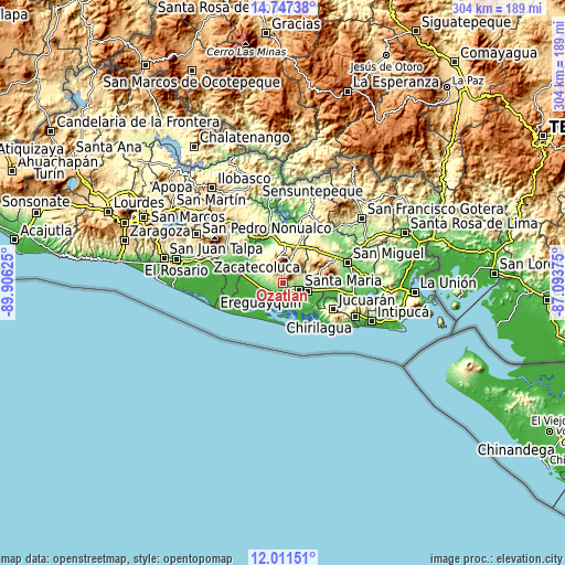
| \ | Map #1 | Map #2 | Topo.Map |
| Scale [m] | 83..1423 m | 7..1634 m | × |
| Scale [ft] | 272..4669 ft | 23..5361 ft | × |
| Average | 303.3 m = 995 ft | 326.1 m = 1070 ft | × |
| Width | 9.51 km = 5.9 mi | 19.01 km = 11.8 mi | 304.2 km = 189 mi |
| Height | 9.51 km = 5.9 mi | 19.01 km = 11.8 mi | 304.2 km = 189 mi |
| ↑Max Latitude | 13.426078° | 13.468819° | 14.74738° |
| Latitude at center | 13.38333° | 13.38333° | 13.38333° |
| ↓Min Latitude | 13.340574° | 13.297811° | 12.01151° |
| ← Min Longitude | -88.543945° | -88.587891° | -89.90625° |
| Longitude center | -88.5° | -88.5° | -88.5° |
| →Max Longitude | -88.456055° | -88.412109° | -87.09375° |
Nearby cities:
Cities around Ozatlán sort by population:
• Usulután elevation 105 m
6.6 km,  124°
124°
• San Rafael Oriente 212 m
16.2 km,  90°
90°
• Puerto El Triunfo 15 m
12.4 km,  205°
205°
• Santiago de María 896 m
11.7 km,  17°
17°
• Berlín 975 m
13.5 km,  344°
344°
• Jucuapa 476 m
19.5 km,  40°
40°
• El Tránsito 119 m
16.6 km,  102°
102°
• Jiquilisco 27 m
11.7 km,  230°
230°
• Chinameca 718 m
20.8 km,  51°
51°
• Santa Elena 180 m
9 km, 90°
• Concepción Batres 108 m
14.9 km, 104°
• San Agustín 240 m
12.2 km,  297°
297°
Multilingual:
 En español:
Ozatlán elevación 237 m.
 En France:
Ozatlán élévation 237 m.


Sources and notes:
- [note 1] Map square and city borders are not equal. Map elevation data is calculated only from area inside that square.
- [src 1] Elevation data from geonames database provided with same terms of usage.
- [src 2] The elevation map of Ozatlán is generated using elevation data from NASA's 3 arcsec (90m) resolution SRTM data.
- [src 3] Base (background) map © OpenStreetMap contributors tiles are generated by Geofabrik and OpenTopoMap.
Copyright & License:
This Ozatlán Elevation Map is licensed under CC BY-SA. You may reuse any part from this page, if you give a proper credit by linking to this URL:
 More info on terms of use page.