Jilib elevation
Jilib (Middle Juba), Somalia elevation is 25 meters and Jilib elevation in feet is 82 ft above sea level [src 1]. Jilib is a populated place (feature code) with elevation that is 265 meters (869 ft) smaller than average city elevation in Somalia.
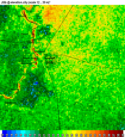
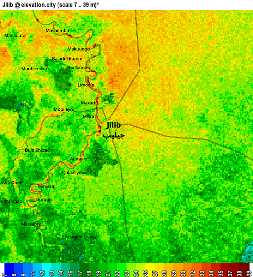
Below is the Elevation map of Jilib, which displays elevation range with different colors. Scale of the first map is from 12 to 39 m (39 to 128 ft) with average elevation of 24.6 meters (=81 ft) [note 1]
These maps also provides idea of topography and contour of this city, they are displayed at different zoom levels. More info about maps, scale and edge coordinates you can find below images.
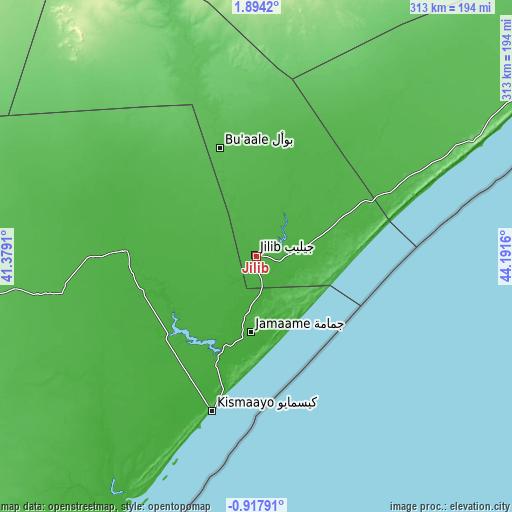
| \ | Map #1 | Map #2 | Topo.Map |
| Scale [m] | 12..39 m | 7..39 m | × |
| Scale [ft] | 39..128 ft | 23..128 ft | × |
| Average | 24.6 m = 81 ft | 23.6 m = 77 ft | × |
| Width | 9.77 km = 6.1 mi | 19.54 km = 12.1 mi | 312.7 km = 194.3 mi |
| Height | 9.77 km = 6.1 mi | 19.54 km = 12.1 mi | 312.7 km = 194.3 mi |
| ↑Max Latitude | 0.532234° | 0.576177° | 1.8942° |
| Latitude at center | 0.48829° | 0.48829° | 0.48829° |
| ↓Min Latitude | 0.444346° | 0.400402° | -0.91791° |
| ← Min Longitude | 42.741405° | 42.697459° | 41.3791° |
| Longitude center | 42.78535° | 42.78535° | 42.78535° |
| →Max Longitude | 42.829295° | 42.873241° | 44.1916° |
Nearby cities:
Cities around Jilib sort by population:
• Kismayo elevation 11 m
97.8 km,  195°
195°
• Marka 12 m
259.6 km,  58°
58°
• Jamaame 12 m
46.8 km,  185°
185°
• Baidoa 441 m
307.3 km,  18°
18°
• Afgooye 87 m
317.9 km,  54°
54°
• Qoryooley 69 m
241.9 km, 53°
• Baardheere 97 m
214 km,  344°
344°
• Buurhakaba 277 m
294.7 km,  29°
29°
• Saacow 63 m
132.4 km, 343°
• Buur Gaabo -2 m
217.2 km,  209°
209°
• Dujuuma 57 m
88.2 km, 344°
• Bu’aale 44 m
69.9 km, 341°
Multilingual:
 En español:
Jilib elevación 25 m.
 En France:
Jilib élévation 25 m.


Sources and notes:
- [note 1] Map square and city borders are not equal. Map elevation data is calculated only from area inside that square.
- [src 1] Elevation data from geonames database provided with same terms of usage.
- [src 2] The elevation map of Jilib is generated using elevation data from NASA's 3 arcsec (90m) resolution SRTM data.
- [src 3] Base (background) map © OpenStreetMap contributors tiles are generated by Geofabrik and OpenTopoMap.
Copyright & License:
This Jilib Elevation Map is licensed under CC BY-SA. You may reuse any part from this page, if you give a proper credit by linking to this URL:
 More info on terms of use page.