Myjava elevation
Myjava (Trenčiansky kraj, Okres Myjava), Slovakia elevation is 332 meters and Myjava elevation in feet is 1089 ft above sea level [src 1]. Myjava is a populated place (feature code) with elevation that is 12 meters (39 ft) bigger than average city elevation in Slovakia.
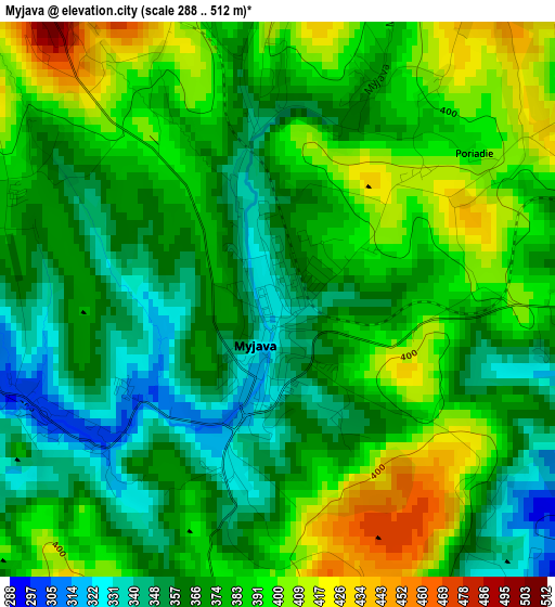
Below is the Elevation map of Myjava, which displays elevation range with different colors. Scale of the first map is from 288 to 512 m (945 to 1680 ft) with average elevation of 376.7 meters (=1236 ft) [note 1]
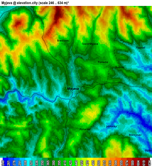
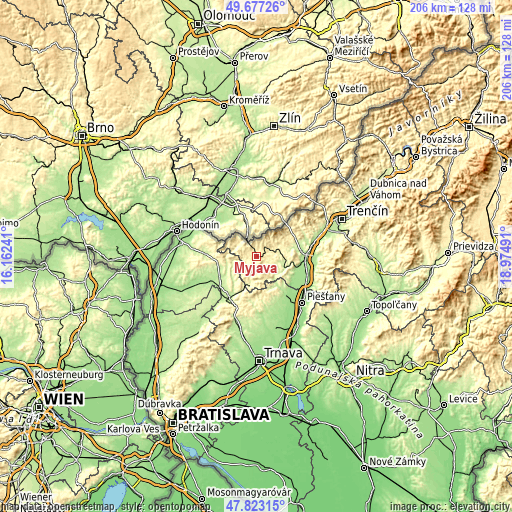
These maps also provides idea of topography and contour of this city, they are displayed at different zoom levels. More info about maps, scale and edge coordinates you can find below images.
| \ | Map #1 | Map #2 | Topo.Map |
| Scale [m] | 288..512 m | 246..634 m | × |
| Scale [ft] | 945..1680 ft | 807..2080 ft | × |
| Average | 376.7 m = 1236 ft | 393.3 m = 1290 ft | × |
| Width | 6.44 km = 4 mi | 12.88 km = 8 mi | 206.2 km = 128.1 mi |
| Height | 6.44 km = 4 mi | 12.88 km = 8 mi | 206.1 km = 128.1 mi |
| ↑Max Latitude | 48.787722° | 48.816667° | 49.67726° |
| Latitude at center | 48.75876° | 48.75876° | 48.75876° |
| ↓Min Latitude | 48.729782° | 48.700786° | 47.82315° |
| ← Min Longitude | 17.524715° | 17.480769° | 16.16241° |
| Longitude center | 17.56866° | 17.56866° | 17.56866° |
| →Max Longitude | 17.612605° | 17.656551° | 18.97491° |
Nearby cities:
Cities around Myjava sort by population:
• Piešťany elevation 161 m
26.3 km,  133°
133°
• Senica 209 m
17.2 km,  239°
239°
• Nové Mesto nad Váhom 195 m
19.2 km,  90°
90°
• Skalica 179 m
26.8 km,  290°
290°
• Holíč 180 m
30.3 km,  281°
281°
• Stará Turá 279 m
9.4 km,  77°
77°
• Vrbové 183 m
19.1 km,  143°
143°
• Brezová pod Bradlom 259 m
10.8 km,  191°
191°
• Gbely 186 m
33.5 km,  262°
262°
• Leopoldov 143 m
37.7 km,  157°
157°
• Čachtice 181 m
16.8 km,  107°
107°
• Smolenice 226 m
30 km,  199°
199°
Multilingual:
 En español:
Myjava elevación 332 m.
 En France:
Myjava élévation 332 m.


Sources and notes:
- [note 1] Map square and city borders are not equal. Map elevation data is calculated only from area inside that square.
- [src 1] Elevation data from geonames database provided with same terms of usage.
- [src 2] The elevation map of Myjava is generated using elevation data from NASA's 3 arcsec (90m) resolution SRTM data.
- [src 3] Base (background) map © OpenStreetMap contributors tiles are generated by Geofabrik and OpenTopoMap.
Copyright & License:
This Myjava Elevation Map is licensed under CC BY-SA. You may reuse any part from this page, if you give a proper credit by linking to this URL:
 More info on terms of use page.