Gbely elevation
Gbely (Trnavský kraj, Okres Skalica), Slovakia elevation is 186 meters and Gbely elevation in feet is 610 ft above sea level [src 1]. Gbely is a populated place (feature code) with elevation that is 134 meters (440 ft) smaller than average city elevation in Slovakia.
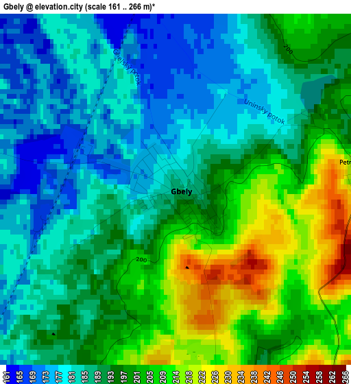
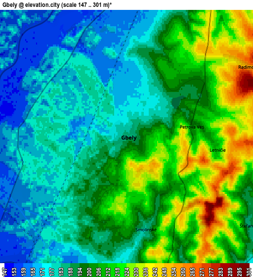
Below is the Elevation map of Gbely, which displays elevation range with different colors. Scale of the first map is from 161 to 266 m (528 to 873 ft) with average elevation of 193.5 meters (=635 ft) [note 1]
These maps also provides idea of topography and contour of this city, they are displayed at different zoom levels. More info about maps, scale and edge coordinates you can find below images.
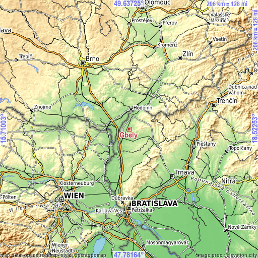
| \ | Map #1 | Map #2 | Topo.Map |
| Scale [m] | 161..266 m | 147..301 m | × |
| Scale [ft] | 528..873 ft | 482..988 ft | × |
| Average | 193.5 m = 635 ft | 194.9 m = 639 ft | × |
| Width | 6.45 km = 4 mi | 12.9 km = 8 mi | 206.3 km = 128.2 mi |
| Height | 6.45 km = 4 mi | 12.9 km = 8 mi | 206.3 km = 128.2 mi |
| ↑Max Latitude | 48.746985° | 48.775954° | 49.63725° |
| Latitude at center | 48.718° | 48.718° | 48.718° |
| ↓Min Latitude | 48.688998° | 48.659979° | 47.78164° |
| ← Min Longitude | 17.072335° | 17.028389° | 15.71003° |
| Longitude center | 17.11628° | 17.11628° | 17.11628° |
| →Max Longitude | 17.160225° | 17.204171° | 18.52253° |
Nearby cities:
Cities around Gbely sort by population:
• Senica elevation 209 m
18.9 km,  103°
103°
• Pezinok 162 m
48.9 km,  166°
166°
• Malacky 164 m
32.1 km,  192°
192°
• Skalica 179 m
16.3 km,  29°
29°
• Myjava 332 m
33.5 km,  82°
82°
• Holíč 180 m
10.9 km,  18°
18°
• Stará Turá 279 m
42.9 km, 81°
• Modra 173 m
45 km,  161°
161°
• Vrbové 183 m
45.8 km, 103°
• Brezová pod Bradlom 259 m
31.6 km, 101°
• Smolenice 226 m
33.1 km,  135°
135°
• Vinosady 145 m
47 km, 164°
Multilingual:
 En español:
Gbely elevación 186 m.
 En France:
Gbely élévation 186 m.


Sources and notes:
- [note 1] Map square and city borders are not equal. Map elevation data is calculated only from area inside that square.
- [src 1] Elevation data from geonames database provided with same terms of usage.
- [src 2] The elevation map of Gbely is generated using elevation data from NASA's 3 arcsec (90m) resolution SRTM data.
- [src 3] Base (background) map © OpenStreetMap contributors tiles are generated by Geofabrik and OpenTopoMap.
Copyright & License:
This Gbely Elevation Map is licensed under CC BY-SA. You may reuse any part from this page, if you give a proper credit by linking to this URL:
 More info on terms of use page.