Leopoldov elevation
Leopoldov (Trnavský kraj, Okres Hlohovec), Slovakia elevation is 143 meters and Leopoldov elevation in feet is 469 ft above sea level [src 1]. Leopoldov is a populated place (feature code) with elevation that is 177 meters (581 ft) smaller than average city elevation in Slovakia.
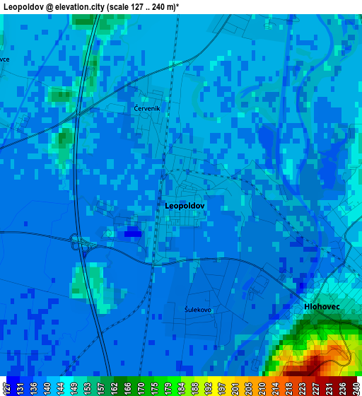
Below is the Elevation map of Leopoldov, which displays elevation range with different colors. Scale of the first map is from 127 to 240 m (417 to 787 ft) with average elevation of 142.4 meters (=467 ft) [note 1]
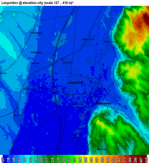
These maps also provides idea of topography and contour of this city, they are displayed at different zoom levels. More info about maps, scale and edge coordinates you can find below images.
| \ | Map #1 | Map #2 | Topo.Map |
| Scale [m] | 127..240 m | 127..418 m | × |
| Scale [ft] | 417..787 ft | 417..1371 ft | × |
| Average | 142.4 m = 467 ft | 171.4 m = 562 ft | × |
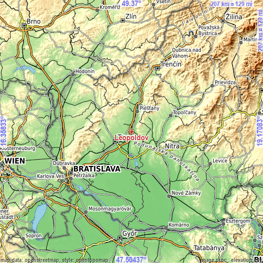
| Width | 6.48 km = 4 mi | 12.96 km = 8.1 mi | 207.4 km = 128.9 mi |
| Height | 6.48 km = 4 mi | 12.96 km = 8.1 mi | 207.4 km = 128.9 mi |
| ↑Max Latitude | 48.474892° | 48.504017° | 49.37° |
| Latitude at center | 48.44575° | 48.44575° | 48.44575° |
| ↓Min Latitude | 48.416591° | 48.387416° | 47.50437° |
| ← Min Longitude | 17.720635° | 17.676689° | 16.35833° |
| Longitude center | 17.76458° | 17.76458° | 17.76458° |
| →Max Longitude | 17.808525° | 17.852471° | 19.17083° |
Nearby cities:
Cities around Leopoldov sort by population:
• Nitra elevation 144 m
28.2 km,  123°
123°
• Trnava 147 m
15.1 km,  239°
239°
• Piešťany 161 m
17.2 km,  15°
15°
• Šaľa 114 m
33.8 km,  165°
165°
• Hlohovec 144 m
3.2 km, 118°
• Galanta 119 m
28.6 km,  185°
185°
• Vrbové 183 m
19.6 km,  350°
350°
• Sládkovičovo 118 m
28.7 km,  198°
198°
• Brezová pod Bradlom 259 m
29.4 km,  325°
325°
• Čachtice 181 m
29.7 km,  3°
3°
• Smolenice 226 m
25.5 km,  284°
284°
• Topoľčany 174 m
32.4 km,  66°
66°
Multilingual:
 En español:
Leopoldov elevación 143 m.
 En France:
Leopoldov élévation 143 m.
 Auf Deutsch:
Leopoldov höhe über dem Meeresspiegel ist 143 m.

Sources and notes:
- [note 1] Map square and city borders are not equal. Map elevation data is calculated only from area inside that square.
- [src 1] Elevation data from geonames database provided with same terms of usage.
- [src 2] The elevation map of Leopoldov is generated using elevation data from NASA's 3 arcsec (90m) resolution SRTM data.
- [src 3] Base (background) map © OpenStreetMap contributors tiles are generated by Geofabrik and OpenTopoMap.
Copyright & License:
This Leopoldov Elevation Map is licensed under CC BY-SA. You may reuse any part from this page, if you give a proper credit by linking to this URL:
 More info on terms of use page.