Črnomelj elevation
Črnomelj, Slovenia elevation is 150 meters and Črnomelj elevation in feet is 492 ft above sea level [src 1]. Črnomelj is a seat of a first-order administrative division (feature code) with elevation that is 164 meters (538 ft) smaller than average city elevation in Slovenia.
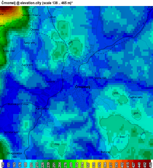
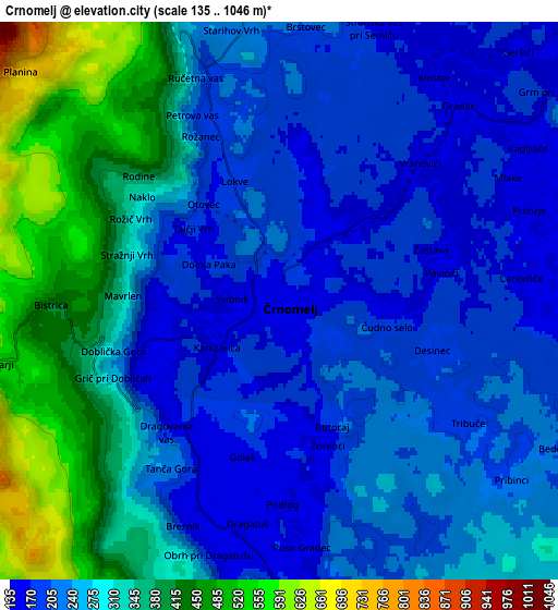
Below is the Elevation map of Črnomelj, which displays elevation range with different colors. Scale of the first map is from 138 to 465 m (453 to 1526 ft) with average elevation of 180.8 meters (=593 ft) [note 1]
These maps also provides idea of topography and contour of this city, they are displayed at different zoom levels. More info about maps, scale and edge coordinates you can find below images.
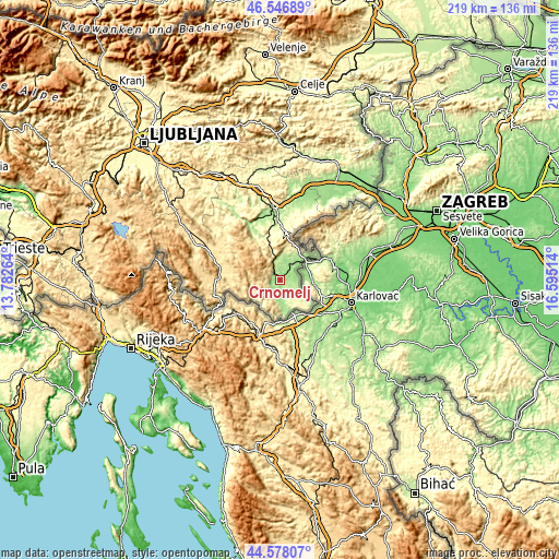
| \ | Map #1 | Map #2 | Topo.Map |
| Scale [m] | 138..465 m | 135..1046 m | × |
| Scale [ft] | 453..1526 ft | 443..3432 ft | × |
| Average | 180.8 m = 593 ft | 276.7 m = 908 ft | × |
| Width | 6.84 km = 4.3 mi | 13.68 km = 8.5 mi | 218.9 km = 136 mi |
| Height | 6.84 km = 4.3 mi | 13.68 km = 8.5 mi | 218.9 km = 136 mi |
| ↑Max Latitude | 45.601864° | 45.632602° | 46.54689° |
| Latitude at center | 45.57111° | 45.57111° | 45.57111° |
| ↓Min Latitude | 45.540339° | 45.509551° | 44.57807° |
| ← Min Longitude | 15.144945° | 15.100999° | 13.78264° |
| Longitude center | 15.18889° | 15.18889° | 15.18889° |
| →Max Longitude | 15.232835° | 15.276781° | 16.59514° |
Nearby cities:
Cities around Črnomelj sort by population:
• Novo Mesto elevation 187 m
25.9 km,  356°
356°
• Kočevje 471 m
26.6 km,  287°
287°
• Metlika 163 m
12.9 km,  49°
49°
• Semič 214 m
8.4 km, 356°
• Straža 170 m
24.9 km,  338°
338°
• Šentjernej 193 m
32 km,  20°
20°
• Žužemberk 233 m
35.5 km,  325°
325°
• Mirna Peč 236 m
33.2 km,  345°
345°
• Dolenjske Toplice 178 m
23 km, 333°
• Kostanjevica na Krki 152 m
35.5 km,  30°
30°
• Šmarjeta 180 m
35 km,  7°
7°
• Kostel 357 m
22.8 km,  252°
252°
Multilingual:
 En español:
Črnomelj elevación 150 m.
 En France:
Črnomelj élévation 150 m.
 Auf Deutsch:
Črnomelj höhe über dem Meeresspiegel ist 150 m.

Sources and notes:
- [note 1] Map square and city borders are not equal. Map elevation data is calculated only from area inside that square.
- [src 1] Elevation data from geonames database provided with same terms of usage.
- [src 2] The elevation map of Črnomelj is generated using elevation data from NASA's 3 arcsec (90m) resolution SRTM data.
- [src 3] Base (background) map © OpenStreetMap contributors tiles are generated by Geofabrik and OpenTopoMap.
Copyright & License:
This Črnomelj Elevation Map is licensed under CC BY-SA. You may reuse any part from this page, if you give a proper credit by linking to this URL:
 More info on terms of use page.