Šmarjeta elevation
Šmarjeta (Šmarješke Toplice), Slovenia elevation is 180 meters and Šmarjeta elevation in feet is 591 ft above sea level [src 1]. Šmarjeta is a seat of a first-order administrative division (feature code) with elevation that is 134 meters (440 ft) smaller than average city elevation in Slovenia.
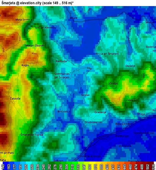
Below is the Elevation map of Šmarjeta, which displays elevation range with different colors. Scale of the first map is from 149 to 516 m (489 to 1693 ft) with average elevation of 249.4 meters (=818 ft) [note 1]
These maps also provides idea of topography and contour of this city, they are displayed at different zoom levels. More info about maps, scale and edge coordinates you can find below images.
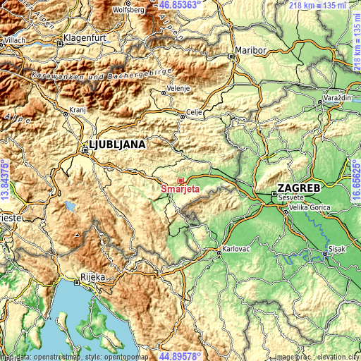
| \ | Map #1 | Topo.Map |
| Scale [m] | 149..516 m | × |
| Scale [ft] | 489..1693 ft | × |
| Average | 249.4 m = 818 ft | × |
| Width | 6.8 km = 4.2 mi | 217.7 km = 135.3 mi |
| Height | 6.8 km = 4.2 mi | 217.7 km = 135.3 mi |
| ↑Max Latitude | 45.913913° | 46.85363° |
| Latitude at center | 45.88333° | 45.88333° |
| ↓Min Latitude | 45.85273° | 44.89578° |
| ← Min Longitude | 15.206055° | 13.84375° |
| Longitude center | 15.25° | 15.25° |
| →Max Longitude | 15.293945° | 16.65625° |
Nearby cities:
Cities around Šmarjeta sort by population:
• Novo Mesto elevation 187 m
10.8 km,  215°
215°
• Sevnica 206 m
14.7 km,  20°
20°
• Trebnje 281 m
17.8 km,  277°
277°
• Straža 170 m
17.9 km,  230°
230°
• Šentjernej 193 m
8.2 km,  125°
125°
• Mirna 272 m
16.6 km,  298°
298°
• Leskovec pri Krškem 209 m
18.1 km,  71°
71°
• Mirna Peč 236 m
13.2 km,  258°
258°
• Kostanjevica na Krki 152 m
14 km,  107°
107°
• Mokronog 312 m
10.2 km, 303°
• Šentrupert 271 m
15.9 km,  311°
311°
• Škocjan 168 m
4.1 km,  50°
50°
Multilingual:
 En español:
Šmarjeta elevación 180 m.
 En France:
Šmarjeta élévation 180 m.
 Auf Deutsch:
Šmarjeta höhe über dem Meeresspiegel ist 180 m.

Sources and notes:
- [note 1] Map square and city borders are not equal. Map elevation data is calculated only from area inside that square.
- [src 1] Elevation data from geonames database provided with same terms of usage.
- [src 2] The elevation map of Šmarjeta is generated using elevation data from NASA's 3 arcsec (90m) resolution SRTM data.
- [src 3] Base (background) map © OpenStreetMap contributors tiles are generated by Geofabrik and OpenTopoMap.
Copyright & License:
This Šmarjeta Elevation Map is licensed under CC BY-SA. You may reuse any part from this page, if you give a proper credit by linking to this URL:
 More info on terms of use page.