Idrija elevation
Idrija, Slovenia elevation is 341 meters and Idrija elevation in feet is 1119 ft above sea level [src 1]. Idrija is a seat of a first-order administrative division (feature code) with elevation that is 27 meters (89 ft) bigger than average city elevation in Slovenia.
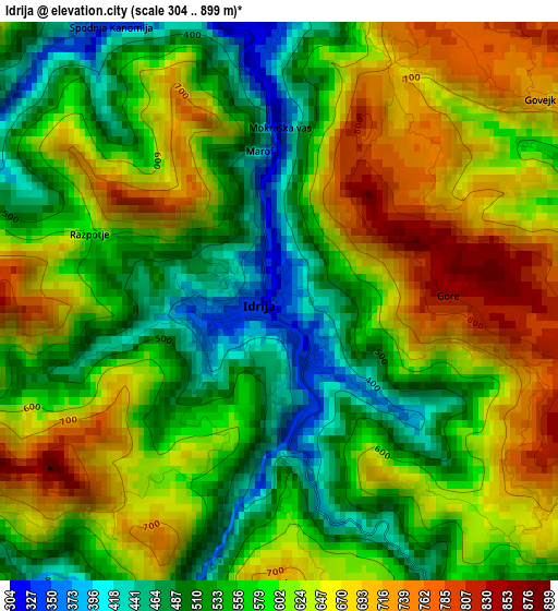
Below is the Elevation map of Idrija, which displays elevation range with different colors. Scale of the first map is from 304 to 899 m (997 to 2949 ft) with average elevation of 595.1 meters (=1952 ft) [note 1]
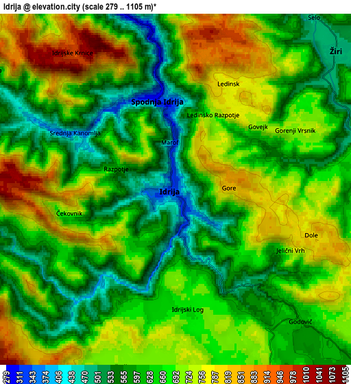
These maps also provides idea of topography and contour of this city, they are displayed at different zoom levels. More info about maps, scale and edge coordinates you can find below images.
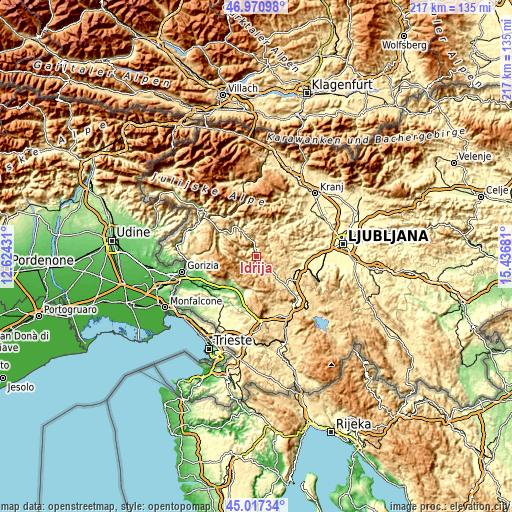
| \ | Map #1 | Map #2 | Topo.Map |
| Scale [m] | 304..899 m | 279..1105 m | × |
| Scale [ft] | 997..2949 ft | 915..3625 ft | × |
| Average | 595.1 m = 1952 ft | 663.5 m = 2177 ft | × |
| Width | 6.79 km = 4.2 mi | 13.58 km = 8.4 mi | 217.2 km = 135 mi |
| Height | 6.79 km = 4.2 mi | 13.58 km = 8.4 mi | 217.2 km = 135 mi |
| ↑Max Latitude | 46.033297° | 46.063797° | 46.97098° |
| Latitude at center | 46.00278° | 46.00278° | 46.00278° |
| ↓Min Latitude | 45.972246° | 45.941695° | 45.01734° |
| ← Min Longitude | 13.986615° | 13.942669° | 12.62431° |
| Longitude center | 14.03056° | 14.03056° | 14.03056° |
| →Max Longitude | 14.074505° | 14.118451° | 15.43681° |
Nearby cities:
Cities around Idrija sort by population:
• Logatec elevation 473 m
18 km,  123°
123°
• Vrhnika 297 m
20.9 km,  102°
102°
• Ajdovščina 103 m
16 km,  215°
215°
• Žiri 479 m
7.4 km,  53°
53°
• Verd 293 m
21.9 km, 103°
• Vipava 110 m
18.1 km,  196°
196°
• Cerkno 318 m
14.2 km,  344°
344°
• Spodnja Idrija 310 m
3.3 km,  355°
355°
• Horjul 348 m
20.9 km,  83°
83°
• Gorenja Vas 403 m
14.7 km,  37°
37°
• Šempas 93 m
23.6 km,  250°
250°
• Lokavec 167 m
16.2 km,  226°
226°
Multilingual:
 En español:
Idrija elevación 341 m.
 En France:
Idrija élévation 341 m.


Sources and notes:
- [note 1] Map square and city borders are not equal. Map elevation data is calculated only from area inside that square.
- [src 1] Elevation data from geonames database provided with same terms of usage.
- [src 2] The elevation map of Idrija is generated using elevation data from NASA's 3 arcsec (90m) resolution SRTM data.
- [src 3] Base (background) map © OpenStreetMap contributors tiles are generated by Geofabrik and OpenTopoMap.
Copyright & License:
This Idrija Elevation Map is licensed under CC BY-SA. You may reuse any part from this page, if you give a proper credit by linking to this URL:
 More info on terms of use page.