Radeče elevation
Radeče, Slovenia elevation is 196 meters and Radeče elevation in feet is 643 ft above sea level [src 1]. Radeče is a seat of a first-order administrative division (feature code) with elevation that is 118 meters (387 ft) smaller than average city elevation in Slovenia.
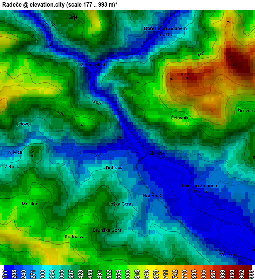
Below is the Elevation map of Radeče, which displays elevation range with different colors. Scale of the first map is from 177 to 993 m (581 to 3258 ft) with average elevation of 421.7 meters (=1384 ft) [note 1]
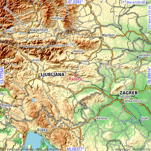
These maps also provides idea of topography and contour of this city, they are displayed at different zoom levels. More info about maps, scale and edge coordinates you can find below images.
| \ | Map #1 | Topo.Map |
| Scale [m] | 177..993 m | × |
| Scale [ft] | 581..3258 ft | × |
| Average | 421.7 m = 1384 ft | × |
| Width | 6.78 km = 4.2 mi | 217 km = 134.8 mi |
| Height | 6.78 km = 4.2 mi | 217 km = 134.8 mi |
| ↑Max Latitude | 46.098541° | 47.0351° |
| Latitude at center | 46.06806° | 46.06806° |
| ↓Min Latitude | 46.037562° | 45.08377° |
| ← Min Longitude | 15.139945° | 13.77764° |
| Longitude center | 15.18389° | 15.18389° |
| →Max Longitude | 15.227835° | 16.59014° |
Nearby cities:
Cities around Radeče sort by population:
• Trbovlje elevation 285 m
14 km,  313°
313°
• Zagorje ob Savi 244 m
16.1 km,  296°
296°
• Hrastnik 298 m
11.7 km,  317°
317°
• Sevnica 206 m
12.2 km,  123°
123°
• Laško 226 m
10.4 km,  22°
22°
• Kisovec 277 m
18.8 km,  294°
294°
• Dol pri Hrastniku 316 m
9.9 km,  326°
326°
• Mirna 272 m
15.7 km,  216°
216°
• Zabukovica 330 m
16.3 km,  353°
353°
• Mokronog 312 m
15.3 km,  192°
192°
• Šentrupert 271 m
12.1 km,  214°
214°
• Dobje pri Planini 563 m
18 km,  64°
64°
Multilingual:
 En español:
Radeče elevación 196 m.
 En France:
Radeče élévation 196 m.


Sources and notes:
- [note 1] Map square and city borders are not equal. Map elevation data is calculated only from area inside that square.
- [src 1] Elevation data from geonames database provided with same terms of usage.
- [src 2] The elevation map of Radeče is generated using elevation data from NASA's 3 arcsec (90m) resolution SRTM data.
- [src 3] Base (background) map © OpenStreetMap contributors tiles are generated by Geofabrik and OpenTopoMap.
Copyright & License:
This Radeče Elevation Map is licensed under CC BY-SA. You may reuse any part from this page, if you give a proper credit by linking to this URL:
 More info on terms of use page.