Železniki elevation
Železniki, Slovenia elevation is 513 meters and Železniki elevation in feet is 1683 ft above sea level [src 1]. Železniki is a seat of a first-order administrative division (feature code) with elevation that is 199 meters (653 ft) bigger than average city elevation in Slovenia.
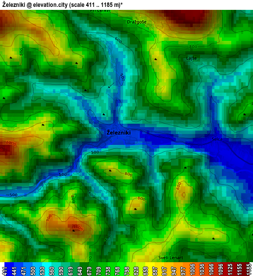
Below is the Elevation map of Železniki, which displays elevation range with different colors. Scale of the first map is from 411 to 1185 m (1348 to 3888 ft) with average elevation of 688.7 meters (=2260 ft) [note 1]
These maps also provides idea of topography and contour of this city, they are displayed at different zoom levels. More info about maps, scale and edge coordinates you can find below images.
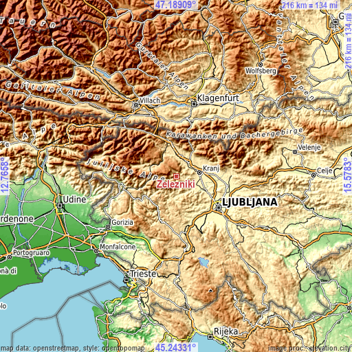
| \ | Map #1 | Topo.Map |
| Scale [m] | 411..1185 m | × |
| Scale [ft] | 1348..3888 ft | × |
| Average | 688.7 m = 2260 ft | × |
| Width | 6.76 km = 4.2 mi | 216.4 km = 134.5 mi |
| Height | 6.76 km = 4.2 mi | 216.3 km = 134.4 mi |
| ↑Max Latitude | 46.255214° | 47.18909° |
| Latitude at center | 46.22482° | 46.22482° |
| ↓Min Latitude | 46.194409° | 45.24331° |
| ← Min Longitude | 14.128105° | 12.7658° |
| Longitude center | 14.17205° | 14.17205° |
| →Max Longitude | 14.215995° | 15.5783° |
Nearby cities:
Cities around Železniki sort by population:
• Kranj elevation 387 m
14.2 km,  83°
83°
• Škofja Loka 360 m
12.3 km,  122°
122°
• Radovljica 489 m
13.3 km,  0°
0°
• Bled 505 m
16.7 km,  344°
344°
• Bistrica pri Tržiču 526 m
17.1 km,  32°
32°
• Lesce 495 m
15.2 km,  355°
355°
• Naklo 408 m
12.4 km,  64°
64°
• Kokrica 403 m
15.4 km,  70°
70°
• Mlaka pri Kranju 410 m
15.1 km, 64°
• Zgornje Bitnje 386 m
12.7 km,  92°
92°
• Gorenja Vas 403 m
13.2 km,  188°
188°
• Sv. Duh 361 m
13.2 km,  110°
110°
Multilingual:
 En español:
Železniki elevación 513 m.
 En France:
Železniki élévation 513 m.
 Auf Deutsch:
Železniki höhe über dem Meeresspiegel ist 513 m.

Sources and notes:
- [note 1] Map square and city borders are not equal. Map elevation data is calculated only from area inside that square.
- [src 1] Elevation data from geonames database provided with same terms of usage.
- [src 2] The elevation map of Železniki is generated using elevation data from NASA's 3 arcsec (90m) resolution SRTM data.
- [src 3] Base (background) map © OpenStreetMap contributors tiles are generated by Geofabrik and OpenTopoMap.
Copyright & License:
This Železniki Elevation Map is licensed under CC BY-SA. You may reuse any part from this page, if you give a proper credit by linking to this URL:
 More info on terms of use page.