Åsele elevation
Åsele (Västerbotten, Åsele Kommun), Sweden elevation is 320 meters and Åsele elevation in feet is 1050 ft above sea level [src 1]. Åsele is a seat of a second-order administrative division (feature code) with elevation that is 245 meters (804 ft) bigger than average city elevation in Sweden.
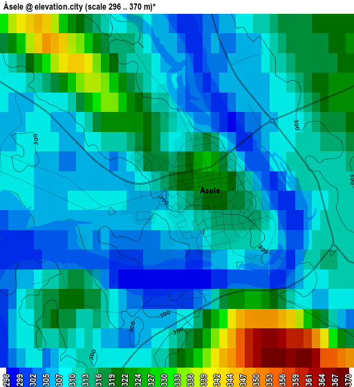
Below is the Elevation map of Åsele, which displays elevation range with different colors. Scale of the first map is from 296 to 370 m (971 to 1214 ft) with average elevation of 313.4 meters (=1028 ft) [note 1]
These maps also provides idea of topography and contour of this city, they are displayed at different zoom levels. More info about maps, scale and edge coordinates you can find below images.
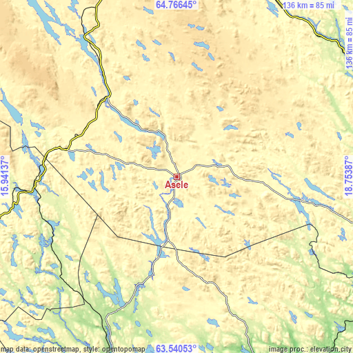
| \ | Map #1 | Topo.Map |
| Scale [m] | 296..370 m | × |
| Scale [ft] | 971..1214 ft | × |
| Average | 313.4 m = 1028 ft | × |
| Width | 4.26 km = 2.6 mi | 136.3 km = 84.7 mi |
| Height | 4.26 km = 2.6 mi | 136.3 km = 84.7 mi |
| ↑Max Latitude | 64.179407° | 64.76645° |
| Latitude at center | 64.16026° | 64.16026° |
| ↓Min Latitude | 64.1411° | 63.54053° |
| ← Min Longitude | 17.303675° | 15.94137° |
| Longitude center | 17.34762° | 17.34762° |
| →Max Longitude | 17.391565° | 18.75387° |
Nearby cities:
Cities around Åsele sort by population:
• Lycksele elevation 224 m
80 km,  52°
52°
• Sollefteå 2 m
110.5 km,  182°
182°
• Strömsund 299 m
93.8 km,  248°
248°
• Vilhelmina 349 m
61.4 km,  327°
327°
• Storuman 396 m
104.6 km,  353°
353°
• Insjön 422 m
27.4 km,  13°
13°
• Långsele 76 m
109.5 km,  187°
187°
• Söderfors 273 m
80.4 km,  24°
24°
• Dorotea 336 m
46.6 km,  284°
284°
• Bredbyn 45 m
87.7 km,  154°
154°
• Ås 179 m
95.9 km,  203°
203°
• Bjurholm 173 m
94.3 km,  105°
105°
Multilingual:
 En español:
Åsele elevación 320 m.
 En France:
Åsele élévation 320 m.


Sources and notes:
- [note 1] Map square and city borders are not equal. Map elevation data is calculated only from area inside that square.
- [src 1] Elevation data from geonames database provided with same terms of usage.
- [src 2] The elevation map of Åsele is generated using GMTED2010 database with 7.5 arcsec (225m) resolution.
- [src 3] Base (background) map © OpenStreetMap contributors tiles are generated by Geofabrik and OpenTopoMap.
Copyright & License:
This Åsele Elevation Map is licensed under CC BY-SA. You may reuse any part from this page, if you give a proper credit by linking to this URL:
 More info on terms of use page.