Kisa elevation
Kisa (Östergötland, Kinda Kommun), Sweden elevation is 108 meters and Kisa elevation in feet is 354 ft above sea level [src 1]. Kisa is a seat of a second-order administrative division (feature code) with elevation that is 33 meters (108 ft) bigger than average city elevation in Sweden.
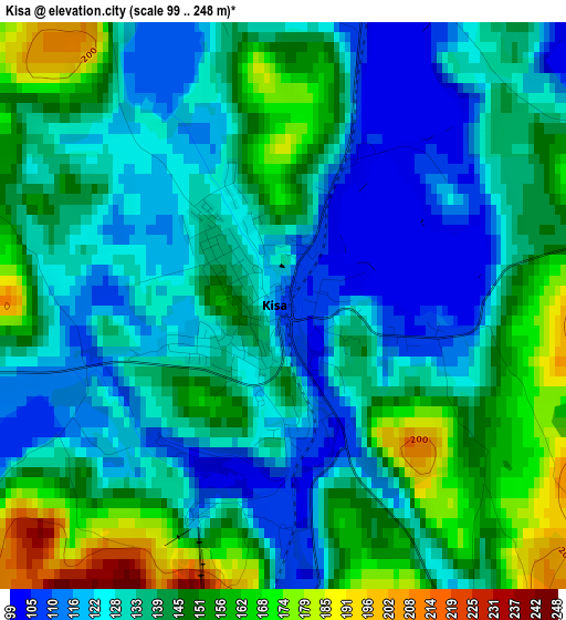
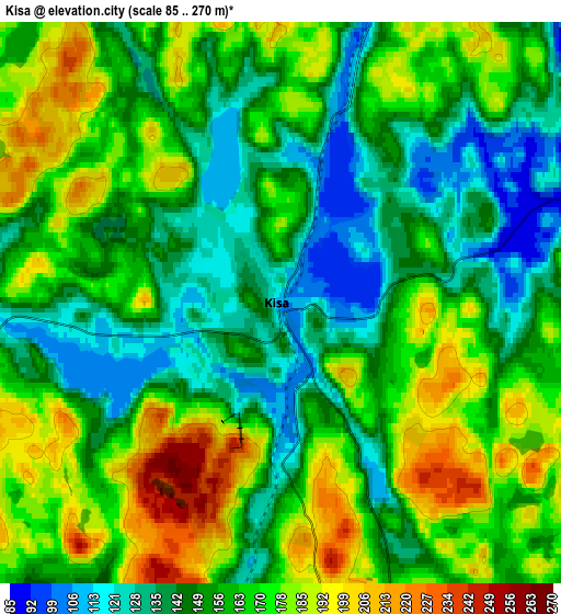
Below is the Elevation map of Kisa, which displays elevation range with different colors. Scale of the first map is from 99 to 248 m (325 to 814 ft) with average elevation of 137.6 meters (=451 ft) [note 1]
These maps also provides idea of topography and contour of this city, they are displayed at different zoom levels. More info about maps, scale and edge coordinates you can find below images.
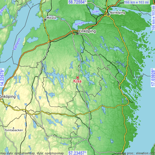
| \ | Map #1 | Map #2 | Topo.Map |
| Scale [m] | 99..248 m | 85..270 m | × |
| Scale [ft] | 325..814 ft | 279..886 ft | × |
| Average | 137.6 m = 451 ft | 160 m = 525 ft | × |
| Width | 5.18 km = 3.2 mi | 10.36 km = 6.4 mi | 165.8 km = 103 mi |
| Height | 5.18 km = 3.2 mi | 10.36 km = 6.4 mi | 165.8 km = 103 mi |
| ↑Max Latitude | 58.011098° | 58.03437° | 58.72554° |
| Latitude at center | 57.98781° | 57.98781° | 57.98781° |
| ↓Min Latitude | 57.964507° | 57.941189° | 57.23457° |
| ← Min Longitude | 15.589085° | 15.545139° | 14.22678° |
| Longitude center | 15.63303° | 15.63303° | 15.63303° |
| →Max Longitude | 15.676975° | 15.720921° | 17.03928° |
Nearby cities:
Cities around Kisa sort by population:
• Tranås elevation 164 m
39 km,  278°
278°
• Vimmerby 124 m
38.1 km,  159°
159°
• Åtvidaberg 94 m
32 km,  42°
42°
• Mantorp 115 m
45.2 km,  333°
333°
• Boxholm 147 m
41.2 km,  304°
304°
• Rimforsa 95 m
16.8 km,  10°
10°
• Sturefors 72 m
38.9 km, 8°
• Mariannelund 147 m
41.5 km,  185°
185°
• Överum 64 m
40.1 km,  89°
89°
• Södra Vi 125 m
29.2 km, 160°
• Grebo 88 m
37.6 km,  21°
21°
• Österbymo 188 m
27.9 km,  229°
229°
Multilingual:
 En español:
Kisa elevación 108 m.
 En France:
Kisa élévation 108 m.


Sources and notes:
- [note 1] Map square and city borders are not equal. Map elevation data is calculated only from area inside that square.
- [src 1] Elevation data from geonames database provided with same terms of usage.
- [src 2] The elevation map of Kisa is generated using elevation data from NASA's 3 arcsec (90m) resolution SRTM data.
- [src 3] Base (background) map © OpenStreetMap contributors tiles are generated by Geofabrik and OpenTopoMap.
Copyright & License:
This Kisa Elevation Map is licensed under CC BY-SA. You may reuse any part from this page, if you give a proper credit by linking to this URL:
 More info on terms of use page.