Nora elevation
Nora (Örebro, Nora Kommun), Sweden elevation is 104 meters and Nora elevation in feet is 341 ft above sea level [src 1]. Nora is a seat of a second-order administrative division (feature code) with elevation that is 29 meters (95 ft) bigger than average city elevation in Sweden.
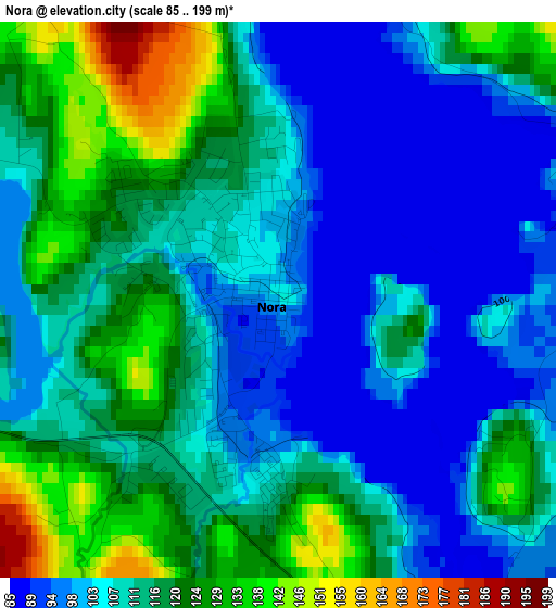
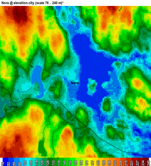
Below is the Elevation map of Nora, which displays elevation range with different colors. Scale of the first map is from 85 to 199 m (279 to 653 ft) with average elevation of 111.2 meters (=365 ft) [note 1]
These maps also provides idea of topography and contour of this city, they are displayed at different zoom levels. More info about maps, scale and edge coordinates you can find below images.
| \ | Map #1 | Map #2 | Topo.Map |
| Scale [m] | 85..199 m | 76..240 m | × |
| Scale [ft] | 279..653 ft | 249..787 ft | × |
| Average | 111.2 m = 365 ft | 138.4 m = 454 ft | × |
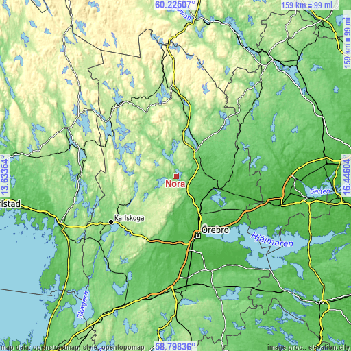
| Width | 4.96 km = 3.1 mi | 9.91 km = 6.2 mi | 158.6 km = 98.5 mi |
| Height | 4.96 km = 3.1 mi | 9.91 km = 6.2 mi | 158.6 km = 98.5 mi |
| ↑Max Latitude | 59.541544° | 59.563813° | 60.22507° |
| Latitude at center | 59.51926° | 59.51926° | 59.51926° |
| ↓Min Latitude | 59.496961° | 59.474648° | 58.79836° |
| ← Min Longitude | 14.995845° | 14.951899° | 13.63354° |
| Longitude center | 15.03979° | 15.03979° | 15.03979° |
| →Max Longitude | 15.083735° | 15.127681° | 16.44604° |
Nearby cities:
Cities around Nora sort by population:
• Örebro elevation 35 m
28.8 km,  160°
160°
• Karlskoga 119 m
36.2 km,  233°
233°
• Lindesberg 74 m
13.4 km,  53°
53°
• Kopparberg 167 m
39.7 km,  356°
356°
• Hovsta 39 m
21.3 km,  152°
152°
• Frövi 45 m
19.4 km,  107°
107°
• Vintrosa 80 m
30.4 km,  189°
189°
• Fjugesta 69 m
39.6 km, 193°
• Storå 71 m
22.3 km,  13°
13°
• Garphyttan 99 m
24.5 km, 192°
• Ekeby-Almby 45 m
33.2 km, 150°
• Fellingsbro 26 m
32.1 km, 107°
Multilingual:
 En español:
Nora elevación 104 m.
 En France:
Nora élévation 104 m.


Sources and notes:
- [note 1] Map square and city borders are not equal. Map elevation data is calculated only from area inside that square.
- [src 1] Elevation data from geonames database provided with same terms of usage.
- [src 2] The elevation map of Nora is generated using elevation data from NASA's 3 arcsec (90m) resolution SRTM data.
- [src 3] Base (background) map © OpenStreetMap contributors tiles are generated by Geofabrik and OpenTopoMap.
Copyright & License:
This Nora Elevation Map is licensed under CC BY-SA. You may reuse any part from this page, if you give a proper credit by linking to this URL:
 More info on terms of use page.