Tibro elevation
Tibro (Västra Götaland, Tibro Kommun), Sweden elevation is 117 meters and Tibro elevation in feet is 384 ft above sea level [src 1]. Tibro is a seat of a second-order administrative division (feature code) with elevation that is 42 meters (138 ft) bigger than average city elevation in Sweden.
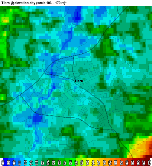
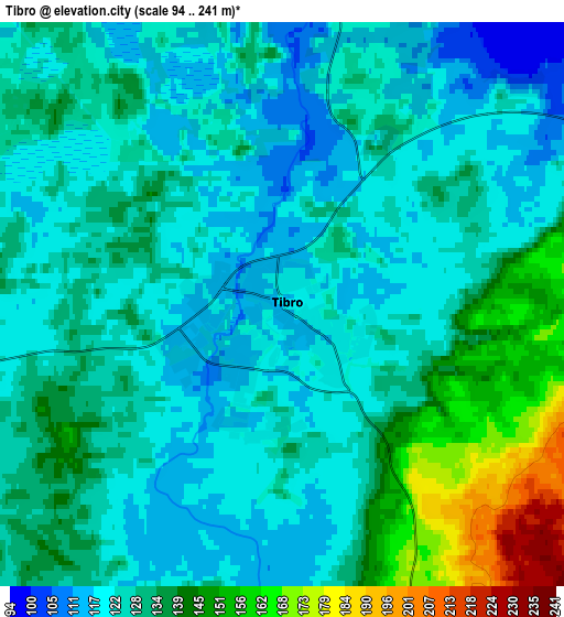
Below is the Elevation map of Tibro, which displays elevation range with different colors. Scale of the first map is from 103 to 170 m (338 to 558 ft) with average elevation of 119.4 meters (=392 ft) [note 1]
These maps also provides idea of topography and contour of this city, they are displayed at different zoom levels. More info about maps, scale and edge coordinates you can find below images.
| \ | Map #1 | Map #2 | Topo.Map |
| Scale [m] | 103..170 m | 94..241 m | × |
| Scale [ft] | 338..558 ft | 308..791 ft | × |
| Average | 119.4 m = 392 ft | 128.9 m = 423 ft | × |
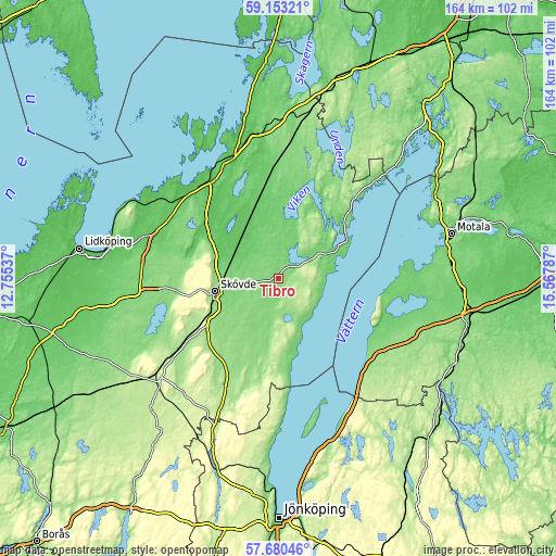
| Width | 5.12 km = 3.2 mi | 10.23 km = 6.4 mi | 163.8 km = 101.8 mi |
| Height | 5.12 km = 3.2 mi | 10.23 km = 6.4 mi | 163.7 km = 101.7 mi |
| ↑Max Latitude | 58.447533° | 58.470521° | 59.15321° |
| Latitude at center | 58.42453° | 58.42453° | 58.42453° |
| ↓Min Latitude | 58.401512° | 58.378479° | 57.68046° |
| ← Min Longitude | 14.117675° | 14.073729° | 12.75537° |
| Longitude center | 14.16162° | 14.16162° | 14.16162° |
| →Max Longitude | 14.205565° | 14.249511° | 15.56787° |
Nearby cities:
Cities around Tibro sort by population:
• Skövde elevation 152 m
18.8 km,  258°
258°
• Tidaholm 148 m
29.6 km,  203°
203°
• Hjo 98 m
15.6 km,  151°
151°
• Töreboda 96 m
31.5 km,  356°
356°
• Skultorp 150 m
20.9 km,  246°
246°
• Karlsborg 93 m
23.6 km,  57°
57°
• Olofstorp 137 m
21.6 km,  205°
205°
• Ödeshög 146 m
36 km,  127°
127°
• Stenstorp 175 m
31.1 km,  237°
237°
• Stöpen 87 m
18.2 km,  289°
289°
• Axvall 129 m
35 km, 262°
• Mölltorp 98 m
16.2 km, 58°
Multilingual:
 En español:
Tibro elevación 117 m.
 En France:
Tibro élévation 117 m.


Sources and notes:
- [note 1] Map square and city borders are not equal. Map elevation data is calculated only from area inside that square.
- [src 1] Elevation data from geonames database provided with same terms of usage.
- [src 2] The elevation map of Tibro is generated using elevation data from NASA's 3 arcsec (90m) resolution SRTM data.
- [src 3] Base (background) map © OpenStreetMap contributors tiles are generated by Geofabrik and OpenTopoMap.
Copyright & License:
This Tibro Elevation Map is licensed under CC BY-SA. You may reuse any part from this page, if you give a proper credit by linking to this URL:
 More info on terms of use page.