Töreboda elevation
Töreboda (Västra Götaland, Töreboda Kommun), Sweden elevation is 96 meters and Töreboda elevation in feet is 315 ft above sea level [src 1]. Töreboda is a seat of a second-order administrative division (feature code) with elevation that is 21 meters (69 ft) bigger than average city elevation in Sweden.
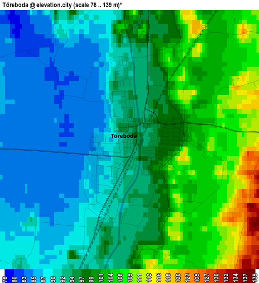
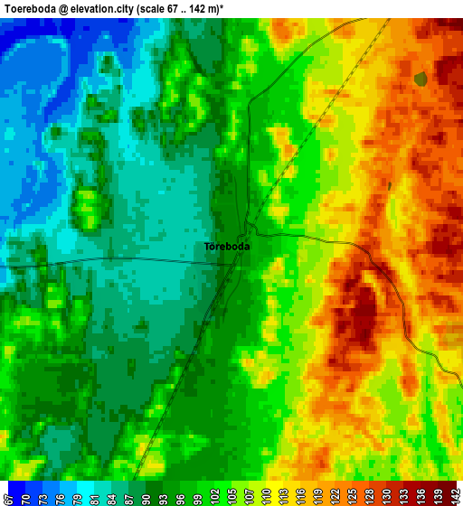
Below is the Elevation map of Töreboda, which displays elevation range with different colors. Scale of the first map is from 78 to 139 m (256 to 456 ft) with average elevation of 96 meters (=315 ft) [note 1]
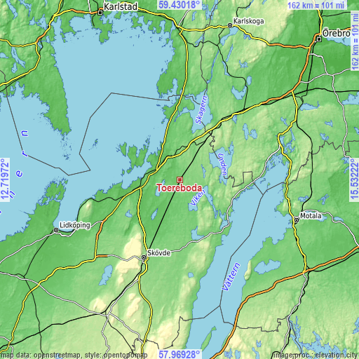
These maps also provides idea of topography and contour of this city, they are displayed at different zoom levels. More info about maps, scale and edge coordinates you can find below images.
| \ | Map #1 | Map #2 | Topo.Map |
| Scale [m] | 78..139 m | 67..142 m | × |
| Scale [ft] | 256..456 ft | 220..466 ft | × |
| Average | 96 m = 315 ft | 100.7 m = 330 ft | × |
| Width | 5.08 km = 3.2 mi | 10.15 km = 6.3 mi | 162.4 km = 100.9 mi |
| Height | 5.08 km = 3.2 mi | 10.15 km = 6.3 mi | 162.4 km = 100.9 mi |
| ↑Max Latitude | 58.730208° | 58.753011° | 59.43018° |
| Latitude at center | 58.70739° | 58.70739° | 58.70739° |
| ↓Min Latitude | 58.684557° | 58.661709° | 57.96928° |
| ← Min Longitude | 14.082025° | 14.038079° | 12.71972° |
| Longitude center | 14.12597° | 14.12597° | 14.12597° |
| →Max Longitude | 14.169915° | 14.213861° | 15.53222° |
Nearby cities:
Cities around Töreboda sort by population:
• Skövde elevation 152 m
38.8 km,  204°
204°
• Mariestad 56 m
17.5 km,  270°
270°
• Tibro 117 m
31.5 km,  176°
176°
• Götene 79 m
41.6 km,  241°
241°
• Anderstorp 157 m
21.6 km,  24°
24°
• Skultorp 150 m
43.2 km, 203°
• Karlsborg 93 m
29 km,  130°
130°
• Laxå 99 m
42 km,  42°
42°
• Gullspång 58 m
31 km,  356°
356°
• Stöpen 87 m
29.6 km,  210°
210°
• Hova 112 m
17.1 km, 18°
• Mölltorp 98 m
28 km,  145°
145°
Multilingual:
 En español:
Töreboda elevación 96 m.
 En France:
Töreboda élévation 96 m.


Sources and notes:
- [note 1] Map square and city borders are not equal. Map elevation data is calculated only from area inside that square.
- [src 1] Elevation data from geonames database provided with same terms of usage.
- [src 2] The elevation map of Töreboda is generated using elevation data from NASA's 3 arcsec (90m) resolution SRTM data.
- [src 3] Base (background) map © OpenStreetMap contributors tiles are generated by Geofabrik and OpenTopoMap.
Copyright & License:
This Töreboda Elevation Map is licensed under CC BY-SA. You may reuse any part from this page, if you give a proper credit by linking to this URL:
 More info on terms of use page.