Skultorp elevation
Skultorp (Västra Götaland, Skövde Kommun), Sweden elevation is 150 meters and Skultorp elevation in feet is 492 ft above sea level [src 1]. Skultorp is a populated place (feature code) with elevation that is 75 meters (246 ft) bigger than average city elevation in Sweden.
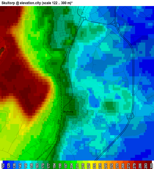
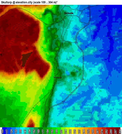
Below is the Elevation map of Skultorp, which displays elevation range with different colors. Scale of the first map is from 122 to 300 m (400 to 984 ft) with average elevation of 181.7 meters (=596 ft) [note 1]
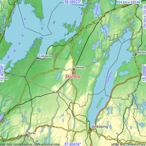
These maps also provides idea of topography and contour of this city, they are displayed at different zoom levels. More info about maps, scale and edge coordinates you can find below images.
| \ | Map #1 | Map #2 | Topo.Map |
| Scale [m] | 122..300 m | 109..304 m | × |
| Scale [ft] | 400..984 ft | 358..997 ft | × |
| Average | 181.7 m = 596 ft | 181.2 m = 594 ft | × |
| Width | 5.13 km = 3.2 mi | 10.26 km = 6.4 mi | 164.1 km = 102 mi |
| Height | 5.13 km = 3.2 mi | 10.26 km = 6.4 mi | 164.1 km = 102 mi |
| ↑Max Latitude | 58.373052° | 58.396089° | 59.08023° |
| Latitude at center | 58.35° | 58.35° | 58.35° |
| ↓Min Latitude | 58.326933° | 58.303851° | 57.60436° |
| ← Min Longitude | 13.789385° | 13.745439° | 12.42708° |
| Longitude center | 13.83333° | 13.83333° | 13.83333° |
| →Max Longitude | 13.877275° | 13.921221° | 15.23958° |
Nearby cities:
Cities around Skultorp sort by population:
• Skövde elevation 152 m
4.6 km,  8°
8°
• Falköping 217 m
25.7 km,  220°
220°
• Skara 120 m
23.4 km,  280°
280°
• Tibro 117 m
20.9 km,  66°
66°
• Tidaholm 148 m
20.2 km,  158°
158°
• Hjo 98 m
27.1 km,  101°
101°
• Åkarp 161 m
16.8 km, 219°
• Götene 79 m
28 km,  315°
315°
• Olofstorp 137 m
14.8 km,  138°
138°
• Stenstorp 175 m
11.1 km, 218°
• Stöpen 87 m
14.4 km, 7°
• Axvall 129 m
16 km, 283°
Multilingual:
 En español:
Skultorp elevación 150 m.
 En France:
Skultorp élévation 150 m.
 Auf Deutsch:
Skultorp höhe über dem Meeresspiegel ist 150 m.

Sources and notes:
- [note 1] Map square and city borders are not equal. Map elevation data is calculated only from area inside that square.
- [src 1] Elevation data from geonames database provided with same terms of usage.
- [src 2] The elevation map of Skultorp is generated using elevation data from NASA's 3 arcsec (90m) resolution SRTM data.
- [src 3] Base (background) map © OpenStreetMap contributors tiles are generated by Geofabrik and OpenTopoMap.
Copyright & License:
This Skultorp Elevation Map is licensed under CC BY-SA. You may reuse any part from this page, if you give a proper credit by linking to this URL:
 More info on terms of use page.