Töcksfors elevation
Töcksfors (Värmland, Årjängs Kommun), Sweden elevation is 120 meters and Töcksfors elevation in feet is 394 ft above sea level [src 1]. Töcksfors is a populated place (feature code) with elevation that is 45 meters (148 ft) bigger than average city elevation in Sweden.
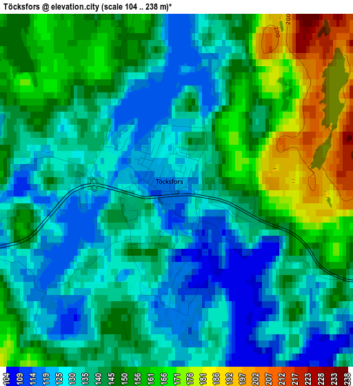
Below is the Elevation map of Töcksfors, which displays elevation range with different colors. Scale of the first map is from 104 to 238 m (341 to 781 ft) with average elevation of 142.5 meters (=468 ft) [note 1]
These maps also provides idea of topography and contour of this city, they are displayed at different zoom levels. More info about maps, scale and edge coordinates you can find below images.
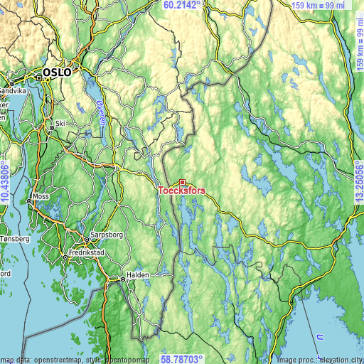
| \ | Map #1 | Topo.Map |
| Scale [m] | 104..238 m | × |
| Scale [ft] | 341..781 ft | × |
| Average | 142.5 m = 468 ft | × |
| Width | 4.96 km = 3.1 mi | 158.7 km = 98.6 mi |
| Height | 4.96 km = 3.1 mi | 158.7 km = 98.6 mi |
| ↑Max Latitude | 59.530451° | 60.2142° |
| Latitude at center | 59.50816° | 59.50816° |
| ↓Min Latitude | 59.485854° | 58.78703° |
| ← Min Longitude | 11.800365° | 10.43806° |
| Longitude center | 11.84431° | 11.84431° |
| →Max Longitude | 11.888255° | 13.25056° |
Nearby cities:
Cities around Töcksfors sort by population:
• Arvika elevation 52 m
44.8 km,  68°
68°
• Åmål 52 m
70.5 km,  136°
136°
• Strömstad 5 m
73.9 km,  211°
211°
• Grums 64 m
73.7 km,  103°
103°
• Årjäng 129 m
20.8 km,  128°
128°
• Bengtsfors 100 m
57.6 km,  157°
157°
• Ed 152 m
66.4 km,  175°
175°
• Charlottenberg 134 m
49.1 km,  31°
31°
• Dals Långed 126 m
70 km, 157°
• Åmotfors 87 m
40.5 km,  45°
45°
• Billingsfors 90 m
62.7 km, 158°
• Slottsbron 68 m
74.1 km,  106°
106°
Multilingual:
 En español:
Töcksfors elevación 120 m.
 En France:
Töcksfors élévation 120 m.
 Auf Deutsch:
Töcksfors höhe über dem Meeresspiegel ist 120 m.

Sources and notes:
- [note 1] Map square and city borders are not equal. Map elevation data is calculated only from area inside that square.
- [src 1] Elevation data from geonames database provided with same terms of usage.
- [src 2] The elevation map of Töcksfors is generated using elevation data from NASA's 3 arcsec (90m) resolution SRTM data.
- [src 3] Base (background) map © OpenStreetMap contributors tiles are generated by Geofabrik and OpenTopoMap.
Copyright & License:
This Töcksfors Elevation Map is licensed under CC BY-SA. You may reuse any part from this page, if you give a proper credit by linking to this URL:
 More info on terms of use page.