Sysert’ elevation
Sysert’ (Sverdlovsk), Russia elevation is 240 meters and Sysert’ elevation in feet is 787 ft above sea level [src 1]. Sysert’ is a populated place (feature code) with elevation that is 41 meters (135 ft) bigger than average city elevation in Russia.
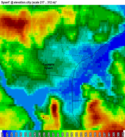
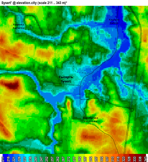
Below is the Elevation map of Sysert’, which displays elevation range with different colors. Scale of the first map is from 217 to 312 m (712 to 1024 ft) with average elevation of 252.7 meters (=829 ft) [note 1]
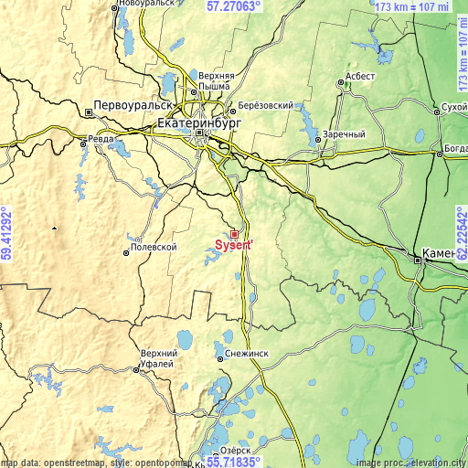
These maps also provides idea of topography and contour of this city, they are displayed at different zoom levels. More info about maps, scale and edge coordinates you can find below images.
| \ | Map #1 | Map #2 | Topo.Map |
| Scale [m] | 217..312 m | 211..343 m | × |
| Scale [ft] | 712..1024 ft | 692..1125 ft | × |
| Average | 252.7 m = 829 ft | 262.8 m = 862 ft | × |
| Width | 5.39 km = 3.3 mi | 10.79 km = 6.7 mi | 172.6 km = 107.2 mi |
| Height | 5.39 km = 3.3 mi | 10.79 km = 6.7 mi | 172.6 km = 107.2 mi |
| ↑Max Latitude | 56.526676° | 56.550906° | 57.27063° |
| Latitude at center | 56.50243° | 56.50243° | 56.50243° |
| ↓Min Latitude | 56.478169° | 56.453892° | 55.71835° |
| ← Min Longitude | 60.775225° | 60.731279° | 59.41292° |
| Longitude center | 60.81917° | 60.81917° | 60.81917° |
| →Max Longitude | 60.863115° | 60.907061° | 62.22542° |
Nearby cities:
Cities around Sysert’ sort by population:
• Aramil elevation 215 m
21.7 km,  2°
2°
• Istok 245 m
32.2 km,  355°
355°
• Bobrovskiy 211 m
21.4 km,  27°
27°
• Dvurechensk 198 m
20 km,  57°
57°
• Gornyy Shchit 286 m
27.6 km,  318°
318°
• Verkhneye Dubrovo 274 m
31.1 km, 26°
• Shabrovskiy 321 m
20.8 km, 315°
• Sovkhoznyy 227 m
37.8 km,  80°
80°
• Shchelkun 262 m
23.5 km,  160°
160°
• Sovkhoznyy 270 m
33.4 km,  330°
330°
• Shirokaya Rechka 274 m
38.7 km, 328°
• Verkhnyaya Sysert’ 248 m
8 km,  209°
209°
Multilingual:
 En español:
Sysert’ elevación 240 m.
 En France:
Sysert’ élévation 240 m.


Sources and notes:
- [note 1] Map square and city borders are not equal. Map elevation data is calculated only from area inside that square.
- [src 1] Elevation data from geonames database provided with same terms of usage.
- [src 2] The elevation map of Sysert’ is generated using elevation data from NASA's 3 arcsec (90m) resolution SRTM data.
- [src 3] Base (background) map © OpenStreetMap contributors tiles are generated by Geofabrik and OpenTopoMap.
Copyright & License:
This Sysert’ Elevation Map is licensed under CC BY-SA. You may reuse any part from this page, if you give a proper credit by linking to this URL:
 More info on terms of use page.