Bakaly elevation
Bakaly (Bashkortostan Republic), Russia elevation is 108 meters and Bakaly elevation in feet is 354 ft above sea level [src 1]. Bakaly is a populated place (feature code) with elevation that is 91 meters (299 ft) smaller than average city elevation in Russia.
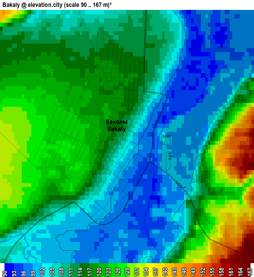
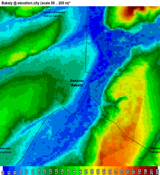
Below is the Elevation map of Bakaly, which displays elevation range with different colors. Scale of the first map is from 90 to 167 m (295 to 548 ft) with average elevation of 112.5 meters (=369 ft) [note 1]
These maps also provides idea of topography and contour of this city, they are displayed at different zoom levels. More info about maps, scale and edge coordinates you can find below images.
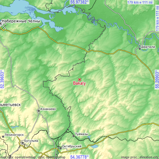
| \ | Map #1 | Map #2 | Topo.Map |
| Scale [m] | 90..167 m | 89..205 m | × |
| Scale [ft] | 295..548 ft | 292..673 ft | × |
| Average | 112.5 m = 369 ft | 124.6 m = 409 ft | × |
| Width | 5.58 km = 3.5 mi | 11.16 km = 6.9 mi | 178.6 km = 111 mi |
| Height | 5.58 km = 3.5 mi | 11.16 km = 6.9 mi | 178.6 km = 111 mi |
| ↑Max Latitude | 55.203976° | 55.229045° | 55.97382° |
| Latitude at center | 55.17889° | 55.17889° | 55.17889° |
| ↓Min Latitude | 55.153789° | 55.128671° | 54.36778° |
| ← Min Longitude | 53.758835° | 53.714889° | 52.39653° |
| Longitude center | 53.80278° | 53.80278° | 53.80278° |
| →Max Longitude | 53.846725° | 53.890671° | 55.20903° |
Nearby cities:
Cities around Bakaly sort by population:
• Tuymazy elevation 113 m
63.9 km,  185°
185°
• Menzelinsk 98 m
75.3 km,  324°
324°
• Dzhalil’ 288 m
70 km,  255°
255°
• Kandry 168 m
71 km,  163°
163°
• Urussu 107 m
68.1 km,  198°
198°
• Chekmagush 148 m
54.4 km,  95°
95°
• Verkhneyarkeyevo 92 m
44.3 km,  47°
47°
• Aktanysh 67 m
62.9 km,  16°
16°
• Muslyumovo 77 m
41 km,  289°
289°
• Subkhankulovo 119 m
69.1 km,  179°
179°
• Sharan 160 m
42.2 km, 162°
• Semiletka 162 m
55.3 km,  68°
68°
Multilingual:
 En español:
Bakaly elevación 108 m.
 En France:
Bakaly élévation 108 m.


Sources and notes:
- [note 1] Map square and city borders are not equal. Map elevation data is calculated only from area inside that square.
- [src 1] Elevation data from geonames database provided with same terms of usage.
- [src 2] The elevation map of Bakaly is generated using elevation data from NASA's 3 arcsec (90m) resolution SRTM data.
- [src 3] Base (background) map © OpenStreetMap contributors tiles are generated by Geofabrik and OpenTopoMap.
Copyright & License:
This Bakaly Elevation Map is licensed under CC BY-SA. You may reuse any part from this page, if you give a proper credit by linking to this URL:
 More info on terms of use page.