Cheremisinovo elevation
Cheremisinovo (Kursk), Russia elevation is 195 meters and Cheremisinovo elevation in feet is 640 ft above sea level [src 1]. Cheremisinovo is a populated place (feature code) with elevation that is 4 meters (13 ft) smaller than average city elevation in Russia.
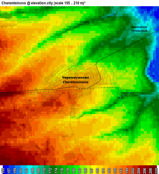
Below is the Elevation map of Cheremisinovo, which displays elevation range with different colors. Scale of the first map is from 155 to 210 m (509 to 689 ft) with average elevation of 187.2 meters (=614 ft) [note 1]
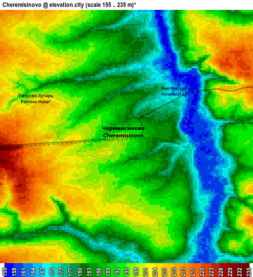
These maps also provides idea of topography and contour of this city, they are displayed at different zoom levels. More info about maps, scale and edge coordinates you can find below images.
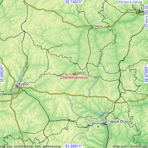
| \ | Map #1 | Map #2 | Topo.Map |
| Scale [m] | 155..210 m | 155..235 m | × |
| Scale [ft] | 509..689 ft | 509..771 ft | × |
| Average | 187.2 m = 614 ft | 190.7 m = 626 ft | × |
| Width | 6.03 km = 3.7 mi | 12.06 km = 7.5 mi | 193 km = 119.9 mi |
| Height | 6.03 km = 3.7 mi | 12.06 km = 7.5 mi | 193 km = 119.9 mi |
| ↑Max Latitude | 51.912616° | 51.939716° | 52.74513° |
| Latitude at center | 51.8855° | 51.8855° | 51.8855° |
| ↓Min Latitude | 51.858367° | 51.831218° | 51.00911° |
| ← Min Longitude | 37.220655° | 37.176709° | 35.85835° |
| Longitude center | 37.2646° | 37.2646° | 37.2646° |
| →Max Longitude | 37.308545° | 37.352491° | 38.67085° |
Nearby cities:
Cities around Cheremisinovo sort by population:
• Livny elevation 180 m
64.4 km,  21°
21°
• Shchigry 221 m
24.8 km,  267°
267°
• Kolpny 171 m
41.2 km,  337°
337°
• Kshenskiy 170 m
31.2 km,  99°
99°
• Troitskiy 241 m
61.3 km,  162°
162°
• Vyshneye Dolgoye 161 m
22 km,  26°
26°
• Zolotukhino 192 m
64.6 km,  289°
289°
• Kastornoye 165 m
59.7 km, 95°
• Solntsevo 170 m
62.9 km,  214°
214°
• Volovo 204 m
45.3 km,  69°
69°
• Tim 261 m
30.8 km,  198°
198°
• Manturovo 206 m
48.8 km,  191°
191°
Multilingual:
 En español:
Cheremisinovo elevación 195 m.
 En France:
Cheremisinovo élévation 195 m.
 Auf Deutsch:
Cheremisinovo höhe über dem Meeresspiegel ist 195 m.

Sources and notes:
- [note 1] Map square and city borders are not equal. Map elevation data is calculated only from area inside that square.
- [src 1] Elevation data from geonames database provided with same terms of usage.
- [src 2] The elevation map of Cheremisinovo is generated using elevation data from NASA's 3 arcsec (90m) resolution SRTM data.
- [src 3] Base (background) map © OpenStreetMap contributors tiles are generated by Geofabrik and OpenTopoMap.
Copyright & License:
This Cheremisinovo Elevation Map is licensed under CC BY-SA. You may reuse any part from this page, if you give a proper credit by linking to this URL:
 More info on terms of use page.