Troitskiy elevation
Troitskiy (Belgorod Oblast), Russia elevation is 241 meters and Troitskiy elevation in feet is 791 ft above sea level [src 1]. Troitskiy is a populated place (feature code) with elevation that is 42 meters (138 ft) bigger than average city elevation in Russia.
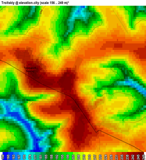
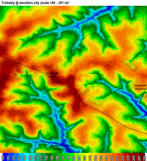
Below is the Elevation map of Troitskiy, which displays elevation range with different colors. Scale of the first map is from 156 to 249 m (512 to 817 ft) with average elevation of 212.4 meters (=697 ft) [note 1]
These maps also provides idea of topography and contour of this city, they are displayed at different zoom levels. More info about maps, scale and edge coordinates you can find below images.
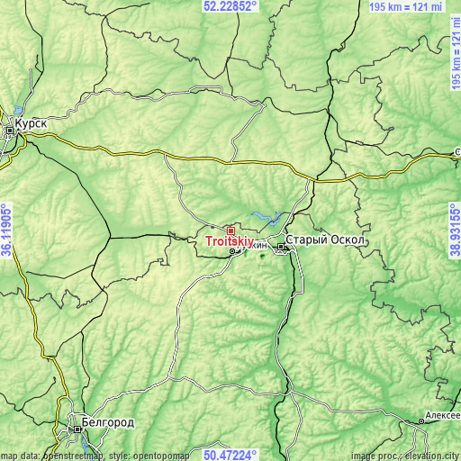
| \ | Map #1 | Map #2 | Topo.Map |
| Scale [m] | 156..249 m | 149..251 m | × |
| Scale [ft] | 512..817 ft | 489..823 ft | × |
| Average | 212.4 m = 697 ft | 205.7 m = 675 ft | × |
| Width | 6.1 km = 3.8 mi | 12.2 km = 7.6 mi | 195.3 km = 121.4 mi |
| Height | 6.1 km = 3.8 mi | 12.2 km = 7.6 mi | 195.3 km = 121.4 mi |
| ↑Max Latitude | 51.386233° | 51.41365° | 52.22852° |
| Latitude at center | 51.3588° | 51.3588° | 51.3588° |
| ↓Min Latitude | 51.331351° | 51.303885° | 50.47224° |
| ← Min Longitude | 37.481355° | 37.437409° | 36.11905° |
| Longitude center | 37.5253° | 37.5253° | 37.5253° |
| →Max Longitude | 37.569245° | 37.613191° | 38.93155° |
Nearby cities:
Cities around Troitskiy sort by population:
• Staryy Oskol elevation 139 m
23 km,  107°
107°
• Gubkin 168 m
8.7 km,  170°
170°
• Chernyanka 122 m
50.4 km,  157°
157°
• Gorshechnoye 245 m
39.9 km,  62°
62°
• Kshenskiy 170 m
55.2 km,  13°
13°
• Pristen’ 243 m
59.3 km,  256°
256°
• Solntsevo 170 m
54.2 km,  277°
277°
• Skorodnoye 227 m
38.1 km,  212°
212°
• Tim 261 m
40.3 km,  316°
316°
• Olym 183 m
57.4 km,  51°
51°
• Kirovskiy 177 m
59.9 km, 276°
• Manturovo 206 m
29.5 km,  291°
291°
Multilingual:
 En español:
Troitskiy elevación 241 m.
 En France:
Troitskiy élévation 241 m.
 Auf Deutsch:
Troitskiy höhe über dem Meeresspiegel ist 241 m.

Sources and notes:
- [note 1] Map square and city borders are not equal. Map elevation data is calculated only from area inside that square.
- [src 1] Elevation data from geonames database provided with same terms of usage.
- [src 2] The elevation map of Troitskiy is generated using elevation data from NASA's 3 arcsec (90m) resolution SRTM data.
- [src 3] Base (background) map © OpenStreetMap contributors tiles are generated by Geofabrik and OpenTopoMap.
Copyright & License:
This Troitskiy Elevation Map is licensed under CC BY-SA. You may reuse any part from this page, if you give a proper credit by linking to this URL:
 More info on terms of use page.