Chern’ elevation
Chern’ (Tula), Russia elevation is 240 meters and Chern’ elevation in feet is 787 ft above sea level [src 1]. Chern’ is a populated place (feature code) with elevation that is 41 meters (135 ft) bigger than average city elevation in Russia.
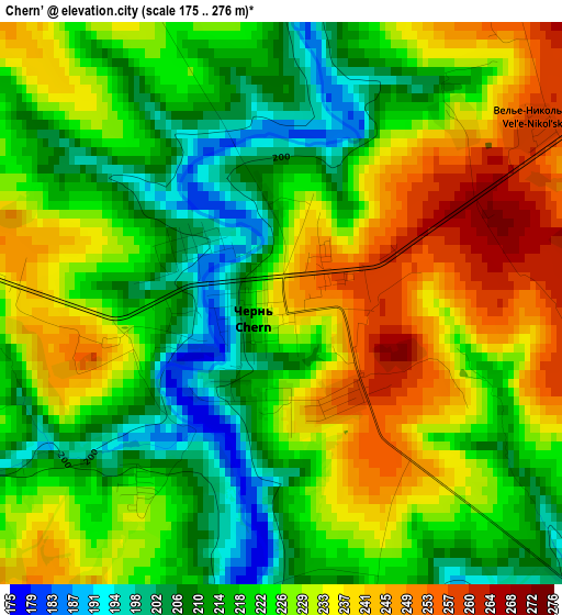
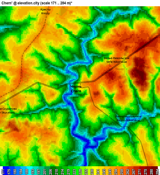
Below is the Elevation map of Chern’, which displays elevation range with different colors. Scale of the first map is from 175 to 276 m (574 to 906 ft) with average elevation of 225.1 meters (=739 ft) [note 1]
These maps also provides idea of topography and contour of this city, they are displayed at different zoom levels. More info about maps, scale and edge coordinates you can find below images.
| \ | Map #1 | Map #2 | Topo.Map |
| Scale [m] | 175..276 m | 171..284 m | × |
| Scale [ft] | 574..906 ft | 561..932 ft | × |
| Average | 225.1 m = 739 ft | 230.7 m = 757 ft | × |
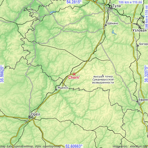
| Width | 5.82 km = 3.6 mi | 11.64 km = 7.2 mi | 186.2 km = 115.7 mi |
| Height | 5.82 km = 3.6 mi | 11.64 km = 7.2 mi | 186.2 km = 115.7 mi |
| ↑Max Latitude | 53.478481° | 53.504626° | 54.2815° |
| Latitude at center | 53.45232° | 53.45232° | 53.45232° |
| ↓Min Latitude | 53.426143° | 53.39995° | 52.60663° |
| ← Min Longitude | 36.870555° | 36.826609° | 35.50825° |
| Longitude center | 36.9145° | 36.9145° | 36.9145° |
| →Max Longitude | 36.958445° | 37.002391° | 38.32075° |
Nearby cities:
Cities around Chern’ sort by population:
• Mtsensk elevation 160 m
29.9 km,  229°
229°
• Plavsk 180 m
37.9 km,  41°
41°
• Bolkhov 189 m
60.2 km,  269°
269°
• Odoyev 219 m
56.2 km,  344°
344°
• Tëploye 239 m
48.4 km,  67°
67°
• Arsen’yevo 231 m
35.9 km,  332°
332°
• Novosil’ 231 m
53.9 km,  171°
171°
• Slavniy 220 m
31 km,  289°
289°
• Korsakovo 217 m
35.8 km,  124°
124°
• Spasskoye-Lutovinovo 237 m
21.4 km,  244°
244°
• Krapivna 177 m
56.8 km,  16°
16°
• Bol’shoye Skuratovo 247 m
5.1 km,  252°
252°
Multilingual:
 En español:
Chern’ elevación 240 m.
 En France:
Chern’ élévation 240 m.


Sources and notes:
- [note 1] Map square and city borders are not equal. Map elevation data is calculated only from area inside that square.
- [src 1] Elevation data from geonames database provided with same terms of usage.
- [src 2] The elevation map of Chern’ is generated using elevation data from NASA's 3 arcsec (90m) resolution SRTM data.
- [src 3] Base (background) map © OpenStreetMap contributors tiles are generated by Geofabrik and OpenTopoMap.
Copyright & License:
This Chern’ Elevation Map is licensed under CC BY-SA. You may reuse any part from this page, if you give a proper credit by linking to this URL:
 More info on terms of use page.