Khodz’ elevation
Khodz’ (Adygeya Republic), Russia elevation is 321 meters and Khodz’ elevation in feet is 1053 ft above sea level [src 1]. Khodz’ is a populated place (feature code) with elevation that is 122 meters (400 ft) bigger than average city elevation in Russia.
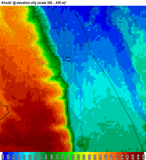
Below is the Elevation map of Khodz’, which displays elevation range with different colors. Scale of the first map is from 300 to 439 m (984 to 1440 ft) with average elevation of 356.1 meters (=1168 ft) [note 1]
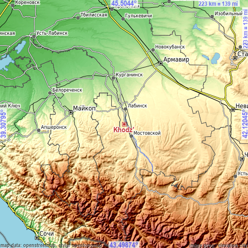
These maps also provides idea of topography and contour of this city, they are displayed at different zoom levels. More info about maps, scale and edge coordinates you can find below images.
| \ | Map #1 | Topo.Map |
| Scale [m] | 300..439 m | × |
| Scale [ft] | 984..1440 ft | × |
| Average | 356.1 m = 1168 ft | × |
| Width | 6.97 km = 4.3 mi | 223 km = 138.6 mi |
| Height | 6.97 km = 4.3 mi | 223 km = 138.6 mi |
| ↑Max Latitude | 44.54153° | 45.5044° |
| Latitude at center | 44.5102° | 44.5102° |
| ↓Min Latitude | 44.478853° | 43.49874° |
| ← Min Longitude | 40.670255° | 39.30795° |
| Longitude center | 40.7142° | 40.7142° |
| →Max Longitude | 40.758145° | 42.12045° |
Nearby cities:
Cities around Khodz’ sort by population:
• Labinsk elevation 271 m
13.9 km,  6°
6°
• Mostovskoy 380 m
12.6 km,  149°
149°
• Rodnikovskaya 214 m
28.5 km,  352°
352°
• Vladimirskaya 316 m
7.4 km,  57°
57°
• Voznesenskaya 385 m
25.6 km,  79°
79°
• Yaroslavskaya 264 m
22.7 km,  299°
299°
• Chamlykskaya 313 m
26.3 km,  29°
29°
• Natyrbovo 220 m
25.4 km,  344°
344°
• Upornaya 475 m
27.6 km,  118°
118°
• Perepravnaya 414 m
20.1 km,  163°
163°
• Gubskaya 466 m
22.4 km,  196°
196°
• Besleneyevskaya 491 m
31.1 km,  178°
178°
Multilingual:
 En español:
Khodz’ elevación 321 m.
 En France:
Khodz’ élévation 321 m.


Sources and notes:
- [note 1] Map square and city borders are not equal. Map elevation data is calculated only from area inside that square.
- [src 1] Elevation data from geonames database provided with same terms of usage.
- [src 2] The elevation map of Khodz’ is generated using elevation data from NASA's 3 arcsec (90m) resolution SRTM data.
- [src 3] Base (background) map © OpenStreetMap contributors tiles are generated by Geofabrik and OpenTopoMap.
Copyright & License:
This Khodz’ Elevation Map is licensed under CC BY-SA. You may reuse any part from this page, if you give a proper credit by linking to this URL:
 More info on terms of use page.